
Miller, John and Henry (sold)

John and Henry Miller (fl. c. 1847 - 1861) were American booksellers and publishers based in Columbus Ohio. The J. & H. Miller firm was active during the mid 19th century. Though not specifically map publishers, the Millers published a number of historical works, many of which contained folding maps. The Miller firm is especially well known for its attention to African American related publications in the years preceding the Civil War.
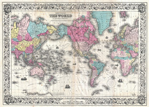
Colton's Map of the World on Mercator's Projection. / Printed for J. & H. Miller, Columbus, Ohio.
sold
- Digital Map Information
- Suitable for large format printing
- DPI: 300
- File Size: 31.26 MB
- File Type: ZIP / TIFF
- ICC color profile embedded
- Delivered instantly via download link
A rare and extremely attractive folding map of the world by J. H. Colton. This map, comprising the entire world, was prepared by Colton in 1852 for issue in J. & H. Miller publication in the 1855 edition of Blake's Volume of the World… . In preparing this map, ... (more details)

Map of the Hudson River.
sold
- Digital Map Information
- Suitable for large format printing
- Full resolution TIFF file
- ICC color profile embedded
- Delivered instantly via download link
This is a scarce 1866 map of the Hudson River, New York by James Miller. It covers the course of the Hudson River from Lake Luzerne south as it empties into the Upper New York Bay. It also covers the numerous towns, cities and counties along its coast, including ... (more details)
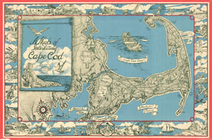
A Map of Interesting Cape Cod.
sold
- Digital Map Information
- Suitable for large format printing
- File Size: 27.6 MB
- File Type: ZIP / TIFF
- ICC color profile embedded
- Delivered instantly via download link
This unusual map of Cape Cod was drawn in 1945 by F. J. Miller. Covers all of Cape Cod as well as parts of the adjacent South Shore including New Bedford, Fairhaven, Plymouth, Buzzard Bay, and Duxbury. Names important towns and roads in addition to offering a ... (more details)