
Lee, Kerry Ernest (sold)
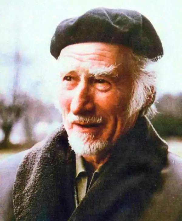
Kerry Ernest Lee (December 4, 1902 - February, 1988) was a British commercial illustrator, artist, and publisher of pictorial maps active in the middle part of the 20th century. Lee was the founder of the London based Pictorial Maps Ltd. He was born in West Ham, Essex, England. Lee's earliest pictorial map work dates to about 1940, when he produced a pictorial map of Scandinavia During World War II, Lee was one of several artist who created dramatic military-educational cut-away images of German aircraft and war maps for the Air Intelligence branch of MI6, A.I.2. After the war, in 1946, he founded Pictorial Maps Ltd. to publish a series of historical and pictorial maps of popular English cities, among them Oxford, Cambridge, London, Stratford-upon-Avon, Birmingham, and Liverpool. He included comic self-portraits illustrating he and his dog Jim in many of the maps. The images proved popular and many were reprinted for sale in the United States by the Travel Association. The firm also employed other artists, including Denis M. Jones. Lee died in Dacorum, Hertfordshire, England.
Colorful pictorial view of Shakespeare's home city.
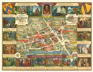
Stratford-upon-Avon.
sold
- Digital Map Information
- Suitable for large format printing
- File Size: 52.33 MB
- File Type: ZIP / TIFF
- ICC color profile embedded
- Delivered instantly via download link
A stunningly vivid and playful 1948 Kerry Lee pictorial map of Stratford-upon-Avon, England. The map looks on the city center from the southeast, across the Avon, with important buildings and Shakespearian locations noted. It is surrounded by 16 images accompanied by quotes drawn from Shakespeare's better-known plays. (more details)
Wonderful pictorial map of Cambridge and its colleges.
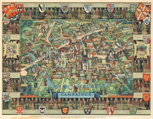
Cambridge.
sold
- Digital Map Information
- Suitable for large format printing
- File Size: 68.47 MB
- File Type: ZIP / TIFF
- ICC color profile embedded
- Delivered instantly via download link
This is a marvelous c. 1948 Kerry Lee pictorial map of Cambridge, England. Charmingly illustrating the world-famous university town, yellow panels mark the city's colleges, including Christ's College, King's College, St. John's College, Trinity College, and Queen's College. Banners highlight other important locations, including chapels, theaters, markets, gates, and The Pepysian Library. Famous personalities walk the streets of Cambridge, including Isaac Newton, William Wordsworth, Lord Keynes, Francis Bacon, Geoffrey Chaucer, and King Henry VIII and Anne Boleyn. Coats of Arms for the city's colleges adorn the border and state when each college was founded. 'Portraits' of famous alumni populate the rest of the border. (more details)
Oxford and its many colleges given the pictorial treatment!
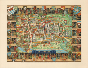
Oxford.
sold
- Digital Map Information
- Suitable for large format printing
- Full resolution TIFF file
- ICC color profile embedded
- Delivered instantly via download link
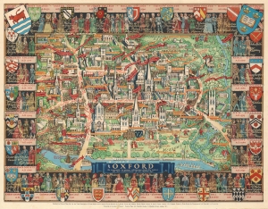
This delightful c. 1948 Kerry Lee bird's eye view of Oxford, England, presents the college city in all its charm; centered on Cathedral Church, the view is framed by gold-hued banners bearing the arms of the city's many colleges, including Merton College, Balliol College, and Queen's College. (more details)
Oxford and its many colleges given the pictorial treatment!
Oxford.
sold
- Digital Map Information
- Suitable for large format printing
- File Size: 70.86 MB
- File Type: ZIP / TIFF
- ICC color profile embedded
- Delivered instantly via download link
This is a wonderful c. 1948 Kerry Lee pictorial map of Oxford, England. Depicting Oxford in all its charm, Cathedral Church immediately draws the eye. Gold hued banners proclaim the city's many colleges, including Merton College, Balliol College, and Queen's College. Other golden hued banners mark more commonplace locations, such as the post office and several hotels. Red banners announce the locations of theatres, churches, the New Bodleian Library, the University Museum, and the Ashmolean Museum and Galleries. The Coats of Arms of Oxford's many colleges create the border, along with portraits of famous alumni. (more details)