
Lewis, Samuel

Samuel Lewis (c. 1754 - 1822) was an American engraver, cartographer, draftsman, and geographer active in Philadelphia in the first of the 19th century. Though is place of birth is uncertain, most agree that Lewis emigrated from Dublin, Ireland, in the late 18th century. Lewis' earliest cartography work was produced in partnership with the well-known Philadelphia publishers Matthew Carey and Henry Schenk Tanner. In 1804, with the intention of republishing high quality English maps in the United States, Lewis partnered with the eminent British map publisher Arron Arrowsmith. Their first joint publication was A New and Elegant General Atlas, but many others followed including an American edition of Arrowsmith's important double hemisphere wall map of the world. Arrowsmith also worked with Jedidiah Morse, among other important American cartographers of the period. Ralph Brown considers Lewis to be "the most enterprising commercial map-maker of the period … " Lewis is best known for his map related to the expedition of Meriwether Lewis (no relation) and William Clark. In 1814 Lewis, copying directly from William Clark's manuscript, issued A Map of Lewis and Clark's Tracks across the Western Portion of North America. This important document was the first published map derived from the Lewis and Clark Expedition and profoundly transformed the cartography of the American northwest. Samuel Lewis of Philadelphia should not be confused with Samuel Lewis of London, another cartographer active during roughly the same period.
Britain's remaining North American colonies.
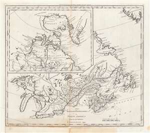
The British Possessions in North America from the best Authorities.
$450.00
Acquire
- Digital Map Information
- Suitable for large format printing
- DPI: 600
- File Size: 37.55 MB
- File Type: ZIP / TIFF
- ICC color profile embedded
- Delivered instantly via download link
This is a first edition example of Samuel Lewis' 1794 map of Canada for Carey's General Atlas, the first atlas published in the young American Republic. It depicts the remaining British colonies in North America (save for Bermuda) in the wake of the American Revolution, before they had cohered into a single entity and identity as Canada. (more details)
Earliest Atlas Map of Maryland Published in the American Republic.
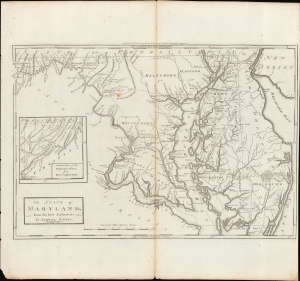
The State of Maryland, from the Best Authorities.
$600.00
Acquire
- Digital Map Information
- Suitable for large format printing
- Full resolution TIFF file
- ICC color profile embedded
- Delivered instantly via download link
An important map of Maryland from the early days of the American Republic, this 1795 work was drawn by Samuel Lewis and engraved by William Barker for inclusion in Matthew Carey's Carey's American Edition of Guthrie's Geography Improved, the first atlas published in the United States. (more details)