
Lindenkohl, Adolph (sold)

Adolph Lindenkohl (March 6, 1833 – June 22, 1904) was a German-American cartographer and draughtsman active in the United States during the second part of the 19th century. Lindenkohl was born in Niederkaufungen, Hesse Cassel, Germany. He was educated at the Realschule and later at the Poytechnische Schule, both in Cassel. After graduating in 1852 he emigrated to the United States where, for 2 years, he taught mathematics before taking a position with the United States Coast Survey. Lindenkhol served as a topographer in the Union Army during the American Civil War, translating Coast Survey methodology and technique to land-side surveys for military use. This experience he later translated to other projects, such as the compilation of the first specific map of Alaska as part of the United States (1867). Lindenkohl was a member of the American Association for the Advancement of Science, the Washington Academy of Sciences, the Philosophical Society of Washington and the National Geographic Society. He retained his position with the Coast Survey until his death in 1904.
Part of Channel Islands National Park.
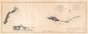
Preliminary Survey of Anacapa Island and East End of Santa Cruz Island California.
sold
- Digital Map Information
- Suitable for large format printing
- File Size: 9.12 MB
- File Type: ZIP / TIFF
- ICC color profile embedded
- Delivered instantly via download link
This is an 1856 U.S. Coast Survey nautical chart or maritime map of Anacapa Island and the eastern part of Santa Cruz Island, California. A view of one of the many sheer cliffs comprising the coastline of Anacapa Island is situated in the lower left quadrant. (more details)
Part of Channel Islands National Park.
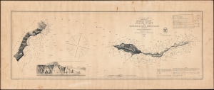
Preliminary Survey of Anacapa Island and East End of Santa Cruz Island California.
sold
- Digital Map Information
- Suitable for large format printing
- File Size: 13.75 MB
- File Type: ZIP / TIFF
- ICC color profile embedded
- Delivered instantly via download link
This is an 1856 U.S. Coast Survey nautical chart or maritime map of Anacapa Island and the eastern part of Santa Cruz Island, California. It provides a great deal of navigational and hydrographical information to mariners. (more details)
First map to show the continental shelf break for a significant portion of the west coast.
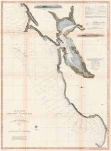
Pacific Coast from Point Pinos to Bodega Head California.
sold
- Digital Map Information
- Suitable for large format printing
- File Size: 100.44 MB
- File Type: ZIP / TIFF
- ICC color profile embedded
- Delivered instantly via download link
This is the 1866 United States Coast Survey map of San Francisco Bay and vicinity from Bodega Head south to Point Pinos and Monterey, California. (more details)
First map to name Alaska and the first specific published map of Alaska as American territory.

North Western America showing the territory ceded by Russia to the United States.
sold
- Digital Map Information
- Suitable for large format printing
- File Size: 38.22 MB
- File Type: ZIP / TIFF
- ICC color profile embedded
- Delivered instantly via download link
A seminal production, this is the first map to name Alaska and the first specific published map of Alaska as an American territory. Centered on the Bering Strait, the map covers all of Alaska as well as parts of adjacent Russia (as far as the Sea of Okhotsk) and Canada. Offers inland detail, especially along the coasts, as well as topography and a breakdown of Russian and Inuit settlements. (more details)
A nautical chart of Cape Canaveral - today the home of NASA's Kennedy Space Center
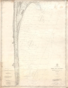
Coast Chart No. 162 From Cape Canaveral Southward to Lat. 27° 41' Florida.
sold
- Digital Map Information
- Suitable for large format printing
- File Size: 16.79 MB
- File Type: ZIP / TIFF
- ICC color profile embedded
- Delivered instantly via download link
This is a 1903 United States Coast and Geodetic Survey nautical chart or map of Cape Canaveral, Florida. The map depicts the coast of Florida from Cape Canaveral to La Roche and from the Florida East Railway line that ran along the coast to the Atlantic Ocean. Highly detailed, myriad depth soundings are noted throughout, particularly in the Indian River and Banana River. Several towns are labeled, including Cape Canaveral, Melbourne, and Houston. Notes concerning the light at Cape Canaveral, buoys, tides, and soundings are situated along the left border and three different scales (one in statute miles, nautical miles, and kilometers) are included in the lower right corner. (more details)