
MacCoun, Townsend (sold)

Townsend MacCoun (1845 - September 10, 1932) was an American cartographer, publisher and historian active in the second half of the 19th and early 20th centuries. Townsend was born in Troy, New York, the son of John T. MacCoun and Angelica Rachel Douw (Lane) MacCoun. MacCoun attended Williams Collage, from which he was awarded degrees in 1866 and 1869. His composed several cultural and geographical works, including a history of the United States, another of the Holy Land, and a series of five historical maps of New York City. He also developed and proselytized employing a universal color coding system in all maps appearing in a single book or book series - a technique that remains in use today in many text books. He was a member of the Chi Psi Fraternity, the American Geographical Society, and the Paris Société Academique d'Histoire Internationale.
Illustrates the city of New Amsterdam from its incorporation to its surrender to the English.
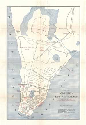
1653 - 1664 Amsterdam in New Netherland The City of the Dutch West India Company.
sold
- Digital Map Information
- Suitable for large format printing
- Full resolution TIFF file
- ICC color profile embedded
- Delivered instantly via download link
This is a 1909 Townsend MacCoun city map or plan of the colony of New Amsterdam, now known as New York City, between 1653 and 1664. Located on the southern tip of Manhattan, the map depicts the region from the Hudson River to the East River and from Midtown to the Battery. The colony itself, however, is confined to the southernmost extreme of Manhattan from Wall Street to the Battery. Streets are illustrated and labeled throughout the settlement, as is Fort Amsterdam and the Wall that gave Wall Street its name. the residences of prominent citizens are labeled within the settlement as well, as are numerous other 'points of interest'. Outside the walls, several farms are labeled by the owner's name (including the Dutch West India Company Farm), along with streets, a mill, and Wolfert Webber's tavern. (more details)
Traces important American Revolution sites throughout the island of Manhattan.
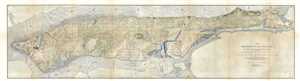
1783 Manhattan Island at the Close of the Revolution Showing the American City with its Landmarks and the Revolutionary Fortifications on the Island.
sold
- Digital Map Information
- Suitable for large format printing
- File Size: 23.94 MB
- File Type: ZIP / TIFF
- ICC color profile embedded
- Delivered instantly via download link
A rare map of the island of Manhattan, New York City, that combines parts of the burgeoning metropolis c. 1909 with those of the city just after the end of the American Revolution. This map was issued by Townsend MacCoun and is based, cartographically, on the ... (more details)
Rare map of Manhattan based on Viele showing c. 1606 American Indian settlements.
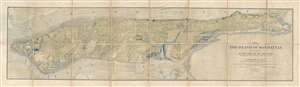
1609 The Island of Manhattan (Mannahtin) At the Time of its Discovery Showing its Elevations, Water-Courses, and Shore Line.
sold
- Digital Map Information
- Suitable for large format printing
- File Size: 25.84 MB
- File Type: ZIP / TIFF
- ICC color profile embedded
- Delivered instantly via download link
A very rare map of the island of Manhattan, New York City, as is presumably appeared in 1609, shortly after the Dutch began settling the island. This map was issued by Townsend MacCoun and is base, cartographically, on the great 1867 survey of Egbert Viele, ... (more details)
Rare map of Manhattan based on Viele showing c. 1606 American Indian settlements.
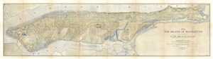
1609 The Island of Manhattan (Mannahtin) at the Time of its Discovery Showing its Elevations, Water-Courses, Marshes, and Shore Line.
sold
- Digital Map Information
- Suitable for large format printing
- File Size: 20.73 MB
- File Type: ZIP / TIFF
- ICC color profile embedded
- Delivered instantly via download link
A rare map of the island of Manhattan, New York City, as it presumably appeared in 1609, shortly after the Dutch began settling the island. This map was issued by Townsend MacCoun and is based, cartographically, on the great 1867 survey of Egbert Viele, ... (more details)
Blends the past and the present together while commemorating Henry Hudson's voyage of exploration up the Hudson River.
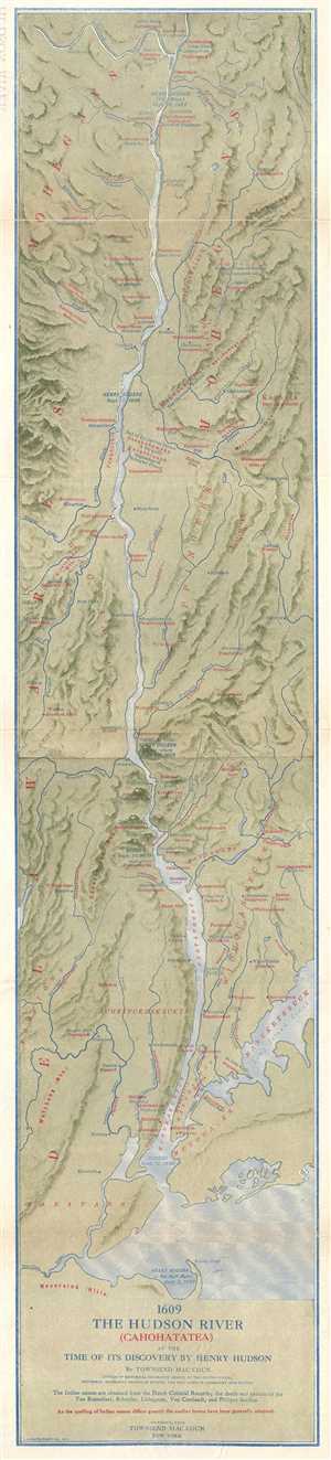
1609 The Hudson River (Cahohatatea) at the Time of its Discovery by Henry Hudson
sold
- Digital Map Information
- Suitable for large format printing
- File Size: 9.2 MB
- File Type: ZIP / TIFF
- ICC color profile embedded
- Delivered instantly via download link
This is a 1909 Townsend MacCoun map of the Hudson River and its environs as they would have looked when Henry Hudson first ascended the river in 1609. Blending sites along the river from 1609 and 1909, the map depicts the region from Waterford, New York ... (more details)