
Matsu, Umiumi (sold)

Umiumi Matsu (July 18, 1883 - October 30, 1925) was a draftsman active in Hawaii in the early 20th century. Matsu first appears in Oahu city directories in 1902 as a clerk for the first land district. In 1909, Matsu was working as a clerk for the Hilo Railroad Company. The following year he is listed as a chainman for the road department in Hilo. He was working as a surveyor for the Thomas Cook Company in Hilo in 1911 and in 1912 he was working as a draftsman for the Loan Fund Commission in Hilo. A year later, in 1913, Matsu began working as a draftsman for the department of public works, where he worked until at least 1920. He created at least one commercial map during his lifetime: a road map of Oahu for the Honolulu Automobile Club. Aside from the entries in the Oahu city directories, we have been unable to unearth very little information about Matsu's life.
A charming early road map of Oahu.
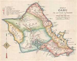
Island of Oahu City and County of Honolulu.
sold
- Digital Map Information
- Suitable for large format printing
- File Size: 5.13 MB
- File Type: ZIP / TIFF
- ICC color profile embedded
- Delivered instantly via download link
This is a 1921 U. Matsu map of the island of Oahu in the Hawaiian Archipelago. The map depicts the entire island from Kaena Point to Makapuu Point and from Kahuku Point to Diamond Head. Importantly, the Mormon settlement at Laie is labeled here. Historically, Laie ... (more details)
Early road map of Oahu.
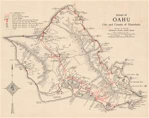
1921 Matsu Road Map of Oahu, Hawaii.
sold
- Digital Map Information
- Suitable for large format printing
- File Size: 10.03 MB
- File Type: ZIP / TIFF
- ICC color profile embedded
- Delivered instantly via download link
This is a 1921 U. Matsu map of the island of Oahu in the Hawaiian Archipelago. The map depicts the entire island in full, from Kaena Point to Makapuu Point and from Kahuku Point to Diamond Head. (more details)