
Moresby, Robert (sold)

Robert Moresby (June 15, 1794 - June 15, 1854) was British Royal Navy and Indian Navy officer and hydrographer. Moresby is most famous for his 1829 - 1833 trigonometrical hydrographic survey of the Red Sea, a seminal work that opened the sea to steam navigation and for which Richard Burton called him 'the Genius of the Red Sea'. Afterwards, from 1834 to 1836 he completed the first complete hydrographic survey of the Maldives - an exceptionally complex region to survey due to its size and the sheer number of coral atolls. He then surveyed the Chagos Archipelago, and the vast submerged reef southeast of the Seychelles. His survey work under often extreme heat conditions, proved hard on his health and by 1839 forced him to give up hydrographic work altogether. After several years of recuperation in India, he returned to the sea in 1842 as captain of the luxurious 'Peninsular and Oriental' steamer, HMS Hindostan. In addition to his survey work, Moresby was also an excellent landscape painter whose artwork record scenes from his many voyages.
Earliest obtainable modern chart of the Maldives.
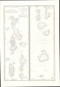
Carte des Iles Maldives. No. 942.
sold
- Digital Map Information
- Suitable for large format printing
- File Size: 28.83 MB
- File Type: ZIP / TIFF
- ICC color profile embedded
- Delivered instantly via download link
This is a rare large-format 1841 French Dépôt-général de la Marine nautical chart of the Maldives Islands in the Indian Ocean. Based on a now-unobtainable 1838 British chart by Robert Moresby, the first modern hydrographic survey of the islands, this is the earliest obtainable specific modern chart of the Maldives. (more details)
First complete survey of the Maldives.
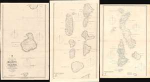
Trigonometrical Survey of the Maldive Islands.
sold
- Digital Map Information
- Suitable for large format printing
- Full resolution TIFF file
- ICC color profile embedded
- Delivered instantly via download link
The largest and most important 1904 chart of the Maldives, compiled by Indian Navy Commander Robert Moresby and Frederick Thomas Powell. The map consists of three joinable panels embracing the Maldive Islands in full, rich with soundings, details about available water supply, tide notes, and a wealth of other practical data for the mariner. This map, the result of meticulous hydrographic work in the mid-19th century, opened the Maldives to steam navigation and was essential to establishing viable steam navigation routes between the Red Sea and the East Indies. It remained the definitive mapping of the Maldives until the 1900s, when it was at last superseded by satellite hydrography. This map also reveals the extent to which the Maldives are at risk form sea-level rise and Global Warming, which is predicted to make the archipelago unhabitable by 2050. (more details)