Most recently added antique and rare maps as of 8/19/2025.
$1,200.00
$1,000.00
$800.00

$650.00
$650.00
$600.00
$150.00
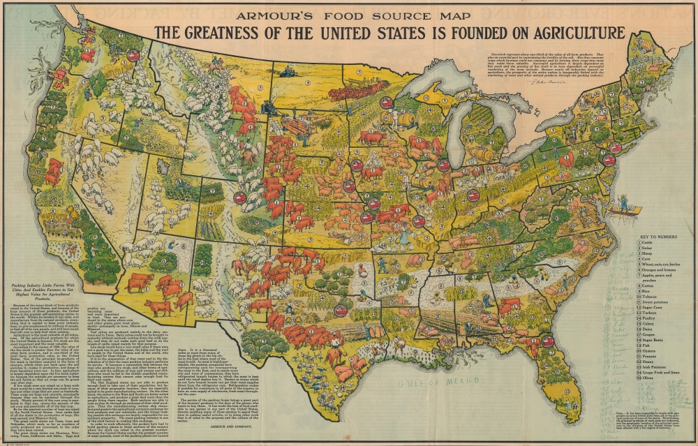
$23,000.00
$2,500.00
$1,300.00
$1,200.00
$700.00
$650.00