
Nolin, Jean-Baptiste (sold)

Jean-Baptiste Nolin (1657 - 1725) was a French cartographer and publisher active in Paris during the late 17th and early 18th centuries. Nolin was a man of exceptional business acumen and while many cartographers struggled financially, he prospered. Many attribute this to the fact that Nolin produced very little original work, relying primarily on business relationships with the legendary Italian cartography Vincenzo Coronelli, Jean-Dominique Cassini, and the French geographer Jean Nicolas du Trallage, Sieur de Tillemont (1620 – 1698). His work is known for exceptional aesthetic élan, combining Italianesque baroque and rococo ethics with most current cartographic data. It might also be said that Nolin was a bit of a con-artist in his self-promotion, often inaccurately using such titles as 'Engraver to the King' and 'Geographer to the Duke of Orleans', neither of which appointments he actually held. In 1705, he was successfully sued by Guillaume De L’Isle for copyright infringement, a case which cost him significant scientific credibility. Nonetheless, Nolin remained commercially popular and prosperous. Nolin's son, also Jean Baptiste Nolin (1686 - 1762) inherited his father’s map plates and republished many of his maps, as well as issuing his own unique maps, well into the 18th century. Both Nolins maintained offices on Rue St. Jacques, Paris.
An Essential, Rare Caribbean.
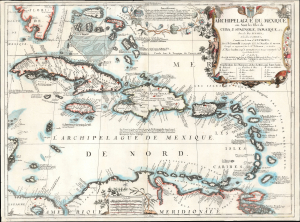
Archipelague du Mexique ou Sont les Isles de Cuba, Espagnole, Jamaique, etc. avec les Isles Lucayes, et les Isles Caribes, conniies sous le nom d’Antilles…
sold
- Digital Map Information
- Suitable for large format printing
- File Size: 21.73 MB
- File Type: ZIP / TIFF
- ICC color profile embedded
- Delivered instantly via download link
This grand, scarce map of the Caribbean and West Indies, produced by Vincenzo Coronelli and Jean-Baptiste Nolin in 1688, is the largest and most beautiful of Coronelli's maps dedicated to the West Indies. (more details)
'Probably the best 17th-century representation of the geography of eastern Canada and the eastern seaboard of America.' -Kershaw
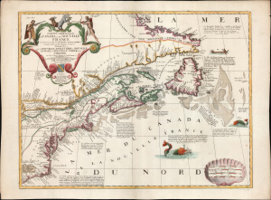
Partie Orientale du Canada ou de la Nouvelle France...
sold
- Digital Map Information
- Suitable for large format printing
- File Size: 27.19 MB
- File Type: ZIP / TIFF
- ICC color profile embedded
- Delivered instantly via download link
This is Vincenzo Coronelli and Jean Baptiste Nolin's separately-published map of Eastern Canada and the Northeastern part of the British Colonies in North America, in an attractive example. It is an essential Canadianum, incorporating up-to-date sources from both the French and English, whilst presenting pro-French territorial claims aggressively. (more details)
Trade missions to Siam and the 1688 Siamese Revolution.
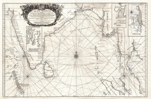
Carte Marine depuis Suratte jusqu'au Detroit de Malaca Dressee par le R.P. Tachard de la Compagnie de Jesus Missionaire et Mathematicien du Roy dans les Indes.
sold
- Digital Map Information
- Suitable for large format printing
- DPI: 300
- File Size: 15.5 MB
- File Type: ZIP / TIFF
- ICC color profile embedded
- Delivered instantly via download link
An impressive separately-issued 1742 nautical map of the Bay of Bengal, India, and Southeast Asia (Thailand, Cambodia) by J. B. Nolin. The map chronicles the travels of the Jesuit Priest Guy Tachard in his attempts to establish a Siamese-French alliance, the eventual collapse of that alliance, and anti-French Siamese Revolution of 1688. (more details)
A scarce map of the world after Coronelli.
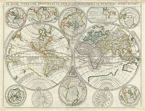
Le Globe Terrestre Represente en Deux Plans - Hemispheres, et en Diverses Autres Figures.
sold
- Digital Map Information
- Suitable for large format printing
- Full resolution TIFF file
- ICC color profile embedded
- Delivered instantly via download link
A scarce example of Jean Baptiste Nolin's 1742 map of the world in two hemispheres. The main map is surrounded by ten additional maps showing the world on various projections and at various periods. Cartographically this map combines elements from Vincenzo ... (more details)