
Payne, John (sold)

John Payne (fl. c. 1780 - c. 1800) was a little known cartographer and map publisher working in New York and Philadelphia in the last years of the 18th century. Nothing is known of his youth and education. He is known to have published Joseph Collyer's 1772 New System of Geography in London, and his own work is probably descended from Collyer's. Payne published, again in London, his two-volume Universal geography formed into a new and entire system in 1791. Dublin editions under this title appeared in 1792 and 1794, lacking maps and reducing the general geography to a glossary to make room travellers' tales, notably those of Hawkesworth: it is probably that Payne had nothing to do with the Dublin editions, which were almost certainly pirate editions. Sometime during the 1790s Payne emigrated to New York, where he would publish in 1798-9 Payne's New and Complete Universal Geography, one of the first examples of American - printed commercial cartography.
The United States, newly minted.
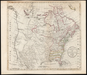
North America, with Boundaries of the Thirteen United States as settled by the Treaty of 1783.
sold
- Digital Map Information
- Suitable for large format printing
- DPI: 600
- File Size: 27.68 MB
- File Type: ZIP / TIFF
- ICC color profile embedded
- Delivered instantly via download link
This is the 1791 John Payne map of the United States issued for his Universal Geography. It is among the earliest maps specifically of the newly formed United States, indicating its western border along the Mississippi River. (more details)
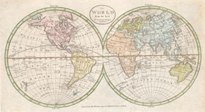
The World from the best authorities.
sold
- Digital Map Information
- Suitable for large format printing
- DPI: 300
- File Size: 2.21 MB
- File Type: ZIP / TIFF
- ICC color profile embedded
- Delivered instantly via download link
An extremely rare and unusual map of the world. Printed in 1798, this is one of the first maps of the world published for general audiences in the New World. While lacking in the refinement commonly seen in European maps of the same period, this map is worthy of ... (more details)
Uncommon 1799 map of the Chesapeake Bay.
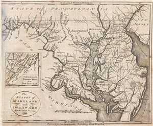
The States of Maryland and Delaware from the latest surveys. 1799.
sold
- Digital Map Information
- Suitable for large format printing
- DPI: 300
- File Size: 1.98 MB
- File Type: ZIP / TIFF
- ICC color profile embedded
- Delivered instantly via download link
This is a 1799 John Payne map of Maryland and Delaware. The map depicts the Chesapeake Bay region from Fort Cumberland on the Potomac River to Delaware Bay and New Jersey and from Philadelphia to Watkins Point. An inset map tracks the Potomac even further west ... (more details)