
Plummer, Frederick Gordon (sold)

Frederick Gordon Plummer (October 4, 1864 - August 15, 1913) was an American surveyor, engineer, and geographer. Plummer completed the first comprehensive survey and mapping of the Mount Rainier Forest Reserve in 1899. The following year he published a report that included detailed descriptions of the forest types and conditions, fire history, hydrology, and grazing in the area that would become Gifford Pinchot National Forest. Fred, a Theosophist, moved his family from Tacoma, Washington, to the Theosophical community of Lomaland at Point Loma, California, in 1903, and became the chief geographer of the United States Forestry Service that same year. He was a leader in the conservation movement until his death. Fred and his wife Emily had six children, one of whom, Lafayette Gordon Plummer, became a Theosophical writer, lecturer, and teacher.
Tacoma as a railroad town.
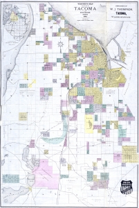
Whitney's Map of the City of Tacoma and environs, Washington.
sold
- Digital Map Information
- Suitable for large format printing
- Full resolution TIFF file
- ICC color profile embedded
- Delivered instantly via download link
This is the rare 1889 W. H. Whitney and Frederick G. Plummer map of Tacoma, Washington. The map illustrates the early days of Tacoma as a stop on the Union Pacific's Northern Pacific Railroad. It combines the functions of a real estate map and a railroad map. An inset in the upper left offers an overview of the general area. (more details)
Tacoma as a railroad town.
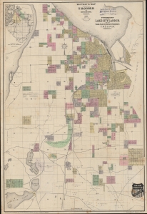
Whitney's Map of the City of Tacoma and environs, Washington.
sold
- Digital Map Information
- Suitable for large format printing
- File Size: 1186.34 MB
- File Type: ZIP / TIFF
- ICC color profile embedded
- Delivered instantly via download link
This is the rare 1889 W. H. Whitney and Frederick G. Plummer map of Tacoma, Washington. The map illustrates the early days of Tacoma as a stop on the Union Pacific's Northern Pacific Railroad. It combines the functions of a real estate map and a railroad map. An inset in the upper left offers an overview of the general area. (more details)
A Monumental, Detailed Map of Washington State highlighting its forestry industry, richness, and diversity.
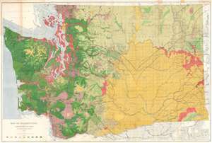
Map of Washington Showing Classification of Lands.
sold
- Digital Map Information
- Suitable for large format printing
- File Size: 150.99 MB
- File Type: ZIP / TIFF
- ICC color profile embedded
- Delivered instantly via download link
This is a large, colorful 1902 Map of Washington State showing the distribution and value of its forest lands - at the time, the primary moneymaker for the state. The map is printed in nine shades, showing unforested regions, cut and burned regions, and the density of forested areas. The map has been updated closely since its 1898 edition, showing dramatic re-growth in reserve areas - in particular, the Mount Rainier and the Olympic Jefferson Forest Reserves. Both of these had been established in 1897, and the dramatic changes shown on this map in comparison with the 1898 edition testify to the efficacy of the reserves in permitting the regrowth of heavily lumbered forest. Both of these areas would be made into National Forests in 1907. (more details)