
Prang, Louis (sold)
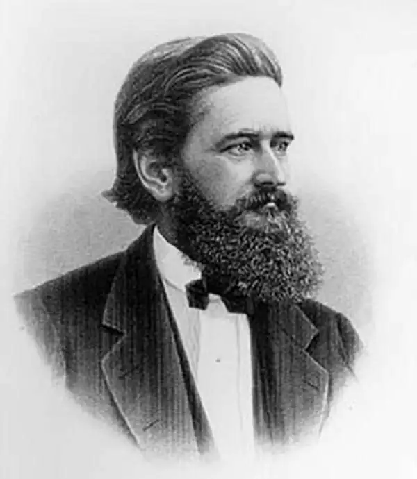
Louis Prang (March 12, 1824 - September 14, 1909) was a Boston-based publisher of lithographs and chromolithographs active in the latter half of the 19th century. Prang was born in Breslau, Germany, where he studied printmaking and engraving from his father, a noted master of the calico process. Around 1850, Prang immigrated to the United States, fearing political persecution in Germany after the failed Springtime of the Peoples Revolution, making him a 48er. In the United States, Prang partnered with another German Printmaker, Julius Mayer, establishing the short-lived Prang & Mayer firm. Ten years later, in 1860, Prang started his own chromolithography firm, L. Prang & Co. Prang quickly established himself as a publisher of postcards and other small prints, which were popular as gifts and collectibles. He was especially successful with mass-produced overviews of major battles in the U.S. Civil War, and his 'War Telegram Marking Map' was memorable for being sold with colored pencils, allowing buyers to track the movement of armies over time. Many consider him to be the "Father of the American Christmas Card". Prang also issued larger format chromolithographs of popular art and even printed his own magazine, Prang's Chromo: A Journal of Popular Art. Through his magazines and limited edition printings, Prang was influential in establishing the popularity of the chromolithographic process in America.
Charting the contours of the early Civil War.
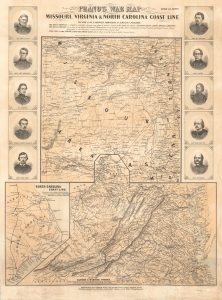
Prang's War Map Missouri, Virginia and North Carolina Coast Line.
sold
- Digital Map Information
- Suitable for large format printing
- File Size: 71.19 MB
- File Type: ZIP / TIFF
- ICC color profile embedded
- Delivered instantly via download link
A rare 1861 Louis Prang map of three theaters of the American Civil War (1861 - 1865), providing an as-it-happened snapshot of the war in its early months, when both Union and Confederate forces rushed to raise armies, produce war materiel, and grasp disputed territory. (more details)
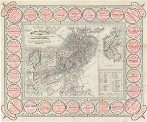
Map of Boston 1862.
sold
- Digital Map Information
- Suitable for large format printing
- Full resolution TIFF file
- ICC color profile embedded
- Delivered instantly via download link
This is a charming 1862 map or plan of the city of Boston, Massachusetts, by the famous Boston lithographer Louis Prang. Covering the entire city of Boston, Prang's meticulously detailed map illustrates streets, piers, parks, bridges, buildings, railways, wards, ... (more details)
Possibly the most beautiful map of Central Park ever published.
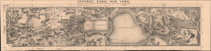
Central Park, New York, A picturesque Guide through the whole Park showing all the improvements up to June 1865.
sold
- Digital Map Information
- Suitable for large format printing
- Full resolution TIFF file
- ICC color profile embedded
- Delivered instantly via download link
An exceptional view map of New York City's Central Park, issued in 1865 by the Boston lithographer Louis Prang. Graced with Prang's exceptional engraving and fine lithography, this is undoubtedly the most beautiful map of Central Park issued in the 19th century. Covering Frederick Law Olmsted's masterpiece in full, Prang's meticulously detailed map illustrates pathways, bridges, lakes, and buildings, along with some individual trees and rocks. (more details)
Possibly the most beautiful map and view of Central Park ever published.
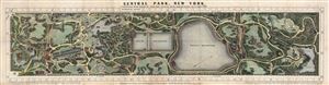
Central Park, New York, A picturesque Guide through the whole Park showing all the improvements up to June 1865.
sold
- Digital Map Information
- Suitable for large format printing
- File Size: 14.56 MB
- File Type: ZIP / TIFF
- ICC color profile embedded
- Delivered instantly via download link
An altogether extraordinary hand colored birds-eye view map of New York City's Central Park prepared and printed in 1865 by the famous Boston lithographer Louis Prang. Graced with Prang's extraordinary engraving and fine lithography, this is certainly the most ... (more details)
Possibly the most beautiful map and view of Central Park ever published.
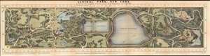
Central Park, New York, A picturesque Guide through the whole Park showing all the improvements up to June 1865.
sold
- Digital Map Information
- Suitable for large format printing
- File Size: 28.74 MB
- File Type: ZIP / TIFF
- ICC color profile embedded
- Delivered instantly via download link
An altogether extraordinary birds-eye view map of New York City's Central Park prepared and printed in 1865 by the famous Boston lithographer Louis Prang. Graced with Prang's exceptional engraving and fine lithography, this is undoubtedly the most beautiful map of Central Park issued in the 19th century. Covering the entire park, Prang's meticulously detailed map illustrates pathways, bridges, lakes, and buildings, along with some individual trees and rocks. All are pictorially rendered in profile. Many of the streets and avenues surrounding the park are also noted. The Park's famous wall, only partially constructed in 1865, is here shown in its completed glory. (more details)
Beautiful veneer made from the wood of the Great Elm celebrates the legacy of the 'veritable and venerable' tree.
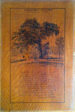
This beautiful wood veneer by L. Prang and Co. depicts the Great Elm on the Boston Common and dates to 1876. The veneer, made out of the wood from the same Great Elm, includes an image of the massive tree before it was destroyed. The view also features a fence ... (more details)
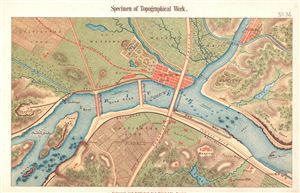
Specimen of Topographical Work. Engraved and Published by L. Prang & Co. Boston.
sold
- Digital Map Information
- Suitable for large format printing
- File Size: 3.01 MB
- File Type: ZIP / TIFF
- ICC color profile embedded
- Delivered instantly via download link
A beautifully colored map and exquisitely engraved map showing examples of various physical and madmade features on an imaginary landscape. Whether this was meant as a cartographic primer, or an example of the firm's general topographical drawing process, is ... (more details)