
Rochefort, Albert Jouvin de (sold)

Albert Jouvin de Rochefort (c. 1640 - c. 1710) was a French cartographer and government official active during the second half of the 17th century. Rochefort is a little known figure who served as Treasure to the King of France at Limoges from 1675 to 1702. In this capacity he traveled extensively throughout France and Europe in General, publishing an account of his travels with the firm of Thierry, Louis and Claude Barbin Billain. He apparently also traveled extensively in Egypt, the Holy Land, and Turkey. He produced several important maps, most of which are on a massive scale, to illustrate his cardinal work, Le voyageur d'Europe, où sont les voyages de France, d'Italie et de Malthe, d'Espagne et de Portugal, des Pays Bas, d'Allemagne et de Pologne, d'Angleterre, de Danemark et de Suède. In 1672-5 Rochefort issued a monumental plan of Paris in nine panels, Paris et ses Environs followed by a smaller plan in 1697, Nouveau plan de Paris. Apparently a portrait of Rochefort is preserved in the National Library of France.
Monumental map of Paris in nine panels.
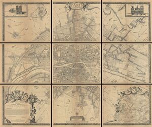
Paris et ses Environs.
sold
- Digital Map Information
- Suitable for large format printing
- File Size: 178.49 MB
- File Type: ZIP / TIFF
- ICC color profile embedded
- Delivered instantly via download link
A rare example of the c. 1900 reissue of Albert Jouvin de Rochefort's monumental 1675 nine panel map of Paris. Rochefort's plan of Paris was influential due to its illustration of the rapidly expanding urban center of Paris. This highly decorative chart shows ... (more details)
Monumental map of Paris in nine panels.
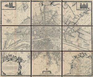
Paris et ses Environs.
sold
- Digital Map Information
- Suitable for large format printing
- File Size: 13.02 MB
- File Type: ZIP / TIFF
- ICC color profile embedded
- Delivered instantly via download link
A rare example of the c. 1900 reissue of Albert Jouvin de Rochefort's monumental 1675 nine panel map of Paris. Rochefort's plan of Paris was influential due to its illustration of the rapidly expanding urban center of Paris. This highly decorative chart shows ... (more details)
Monumental map of Paris in nine panels.
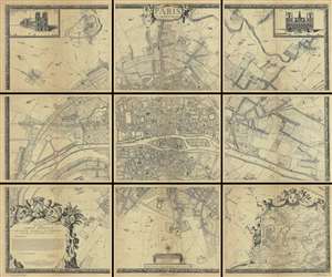
Paris et ses Environs.
sold
- Digital Map Information
- Suitable for large format printing
- File Size: 180.69 MB
- File Type: ZIP / TIFF
- ICC color profile embedded
- Delivered instantly via download link
A rare example of the c. 1900 reissue of Albert Jouvin de Rochefort's monumental 1675 nine panel map of Paris. Rochefort's plan of Paris was influential due to its illustration of the rapidly expanding urban center of Paris. This highly decorative chart shows ... (more details)
One of the most richly informative cartographic productions ever created.
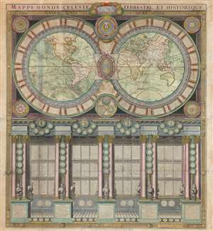
Mappe-Monde Celeste Terrestre et Historique.
sold
- Digital Map Information
- Suitable for large format printing
- DPI: 600
- File Size: 132.49 MB
- File Type: ZIP / TIFF
- ICC color profile embedded
- Delivered instantly via download link
A stunning large format wall map of the world in six panels issued in 1786 by Charles Desnos and Nicolas Jaugeon. Described by map historian Rodney W. Shirley as 'a veritable compendium of a map,' this is one of the most richly informative cartographic productions ever issued. The map consists of a double hemisphere map projection surrounded by no less than 60 Aeoli windheads, astronomical data on constellations, cosmic systems, and other charts - intentionally placing the world in the context of the greater cosmos. Its elegant presentation conveys confidence in the human capacity to describe not only the Earth, but the cosmos itself. The double hemisphere map rests upon Corinthian columns, underscoring the classical foundations of western scientific thought, here augmented by new discovery. The unique, neo-classical motif is carried through to the bottom half of the engraving, where panels of text are set within a portico supported by Corinthian columns. Completing the illusion are a coffered roof and a patterned tile floor. At the base of the columns there busts and accounts of the great explorers, among them Columbus, Magellan, and Vasco de Gama. (more details)