
Schmettau, Samuel Graf von (sold)

Samuel Graf von Schmettau (March 24, 1684 - August 18, 1751) was a Prussian Field Marshal and cartographer active in the first half of the 18th century. Schmettau was born in London at the Royal Prussian Amtskammerrat the Embassy of influential Hugueont stock. He joined the military at just 15, serving under various flags for various commanding officers, most of whom were his relatives. He saw battle on multiple occasions and rose quickly through the ranks, being made major in 1707 and lieutenant colonel in 1708, and field marshal lieutenant in 1733. In 1741 he was made Imperial Field Marshal, but transferred to the Prussian Army to become instead Prussian Field Marshal. In 1842 he received the Order of the Black Eagle. He was an excellent self-educated cartographer, producing his first map, a detailed survey of Sicily issued in 1723. A plan of Berlin followed in 1748, and a plan of Ostfriesland in 1751.
State-of-the-Art Cartography of the 'Akademiya Nauk', published (instead) by the Berlin Royal Academy of Science
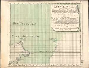
Carte Marine de la Mer Glaciale avec une Partie de la Province de Jrkucki 1749.
sold
- Digital Map Information
- Suitable for large format printing
- Full resolution TIFF file
- ICC color profile embedded
- Delivered instantly via download link
This is a rare 1749 map of the Bering Strait by Issak Bruckner (Issac Brouckner on the map). It is a remarkable and important artifact of 18th century cartography, illustrating the vectors by which secret cartographic data passed from the Russian Academy to the west, specifically to the Royal Academy of Sciences in Berlin under the auspices of Field Marshall Count Samuel von Schmettau, (to whom the map was dedicated). The map is one of twelve sheets executed by the Swiss instrument maker and geographer Bruckner, whose decade as Master of Instruments and globemaker for the Russian Academy of Sciences granted him astonishing access to the latest, secret Russian Naval maps of the northeast Russian coastline. Count von Schmettau opened the Royal Academy's archives to Bruckner, who would synthesize that information along with his own to produce the Nouvel Atlas de Marine, a meticulous twelve-sheet map of the world which Philips would hail as the first Prussian marine atlas. (Phillips, Atlases, 4146). (more details)
The finest and largest map of Sicily of the 18th century.
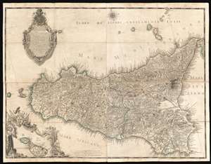
Descrizione Geografica del Regno di Sicilia e sue Isole …
sold
- Digital Map Information
- Suitable for large format printing
- DPI: 600
- File Size: 128.63 MB
- File Type: ZIP / TIFF
- ICC color profile embedded
- Delivered instantly via download link
Issued in 1779 by Gian Giuseppe Orcel, this is the greatest map of Sicily to appear in the 18th century. One of the few maps published in Sicily (Palermo), this map is derived from a survey completed in 1720 by the Austrian Field Marshal Samuel Graf von Schmettau, but is much advanced upon, with significant corrections, and on a far grander scale. Oriented slightly to the east of north, coverage extends to the whole of Sicily with the Aeolian Islands, and an inset mapping nearby Malta and Gozo. The map is dedicated to Marc Antonio Colonna II, Prince of Stigliano, who from 1775 to 1781 was Viceroy of Sicily under the House of Bourbon of the Two Sicilies. (more details)