
Stebbins, R. (sold)

R. Stebbins (fl. c. 1830 - 1836) was a New York based map publisher active from 1831 to about 1836. He is a very elusive figure, of which little is known. His firm, R. Stebbins and Company, is associated with only one map, an 1835 reissue of Charles Varlé's 1817 map of the United States. His name also appears on a rare 1831 map of Ohio published in partnership with William Chapin, and an 1831 map of the world. He may have some association with the silversmithing firm of Wilson and Stebbins. There are several other publishers of the Stebbins name with whom R. Stebbins may be associated, among the Henry Searls Stebbins (Ohio, 1835 - 1898) and L. Stebbins (Hartford, c. 1856). All of his work is exceedingly rare.
An extremely rare, previously uncatalogued Ohio wall map.
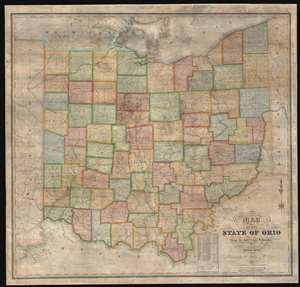
Map of the State of Ohio from the latest and best Authorities.
sold
- Digital Map Information
- Suitable for large format printing
- DPI: 600
- File Size: 165.32 MB
- File Type: ZIP / TIFF
- ICC color profile embedded
- Delivered instantly via download link
This is an impressively elusive 1831 William Chapin wall map of Ohio - one of the earliest large format wall maps of the state to exhibit a complete county structure. The state's interconnected network of roads and canals is illustrated in detail, including the National Road (then under construction), the Ohio and Erie Canal, and the Miami and Erie Canal. This map supersedes the 1825 John Kilbourne map of Ohio, expanding upon it in terms of completeness, detail, and proportion. (more details)