
Stemmen, Jan Heeren (sold)

Jan Heeren Stemmen (1695 - 1734) was a Dutch engraver in Amsterdam whose work was published by the firms of Covens and Mortier, Bilhamer, Heyman van Dyck, and Ottens. No details of his early life or education have come down to us, though he appears to have been moderately successful: he married Jannetje de Hoonet at a young age, and is known to have fathered two children; a daughter, Anna in 1712 and a son Jan in 1716.
'A towering landmark along the path of Western cartographic development' - Wheat
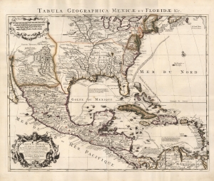
Carte du Mexique et de la Floride des Terres Angloises et des Isles Antilles... / Tabula Geographica Mexicae et Floridae etc.
sold
- Digital Map Information
- Suitable for large format printing
- Full resolution TIFF file
- ICC color profile embedded
- Delivered instantly via download link
This is the 1722 Covens and Mortier issue of Guillaume de L'Isle's groundbreaking map of North America, focusing on Mexico, the Mississippi watershed, and the West Indies. De L'Isle first published this map in 1703, at which point it was the most sophisticated map of the region obtainable: the first map to accurately denote the course of the Mississippi River, the first to accurately place the Great Lakes, and the first appearance on a map of updates from La Salle, Bienville, and D'Iberville. (more details)
'A towering landmark along the path of Western cartographic development' - Wheat
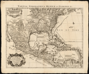
Carte du Mexique et de la Floride des Terres Angloises et des Isles Antilles... / Tabula Geographica Mexicae et Floridae etc.
sold
- Digital Map Information
- Suitable for large format printing
- DPI: 600
- File Size: 60.78 MB
- File Type: ZIP / TIFF
- ICC color profile embedded
- Delivered instantly via download link
This is the 1722 Covens and Mortier issue of Guillaume de L'Isle's groundbreaking map of North America, focusing on Mexico, the Mississippi watershed, and the West Indies. De L'Isle first published this map in 1703, at which point it was the most sophisticated map of the region obtainable: the first map to accurately denote the course of the Mississippi River, the first to accurately place the Great Lakes, and the first appearance on a map of updates from La Salle, Bienville, and D'Iberville. (more details)