
Stevens, Isaac Ingalls (sold)
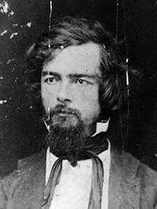
Isaac Ingalls Stevens (March 25, 1818 – September 1, 1862) was an American military officer and politician. He served as governor of the Territory of Washington from 1853 to 1857, and later as its delegate to the United States House of Representatives; he was also Superintendent of Indian Affairs. He was a polarizing figure, whose tenure as governor overwhelms Washington's territorial history; accounts of him condemn or applaud. A New Englander, the diminutive Stevens graduated from Phillips Academy in 1833. He attended West Point, where he graduated at the top of his class. He became career military. He was adjutant of the Corps of Engineers during the Mexican-American War, performing with distinction in combat. He swiftly earned wartime promotions to Captain and Major, and received severe wounds in combat. He would in 1851 publish a book on his experiences during the war. Between 1841 and 1849 he was superintendent of fortifications on the New England coast, and was given command of the coast survey until 1853. His support of fellow Mexican War veteran Franklin Pierce led him to be rewarded by the new President Pierce by being made governor and Superintendent of Indian Affairs for the new Washington Territory. Stevens also undertook to use his travel west as an opportunity to survey a railroad route across the northern United States (he was an experienced engineer, although his connections with President Pierce and Secretary of War Jefferson Davis doubtless aided his bid.)He would publish the results of his survey in 1855. His governorship would prove controversial. Aggressive in diplomacy as well as war, he compelled Native American tribes of Washington Territory by both intimidation and force, and was not above forging signatures on treaties. His tenure resulted in the Treaties of Medicine Creek, Treaty of Hellgate, Treaty of Neah Bay, Treaty of Point Elliott, Point No Point Treaty, and Quinault Treaty. He imposed martial law to remove dissent from both the Indians and Whites who opposed his policies. He jailed opposing judges, and raised a private army - for which he was convicted for contempt of court, rebuked by the President of the United States. Despite opposition, he was popular enough among white settlers in the Territory to be elected as the territory's delegate to the United States Congress in 1857 and 1858. During the American Civil War, he held several Union commands and was - at the time of his death - under consideration for appointment to command the Army of Virginia. He was killed at the Battle of Chantilly, leading his men from the front, carrying the fallen colors of one of his regiments against Confederate positions. He was posthumously promoted to Major General.
'An Excellent Map' -Wheat
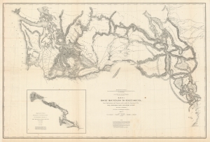
Map No. 3 Rocky Mountains to Puget Sound; from Explorations and Surveys Made Under the Direction of the Hon. Jefferson Davis Secretary of War.
sold
- Digital Map Information
- Suitable for large format printing
- File Size: 105.16 MB
- File Type: ZIP / TIFF
- ICC color profile embedded
- Delivered instantly via download link
This is a superb example of the map detailing Isaac Stevens' 1853-1854 reconnaissance of a railway route through the Rocky Mountains to the Pacific. This was part of a broad United States effort to determine a workable rail route to the Pacific through the Rockies, in the hope of opening Asian markets to American trade. Stevens, then en route to take up his new role as governor and Superintendent of Indian Affairs for the Washington Territory, successfully bid to undertake this survey of the route, which was executed over most of 1853 and part of 1854. (more details)
Reconnoitering the Northern Rockies.
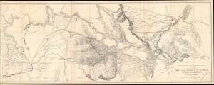
Milk R. to the crossing of the Columbia R.
sold
- Digital Map Information
- Suitable for large format printing
- File Size: 97.68 MB
- File Type: ZIP / TIFF
- ICC color profile embedded
- Delivered instantly via download link
A remarkable, large-format map of central Montana, with portions of northern Idaho and eastern Washington, prepared by Isaac Stevens as part of the expedition he led through the territory in 1853 - 1855 to scout out a potential transcontinental railroad route. When produced, due to its size and detail, it was the most complete map of these lands to date. (more details)