
Teesdale, Henry (sold)

Henry Teesdale (December 1776 - January 1856) was a British map publisher active in the first half of the 19th century. Teesdale was born in London. He was elected to the Royal Geographical Society in 1830. Teesdale initially partnered with John Hordan and William Colling Hobson as Henry Teesdale and Company, but this partnership was dissolved in 1832. Afterwards Teesdale continued to publish maps and atlases on his own account. He worked with several major British map engravers of the period including John Crane Dower, Christopher Greenwood, and Josiah Henshall, among others. His most prominent work is a large map of the world engraved by Dower. He must have enjoyed considerable commercial success because in 1845 he is registered as a partner in the Royal Bank of Scotland. Teesdale died in January of 1856 and was buried in All Souls, Kensal Green.
The last days of Gran Colombia.
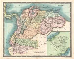
Columbia.
sold
- Digital Map Information
- Suitable for large format printing
- DPI: 600
- File Size: 40.15 MB
- File Type: ZIP / TIFF
- ICC color profile embedded
- Delivered instantly via download link
This is a beautiful 1831 John Dower and Henry Teesdale map of Gran Colombia, published in their A New General Atlas of the World. It depicts the state of Gran Colombia, which dissolved the same year this map was published, resulting in the creation of Venezuela, Ecuador, and a rump Republic of New Granada. (more details)
The building blocks of German unification.
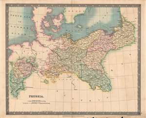
Prussia.
sold
- Digital Map Information
- Suitable for large format printing
- DPI: 600
- File Size: 35.54 MB
- File Type: ZIP / TIFF
- ICC color profile embedded
- Delivered instantly via download link
This is a fine example of Henry Teesdale and John Dower's 1831 map of Prussia published in their A New General Atlas of the World. It depicts the Kingdom of Prussia as it emerged from the Napoleonic Wars and the Congress of Vienna, larger and more powerful than before, poised to challenge Austria for preeminence in the German lands. (more details)
The Caribbean on the cusp of emancipation.
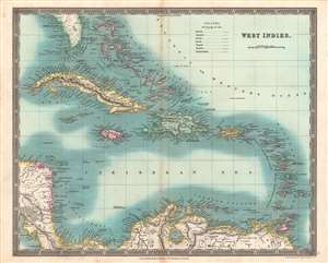
West Indies.
sold
- Digital Map Information
- Suitable for large format printing
- DPI: 600
- File Size: 44.63 MB
- File Type: ZIP / TIFF
- ICC color profile embedded
- Delivered instantly via download link
This is an especially vivid example of John Dower and Henry Teesdale's 1831 map of the West Indies published in their A New General Atlas of the World. This map was published when the region was undergoing rapid transformations resulting from the end of the slave trade and the institution of slavery itself. (more details)
A beautiful map of the Eastern Hemisphere.
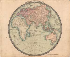
The Eastern Hemisphere.
sold
- Digital Map Information
- Suitable for large format printing
- DPI: 600
- File Size: 34.6 MB
- File Type: ZIP / TIFF
- ICC color profile embedded
- Delivered instantly via download link
This is a beautifully-colored 1831 Henry Teesdale / John Dower map of the Eastern Hemisphere published in their A New General Atlas of the World. It reflects the latest geographical knowledge available at that time and charts the voyages of Captain James Cook. (more details)
A beautiful map of the Holy Land in ancient times.
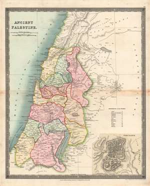
Ancient Palestine.
sold
- Digital Map Information
- Suitable for large format printing
- DPI: 600
- File Size: 34.32 MB
- File Type: ZIP / TIFF
- ICC color profile embedded
- Delivered instantly via download link
Here is Henry Teesdale / John Dower's 1831 map of the Holy Land as it appeared in ancient times, published in A New General Atlas of the World. It illustrates the location of the Twelve Tribes of Ancient Israel, as discussed in the Bible, in particular the Book of Joshua. (more details)
The early days of British Australia.
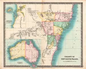
Colony of New South Wales, Swan River Settlement, Australia.
sold
- Digital Map Information
- Suitable for large format printing
- DPI: 600
- File Size: 34.8 MB
- File Type: ZIP / TIFF
- ICC color profile embedded
- Delivered instantly via download link
This is the Teesdale / John Dower's brilliantly colored 1831 map of Australia, with a focus on the Colony of New South Wales. It illustrates the territory as it was rapidly developing and transitioning from a penal colony to a society of free settlers. (more details)
Independent Greece.
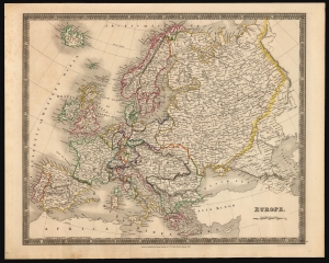
Europe.
sold
- Digital Map Information
- Suitable for large format printing
- DPI: 600
- File Size: 38.17 MB
- File Type: ZIP / TIFF
- ICC color profile embedded
- Delivered instantly via download link
This is an 1831 Henry Teesdale and John Crane Dower map of Europe, inclusive of Iceland and reaching as far east as the Ural mountains. Political borders, highlighted with original outline color, reflect an up-to-date presentation of the European international scene. (more details)
Detailed, Elegant 19th Century Map of World.
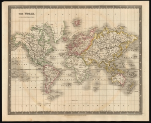
The World, On Mercators Projection.
sold
- Digital Map Information
- Suitable for large format printing
- DPI: 600
- File Size: 30.91 MB
- File Type: ZIP / TIFF
- ICC color profile embedded
- Delivered instantly via download link
This is an 1831 Henry Teesdale and John Crane Dower map of the world. It covers the explored world on a Mercator projection: the Americas, Europe, Asia, Africa, Australia and Oceania are presented clearly. The Arctic and Antarctic regions, as yet unpenetrated by explorers, are bare of detail. (more details)
A remarkable heavily annotated wall format map of the world showing Texas as a Republic.
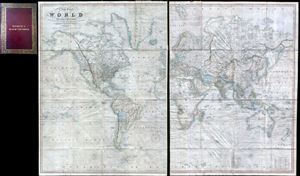
A New Chart of the World On Mercator's Projection With The Tracks Of The Most Celebrated and Recent Navigators.
sold
- Digital Map Information
- Suitable for large format printing
- Full resolution TIFF file
- ICC color profile embedded
- Delivered instantly via download link
This is an impressive 1844 large format map of the world by Henry Teesdale. The map covers the entire world on a Mercator projection with copious notes and annotations throughout. The map is thorough, but predictably presented an highly Anglo-centric perspective ... (more details)
A remarkable heavily annotatioed wall format map of the world showing Texas as a Republic.
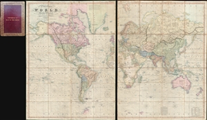
A New Chart of the World On Mercator's Projection With The Tracks Of The Most Celebrated and Recent Navigators.
sold
- Digital Map Information
- Suitable for large format printing
- Full resolution TIFF file
- ICC color profile embedded
- Delivered instantly via download link
This is an impressive 1844 large format map of the world by Henry Teesdale. The map covers the entire world on a Mercator projection with copious notes and annotations throughout. The map is thorough, but predictably presented a highly Anglo-centric perspective ... (more details)
One of only a few English maps to recognize the Republic of Texas. / The first map to show a fully explored Northwest Passage.
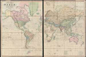
A New Chart of the World On Mercator's Projection With The Tracks Of The Most Celebrated and Recent Navigators.
sold
- Digital Map Information
- Suitable for large format printing
- Full resolution TIFF file
- ICC color profile embedded
- Delivered instantly via download link
This is an impressive 1845 large format map of the world by Henry Teesdale. The map covers the entire world on a Mercator projection with copious notes and annotations throughout. It is significant for many reasons, but chief among them is that it is one of the few English maps to recognize the Republic of Texas (as England itself did not) - and depict its most ambitious boundary configuration. It is also the first map to show a complete northwest passage following the Deese-Simpson Expedition. The map is thorough, including the most up to date political events and discoveries, but also tends to be biased, although not always towards Anglo-centric interests. For example, the map agrees with British claims to British Columbia relating to the 54/40 Oregon Question, and ignores the discoveries of Charles Wilkes (1798 - 1877) and the U.S. Exploring Expedition (1838 - 1842), no doubt to bolster the competing exploratory claims of Englishman John Ross (1777 - 1856). Teesdale's map is beautifully presented in two sections, each of which have been dissected into sixteen panels and laid on linen. The whole folds into a beautifully tooled leather binder with marbled endpapers. (more details)
A remarkable heavily annotated wall format map of the world showing Texas as a Republic.
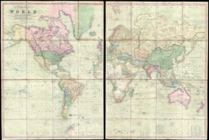
A New Chart of the World On Mercator's Projection With The Tracks Of The Most Celebrated and Recent Navigators.
sold
- Digital Map Information
- Suitable for large format printing
- DPI: 300
- File Size: 81.91 MB
- File Type: ZIP / TIFF
- ICC color profile embedded
- Delivered instantly via download link
This is an impressive 1845 large format map of the world by Henry Teesdale. The map covers the entire world on a Mercator projection with copious notes and annotations throughout. It is significant for many reasons, but chief among them is that it is one of the few English maps to recognize the Republic of Texas (as England itself did not) - and depict its most ambitious boundary configuration. It is also the first map to show a complete northwest passage following the Deese-Simpson Expedition. The map is thorough, including the most up to date political events and discoveries, but also tends to be biased, although not always towards Anglo-centric interests. For example, the map agrees with British claims to British Columbia relating to the 54/40 Oregon Question, and ignores the discoveries of Charles Wilkes (1798 - 1877) and the U.S. Exploring Expedition (1838 - 1842), no doubt to bolster the competing exploratory claims of Englishman John Ross (1777 - 1856). Teesdale's map is beautifully presented in two sections, each of which have been dissected into sixteen panels and laid on linen. The whole folds into a beautifully tooled leather binder with marbled endpapers. (more details)