
Turney, Omar A. (sold)
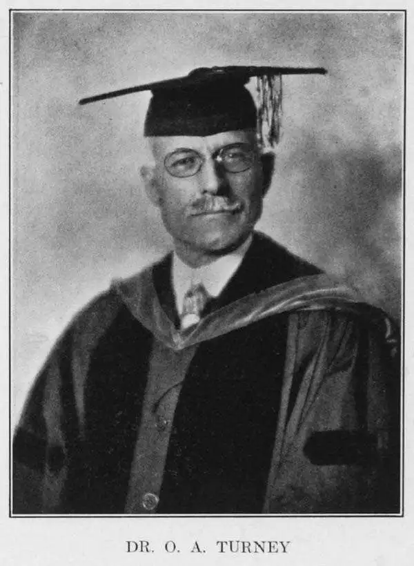
Dr. Omar A. Turney (November 1, 1866 - December 21, 1929) was an American archaeologist and engineer. He had been employed beginning 1888 as assistant engineer on the rebuilding of the Arizona canal dam, and was later employed as a surveyor for the Santa Fe, Prescott and Phoenix Railway. He also served successively in the United States geological survey and in the United States reclamation service. He was one of the principal sponsors of the Roosevelt Dam, and is largely responsible for the name given the dam. For twelve years after leaving the government service Dr. Turney served the cities of Phoenix, Mesa, Tempe and Glendale as city engineer. For many years he was secretary and managing trustee of the Phoenix Public Library. In his last year of life he published a series of articles in The Arizona Historical Review entitled 'Prehistoric Irrigation,' the result of the collection of data over period of more than forty years. He is known to have produced a map of ancient canals in the area of Phoenix, AZ, which attended the series. His findings were presented to the Royal Geographic Society of London, resulting in his being made a Fellow of the society.
Scarce 1929 Map of Prehistoric Canals of Phoenix, Tempe and Scottsdale, AZ
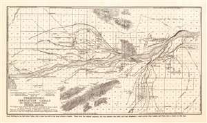
Map of Prehistoric Irrigation Canals. Dr. Omar A. Turney F.R.G.S. Phoenix, AZ
sold
- Digital Map Information
- Suitable for large format printing
- File Size: 9.24 MB
- File Type: ZIP / TIFF
- ICC color profile embedded
- Delivered instantly via download link
This 1929 Omar Turney map of regional Phoenix, Arizona shows the results of exhaustive surveys cataloguing Hohokam canal systems in the Salt River Valley. Constructed with hand tools over the span of several hundred years as far back as 600 C.E., this canal system is the largest pre-industrial irrigation system in the Western Hemisphere. Major canals in the system extended as far as twelve miles in length. They were remarkably sophisticated, tapered to maintain a constant velocity of water along their length, and varied in construction to suit changes in terrain. They remained useful for a millennium: Spanish explorers found modern Pima using some of these canals as recently as the 18th century. Turney’s astonishment and respect for the accomplishments of these ancients is evident in the text of the map:
These were the original engineers, the true pioneers who built, used and abandoned a canal system when London and Paris were a cluster of wild huts.Truly remarkable. (more details)