
Warner, Joseph (sold)

Joseph Warner (fl. c. 1876 - c. 1908) was an American bird's-eye view artist and publisher active in the late 19th century. Warner appears to have worked with the prolific view artist Albert Ruger. Little is known of Warner's life and only three known views bear his imprint: Portland, Maine; Fenton, Michigan; and Zeeland, Michigan. Two of these were published by Joseph Stoner. He is further known to have worked as an agent for Ruger in the publication of Ruger's 1879 view of East Saginaw. Little else is known of his life or work.
Issued just one year after the Great Chicago Fire of 1871.
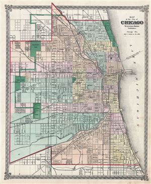
Map of the city of Chicago.
sold
- Digital Map Information
- Suitable for large format printing
- File Size: 10.04 MB
- File Type: ZIP / TIFF
- ICC color profile embedded
- Delivered instantly via download link
A fine c. 1872 map of Chicago issued by Warner and Beers. The map covers from Fullerton and Wrightwood Avenues to the Union Stockyards and from Central Park to Lake Michigan. All streets, wards, rail lines, public buildings, and parks are identified. The map ... (more details)
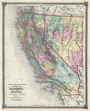
Atlas of the United States. County Map of California and Nevada.
sold
- Digital Map Information
- Suitable for large format printing
- File Size: 10.75 MB
- File Type: ZIP / TIFF
- ICC color profile embedded
- Delivered instantly via download link
This is a beautiful 1874 Warner and Beers' map of California and Nevada. It depicts the states of California and Nevada in extraordinary detail, noting major towns, counties, cities, lakes, rivers, railway lines, roads and other topographical features, with ... (more details)
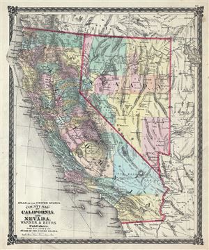
Atlas of the United States. County Map of California and Nevada.
sold
- Digital Map Information
- Suitable for large format printing
- File Size: 10.74 MB
- File Type: ZIP / TIFF
- ICC color profile embedded
- Delivered instantly via download link
This is a beautiful 1875 Warner and Beers' map of California and Nevada. It depicts the states of California and Nevada in extraordinary detail, along with parts of neighboring Utah, Oregon, Idaho and Arizona, noting major towns, counties, cities, lakes, ... (more details)
Issued just a few years after the Great Chicago Fire of 1871.
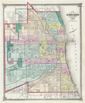
Map of the city of Chicago.
sold
- Digital Map Information
- Suitable for large format printing
- File Size: 9.91 MB
- File Type: ZIP / TIFF
- ICC color profile embedded
- Delivered instantly via download link
A fine 1875 map of Chicago issued by Warner and Beers. The map covers from Fullerton and Wrightwood Avenues to the Union Stockyards and from Central Park to Lake Michigan. All streets, wards, rail lines, public buildings, and parks are identified. ... (more details)
Very rare Bird's-Eye View of Portland, Maine. Only 4 known examples.
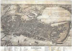
Bird's Eye View of the City of Portland Maine, 1876.
sold
- Digital Map Information
- Suitable for large format printing
- Full resolution TIFF file
- ICC color profile embedded
- Delivered instantly via download link
An exceptional 1876 Bird's-Eye View Map of Portland, Maine, by Joseph Warner. One of only three known views by Warner, this is a dramatic aerial view of Portland as seen from the east looking west. The cartographer has identified some 90 locations, ... (more details)
Very rare Bird's-Eye View of Portland, Maine. Only 4 known examples.
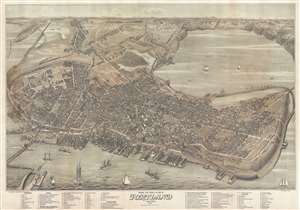
Bird's Eye View of the City of Portland Maine, 1876.
sold
- Digital Map Information
- Suitable for large format printing
- File Size: 40.22 MB
- File Type: ZIP / TIFF
- ICC color profile embedded
- Delivered instantly via download link
An exceptional 1876 Bird's-Eye View Map of Portland, Maine, by Joseph Warner. One of only three known views by Warner, this is a dramatic aerial view of Portland as seen from the east looking west. The cartographer has identified some 90 locations, ... (more details)