
Watson, Gaylord (sold)

Gaylord Watson (September 23, 1833 - October 10, 1896) was an American map publisher and engraver based in New York City. Watson briefly partnered with his uncle Humphrey Phelps as Phelps and Watson (1859 - January 1, 1865) with offices at 16 Beekman Street, New York. After 1864 he established his own imprint, now at 61 Beekman. Watson focused on highly decorative emigrant guides, wall maps, and railroad maps. Around 1871 Watson established a branch office in Chicago under the management of D. Needham at no. 66 Lake Street. In 1881 a fire destroyed Watson's offices at 61 Beekman Street, pushing him into deep financial stress. A notice appearing in Publisher's Weekly, 1893, reads, 'Gaylord Watson, map publisher, has been sold out by the sheriff. The sale realized about $800', suggesting that Watson had either died or fallen into bankruptcy. Watson lived in Queens, then Brooklyn, and in 1894, shortly before his death, Omaha, Nebraska.
One of the earliest maps to illustrate Wyoming as a territory.
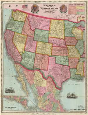
Watson's New Map of the Western States Territories, Mexico and Central America.
sold
- Digital Map Information
- Suitable for large format printing
- File Size: 80.22 MB
- File Type: ZIP / TIFF
- ICC color profile embedded
- Delivered instantly via download link
A visually striking large format 1869 map of the western United States by the New York map publisher Gaylord Watson. The map covers form Illinois and Mississippi to the Pacific. It offers a detailed breakdown of the transcontinental railroad system shortly after the driving of the Golden Spike on May 10, 1869, at Promontory Summit, Utah Territory. This is also one of the earliest maps to illustrate Wyoming after its official designation as a territory in 1868. To the left and right of the title are front and back illustrations of the Great Seal of the United States. In the upper right is a chart illustrating navigable mileage on western rivers, including the Mississippi, Illinois, Wabash, and Arkansas. (more details)
Chicago after the Great Chicago Fire.
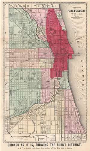
Chicago as it is, Showing the Burnt District.
sold
- Digital Map Information
- Suitable for large format printing
- File Size: 11.49 MB
- File Type: ZIP / TIFF
- ICC color profile embedded
- Delivered instantly via download link
This is an 1871 Gaylord Watson city plan or map of Chicago, Illinois, highlighting the area burned by the Great Chicago Fire. Dark red emphasizes the over three square miles burned by the fire and a nota bene below the bottom border reinforces this fact. City wards are labeled and shaded different colors for easy differentiation. Streets are illustrated and labeled throughout, along with parks, cemeteries, and an artesian well. Sites within the burned area are also identified, including three railroad passenger stations on the shore of Lake Michigan, the courthouse, post office, and water works. It is worth noting that the water tower and the pump house at the water works both survived the fire and can still be visited in Chicago. (more details)