
White, Charles A. White (sold)
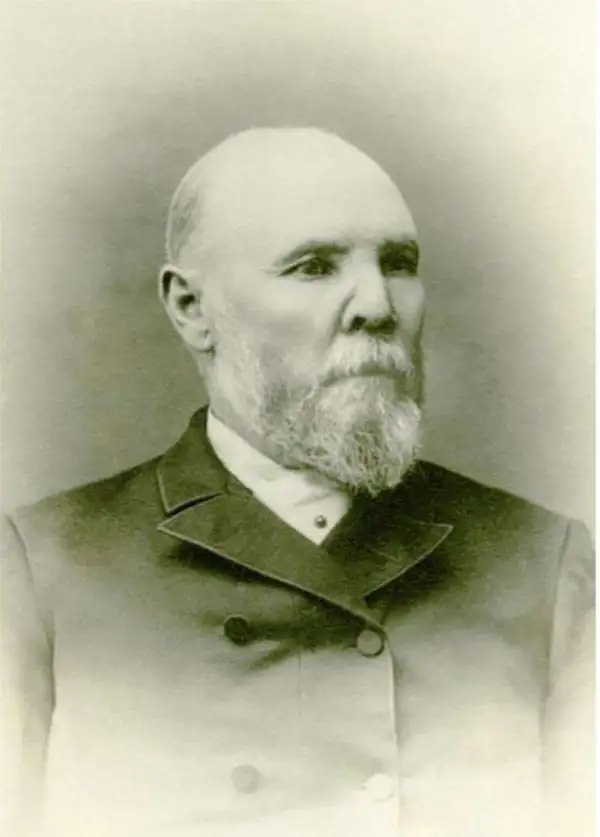
Charles A. White (1830 - 1898) was a Swedish-American civil engineer and surveyor active in Washington Territory in the late 19th century. White first appears in Washington in 1859, where is is listed as a 'compassion for Issac Smith and Jared Hurd on Contract 46', an effort to set up townships between Seattle and Everett. By 1864 he was county surveyor for Walla Walla. IN 1870, he was in Olympia, where he produced a large scale map of Washington Territory later published by the Colton firm. This map won first prize at the Thurston County Fair in 1871 and is today considered one of the best and rarest map of of said territory. He became county commissioner of Walla Walla in 1874, where he worked on a Northern Pacific Railroad connection between Olympia and Tenino. He then turned his civil engineering interests to Tacoma, where form 1885 to 1890, he was active. He retired and settled in Seattle in 1892. He died in 1898, the recorded cause 'senile decay.' White pass, near Mount Reiner, is named after him. (Credit for this bio: Surveying North of the River, Second Edition, Volume 1, page 499.)
The first commercially produced large format map of Washington Territory.
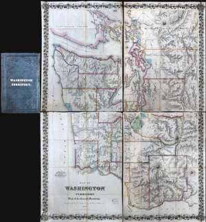
Map of Washington Territory West of the Cascade Mountains Compiled by the Government Surveys by Chas. A. White. C. E.
sold
A landmark production, this is the first large format commercially issued map of Washington Territory. It was issued by Charles A. White, woring with George Woolworth and Charles B. Colton, in 1870. The Colton brothers doubtless intended the map to capitalize on general interest in the region stemming from the imminent construction of the Northern Pacific Railroad. Although the Northern Pacific had been delayed for many years, construction finally began in 1870 and brought with it the promise of a land rush and an associated trade explosion to this previously remote and inaccessible part of the country.
Washington Territory Land Rush
The map's coverage extends from Vancouver to the Columbia River and from the Pacific to the Cascade Mountains. The region's rich topography is illustrated via shading and hachure. Cartographically, this map based upon the U.S. Government Land Surveys and the United States Coast Survey. The platting work of the U.S. Land Survey for Washington Territory is evident throughout in the form of small and large squares. Some of this land had clearly been assigned and color coding indicates Prairie Lands (Green), Government Reserves (Red), and Indian Reservations (Light Blue). Among other things, the prevalence of largely unassigned plats indicates the extraordinary wealth of excellent land available to enterprising pioneer settlers. Between 1870, when his map was issued, and 1880, the population of Washington Territory over tripped, from about 23,500 to 75,000 (more details)
Washington Territory Land Rush
The map's coverage extends from Vancouver to the Columbia River and from the Pacific to the Cascade Mountains. The region's rich topography is illustrated via shading and hachure. Cartographically, this map based upon the U.S. Government Land Surveys and the United States Coast Survey. The platting work of the U.S. Land Survey for Washington Territory is evident throughout in the form of small and large squares. Some of this land had clearly been assigned and color coding indicates Prairie Lands (Green), Government Reserves (Red), and Indian Reservations (Light Blue). Among other things, the prevalence of largely unassigned plats indicates the extraordinary wealth of excellent land available to enterprising pioneer settlers. Between 1870, when his map was issued, and 1880, the population of Washington Territory over tripped, from about 23,500 to 75,000 (more details)