
Wisner, William H. (sold)
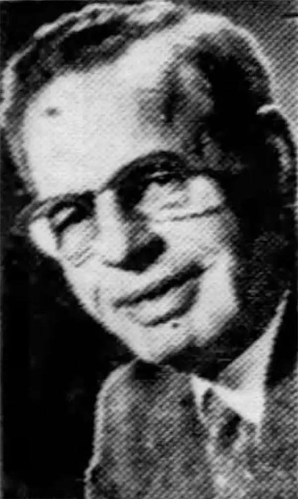
William H. Wisner (1894 - December 11, 1963) was the manager of the editorial art department of The Chicago Tribune. Born in Brooklyn, Wisner attended Columbia University and the College of the City of New York. He then attended the Julian academy in Paris where he received his formal art training. He began working for the Tribune in 1913, but left the newspaper during World War I to serve as an attache to the inter-allied mission for propaganda. He rejoined the Tribune in 1919 as head of its editorial art department. Wisner held several posts over the course of his career with the Tribune, including several influential and revolutionary positions concerning the integration of photography into the newspaper. His greatest work, though, was 'when he devoted himself entirely to the complicated task of preparing full-color maps which provided Tribune readers with up-to-the-minute developments on the global battlefronts.' In 1948, Wisner resumed full management of the editorial art department and held that position until his retirement in January 1963.
Printed a week after the Japanese invasion of Luzon.
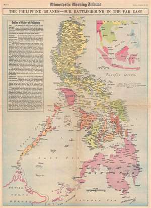
The Philippine Islands - Our Battleground in the Far East.
sold
- Digital Map Information
- Suitable for large format printing
- File Size: 10.18 MB
- File Type: ZIP / TIFF
- ICC color profile embedded
- Delivered instantly via download link
This is a Thursday, December 18, 1941, W. H. Wisner and Minneapolis Morning Tribune map of the Philippines. Printed eight days after the first Japanese landing on Luzon, this map depicts the Philippine Archipelago from Babuyan Channel to the Sulu Archipelago and ... (more details)
Depicts the Mediterranean islands that were critical to supplying Axis troops in North Africa.
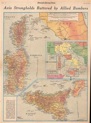
Axis Strongholds Battered by Allied Bombers.
sold
- Digital Map Information
- Suitable for large format printing
- File Size: 11.8 MB
- File Type: ZIP / TIFF
- ICC color profile embedded
- Delivered instantly via download link
This is a Friday, May 7, 1943 William H. Wisner and Minneapolis Morning Tribune map of Italy, Corsica, Sardinia, and Sicily. The map depicts all three islands (Corsica, Sardinia, and Sicily) in full and depicts Italy from the Tyrrhenian Sea to the Adriatic Sea ... (more details)
Provides an incredible visual summary of combat on the Eastern Front through the beginning of May 1943.
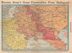
Russian Army's Great Counterdrive from Stalingrad.
sold
- Digital Map Information
- Suitable for large format printing
- File Size: 11.97 MB
- File Type: ZIP / TIFF
- ICC color profile embedded
- Delivered instantly via download link
This is a Wednesday, March 3, 1943 William H. Wisner and Minneapolis Morning Tribune map of the Eastern Front during World War II. The map depicts the region from Copenhagen, Berlin, Prague, and the Adriatic Sea to the Ural Mining and Industrial Area, the ... (more details)
Pacific War after Guadalcanal.
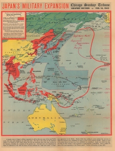
Japan's Military Expansion.
sold
- Digital Map Information
- Suitable for large format printing
- Full resolution TIFF file
- ICC color profile embedded
- Delivered instantly via download link
This is a 1943 William Wisner map of the Japanese Empire during World War II. Published on February 14, 1943, Wisner's map captures the moment when the tide of the war was turning in the Allies' favor. The American Navy sank 4 Japanese aircraft carriers during the June 1942 Battle of Midway, and the Japanese had been on the back foot since. The Battle of Guadalcanal ended just days before this map's publication, securing the first Allied ground victory in the Pacific. By publishing this map, the Chicago Sunday Tribune gave its readers a visual summary of the status of the war in the Pacific following the critical victory at Guadalcanal. (more details)