
American Association of University Women (sold) (AAUW)

The American Association of University Women (AAUW) (1881 - present) is an American non-profit organization that advocates for equality for women and girls through advocacy, education, and research. Founded in 1881 in Boston by Marion Talbot and Ellen Swallow Richards, that AAUW now has over 170,000 members and supporters, 1,000 branches, and 800 college and university partners. Originally known as the Association of Collegiate Alumnae, the AAUW has participated in many campaigns advocating for women. In 1887, a fellowship was created to support women's education. The organization donated money to the campaign to purchase a gram of radium for Marie Curie in 1919. During World War II, the AAUW worked to support displaced female scholars and began raising money on their behalf. Today, the AAUW sponsors many different programs and still supports women's education through scholarships, grants, fellowships, and other awards. They also support research, STEM education, and leadership initiatives.
AKA: AAUW
One of the earliest uses of the term 'Arrowhead' to describe NE Minnesota.
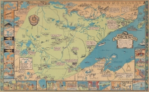
This is a 1929 Irene Anderson and Kathryn Arnquist pictorial map of the Arrowhead Region of Minnesota. It represents one of the earliest uses of the term 'Arrowhead' to refer to northeastern Minnesota. (more details)
Art deco masterpiece from the Golden Age of American Pictorial Cartography.
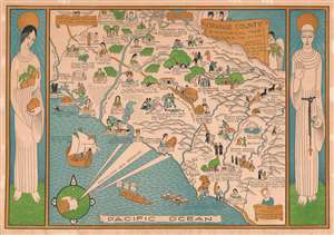
Orange County A Historical Map.
sold
- Digital Map Information
- Suitable for large format printing
- File Size: 21.77 MB
- File Type: ZIP / TIFF
- ICC color profile embedded
- Delivered instantly via download link
A product of the Golden Age of American Pictorial cartography, this is a rare and spectacular Jean Goodwin 1929 Art Deco pictorial map of Orange County, Los Angeles metro area, California. The map is divided triptych-style into three 'panels': the left panel is a personification of California, arms full of oranges; a map of Orange County occupies the primary central panel; and at right a Franciscan friar references regional influence of early Franciscan Missions. Female portraits, bearing a resemblance to 'California' on the left, mark cities and towns including Huntington Beach, Anaheim, Brea, and Laguna Beach. Alternative iconography marks other towns, such as two seals for Seal Beach, or a sunset for Sunset Beach. Pictorial vignettes throughout celebrate California's history. An American soldier marks Ranchos Los Coyotes, an early American army camp from 1847. A stagecoach rumbles along the El Camino Real, and miners hunt for coal and silver in the county's hilly terrain. A 'golden' title cartouche flanked by three angels occupies the upper right section of the central 'panel'. (more details)
Rare pictorial map of Minnesota.
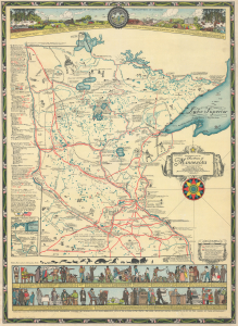
Historical Map of the State of Minnesota (The Land of the Cloud-Tinted Water).
sold
- Digital Map Information
- Suitable for large format printing
- Full resolution TIFF file
- ICC color profile embedded
- Delivered instantly via download link
This is a 1931 Barbara Bell pictorial historical map of the State of Minnesota. Both visually striking and cleverly designed, it provides a comprehensive overview of the state's climate, ecology, and history from Native Americans to airplanes and automobiles. Stylistically, the map is clearly inspired by the work of Jo Mora, which it somewhat resembles. (more details)
A wonderful pictorial map of Washington State created by a celebrated woman artist.
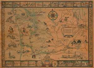
Historical Map of the State of Washington.
sold
- Digital Map Information
- Suitable for large format printing
- File Size: 42.62 MB
- File Type: ZIP / TIFF
- ICC color profile embedded
- Delivered instantly via download link
This is a 1931 Bertha Ballou pictorial map of Washington State tracing historical events around the state. The map depicts the region from the Pacific Ocean to Idaho and from Canada to Oregon and includes views of several of Washington's well-known mountain peaks, including Mt. Saint Helens and Mt. Rainier. Beginning with the arrival of Sir Francis Drake in 1579, Ballou identifies key events in the history of the region, such as the 1855 gold rush, the arrival of Vancouver, and battles all across the state. One such event, the 1847 Whitman massacre, is illustrated by a vignette in the lower right quadrant. The Whitman massacre, as it has become known, was the murder of missionaries Marcus Whitman, his wife Narcissa, and eleven others by Cayuse Indians, and is one of the most notorious episodes in the history of the American settlement of the Pacific Northwest. The incident sparked the Cayuse War, which raged until 1855.
Historical forts are illustrated in profile, including Fort Nisqually which was a Hudson's Bay Company post, Fort Astoria (in Oregon), and Fort Walla Walla, all of which are labeled and the date they were established given. Seattle, Tacoma, Spokane, and Olympia are labeled, with Olympia marked by a vignette of the State Capital. The rail lines of the Northern Pacific Railroad; Chicago, Milwaukee, St. Paul, and Pacific Railroad; the Oregon Railroad and Navigation Company; and the Spokane, Portland, and Seattle Railway are illustrated and identified. Other vignettes include an illustration of a covered wagon being pulled by a team of oxen, a cowboy riding a bronco, and the Grand Coulee. The whole is surrounded by a pictorial border consisting of views of historical events along with common sights around Washington. (more details)
Historical forts are illustrated in profile, including Fort Nisqually which was a Hudson's Bay Company post, Fort Astoria (in Oregon), and Fort Walla Walla, all of which are labeled and the date they were established given. Seattle, Tacoma, Spokane, and Olympia are labeled, with Olympia marked by a vignette of the State Capital. The rail lines of the Northern Pacific Railroad; Chicago, Milwaukee, St. Paul, and Pacific Railroad; the Oregon Railroad and Navigation Company; and the Spokane, Portland, and Seattle Railway are illustrated and identified. Other vignettes include an illustration of a covered wagon being pulled by a team of oxen, a cowboy riding a bronco, and the Grand Coulee. The whole is surrounded by a pictorial border consisting of views of historical events along with common sights around Washington. (more details)