
Alexander, William DeWitt (sold)
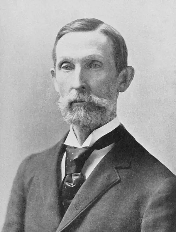
William DeWitt Alexander (1833 - 1913) was a Hawaiian born historian, publisher, writer, surveyor, and teacher. Alexander was born in Honolulu in 1833 to missionary parents. He received a degree from Yale University in 1855. After completing his studies, Alexander remained in the continental United States, first, during the winter of 1855 - 56, taking a job at Beloit College in Wisconsin. Then he moved on to become the schoolmaster of the Vincennes Academy in Vincennes, Indiana, a school recently started by one of his uncles. He returned to Hawaii in 1858 after receiving an offer to teach at the Punahou School, where he taught Greek and history. He became president of the school (then known as O'ahu College) in November 1864. During this time Alexander published a number of books on Hawaiian history and ethnography. In 1869, during a summer vacation, Alexander undertook a survey and produced a map of the Haleakala Crater on Maui. Although he had spent the previous fourteen years in education, he came by his surveying skills honestly. His father, William Patterson Alexander, was a surveyor, and 'W. D.' (as Alexander was known during his childhood) would likely help his father when on vacation from attending the Punahou School. Alexander's map of Haleakala was likely the most scientific land survey of Hawaii produced up to that time. With this achievement, Alexander was appointed surveyor general of the Hawaiian Government Survey in the fall of 1870. This appointment handed Alexander the task of creating a surveying and mapping agency for the Hawaiian government. In this office Alexander did much of his most important work in mapping the Hawaiian Islands. He remained the Surveyor-General of the Hawaiian Government Survey until American annexation of the Hawaiian Islands in 1898, and even then, because the transition took place over a few years, he held the position until 1901. Eventually he attained the office of Surveyor-General of the Territory of Hawaii and a high position in the Privy Council of Kalakaua and Lili'uokalani. Alexander resigned as the head of the Hawaiian Territorial Survey in 1901 when he was put in charge of the Branch Office of the U.S. Coast and Geodetic Survey in the Hawaiian Islands. Alexander married Abigail Charlotte Baldwin in 1860 with whom he had three sons and two daughters.
Most sophisticated 19th century map of Molokai.
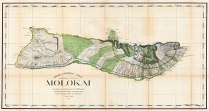
Hawaiian Government Survey. Molokai.
sold
- Digital Map Information
- Suitable for large format printing
- File Size: 154.9 MB
- File Type: ZIP / TIFF
- ICC color profile embedded
- Delivered instantly via download link
This 1897 Christopher Willis map of Molokai is the most sophisticated 19th century mapping of the island. Surveyors from the Hawaiian Government Survey mapped the length and breadth of Molokai and, per Moffat and Fitzpatrick, the map 'represents the final stage in the process of understanding and correctly illustrating the shape of this elongated island between O'ahu and Maui'. (more details)
First scientific survey of Maui.
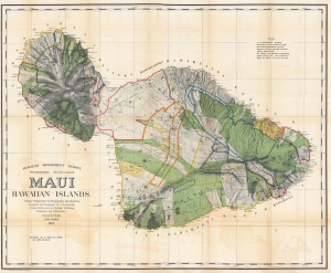
Maui, Hawaiian Islands.
sold
- Digital Map Information
- Suitable for large format printing
- File Size: 310 MB
- File Type: ZIP / TIFF
- ICC color profile embedded
- Delivered instantly via download link
This is the 1903 Frank S. Dodge and John M. Donn map of Maui in the Hawaiian Islands. This map is the first scientific survey of Maui as well as the first map commissioned by U.S. Government after Hawaii's 1898 annexation. (more details)
1st modern survey of Hawaii.
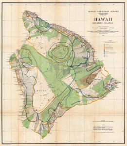
Hawaii Hawaiian Islands.
sold
- Digital Map Information
- Suitable for large format printing
- File Size: 135.38 MB
- File Type: ZIP / TIFF
- ICC color profile embedded
- Delivered instantly via download link
This is a 1906 John M. Donn map of Hawaii, Hawaiian Islands. This map represents the first comprehensive modern survey of Hawaii. (more details)