
Army Orientation Branch

The Army Orientation Branch (1940 - c. 1949) created special maps for teaching the Army Orientation Course and was based at The Pentagon in Washington, D.C. The Army Orientation Branch was part of the Information and Education Division.
Includes photographs of HA. 19, the captured Japanese mini-sub!
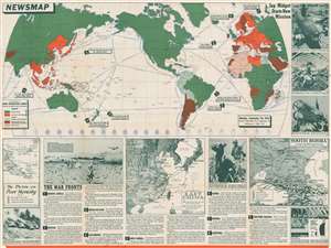
Newsmap. Monday, September 28, 1942. Week of September 18 to September 25. Volume 1, No, 23.
$500.00
Acquire
- Digital Map Information
- Suitable for large format printing
- File Size: 108.93 MB
- File Type: ZIP / TIFF
- ICC color profile embedded
- Delivered instantly via download link
One of the earliest maps in the series, this is a 1942 Army Orientation Course Newsmap of the world. Nearly half of this fascinating piece is occupied by a map of the world, with the Americas at center, that uses color to illustrate how the world is divided between the Allied Powers and the Axis. Here, the orange marks 'Axis and Axis Occupied' territory, while the green marks the 'United Nations'. Nine war-related events that took place across the world are marked as well, with numbered arrows and captions informing the viewer what the event was, and a line and a circle indicating the general area where the event took place. (more details)
Understanding the Enemy.
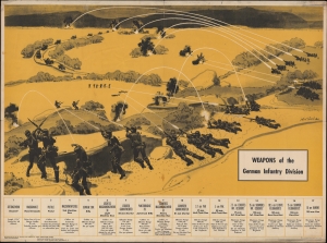
Weapons of the German Infantry Division.
$275.00
Acquire
- Digital Map Information
- Suitable for large format printing
- File Size: 59.82 MB
- File Type: ZIP / TIFF
- ICC color profile embedded
- Delivered instantly via download link
A curious 1943 World War II Newsmap prepared and distributed by the Army Orientation Course, set up by the Army Orientation Branch. This Newsmap was issued to educate American soldiers on German weapons and capabilities during the offensive drive northward through Italy. (more details)
A map of the East Indies created to help educate soldiers during World War II.
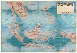
Netherlands East Indies.
$150.00
Acquire
- Digital Map Information
- Suitable for large format printing
- File Size: 91.15 MB
- File Type: ZIP / TIFF
- ICC color profile embedded
- Delivered instantly via download link
This is a c. 1943 Army Orientation Branch map of the East Indies. Depicting the region from the Indian Ocean to New Guinea and from Hainan and French Indochina to northern Australia, maps like this one created by the Army Orientation Branch were meant to help educate soldiers about where World War II was being fought in a general sense. Major cities are marked throughout, including Haiphong, Saigon, Darwin, Manila, Singapore, and Batavia. No information about the current state of the fighting is included, likely because these maps were meant to be used as educational aids in classes and the war front was constantly fluid. (more details)
Recounts the capture of four important islands in the Mediterranean.
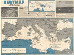
NEWSMAP Monday, June 21, 1943. Week of June 10 to June 17.
$300.00
Acquire
- Digital Map Information
- Suitable for large format printing
- File Size: 109.98 MB
- File Type: ZIP / TIFF
- ICC color profile embedded
- Delivered instantly via download link
This 1943 Army Orientation Course Newsmap map of the Mediterranean, Europe, and North Africa details Allied operations in the middle of June. Short paragraphs describe five significant events from the past week. The most important, particularly with the benefit of hindsight, garners top recognition: The Allied capture of four small islands in the Mediterranean. Published only a few weeks before the Allied invasion of Sicily, codenamed Operation Husky, the eviction of Italian forces from these islands removed one of the last hurdles to the forthcoming landings. From Sicily, the Allies would jump to mainland Italy, the first Western Allied assault on Axis-occupied Europe. Other actions recounted include brutal fighting on the Eastern Front between the Nazis and the Red Army, British and American aerial bombardments of targets in Germany, and an announcement that U.S. submarines sunk another dozen Japanese ships the previous week. (more details)
Highlights the world's air routes, a critical part of World War II.
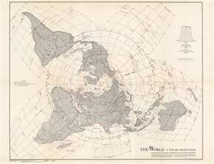
The World. A Polar Projection. With Modified Extensions Interrupted for Southern Hemisphere.
$450.00
Acquire
- Digital Map Information
- Suitable for large format printing
- Full resolution TIFF file
- ICC color profile embedded
- Delivered instantly via download link
This is a two-sided 1943 Army Orientation Course NEWSMAP with a map of the world on a polar projection created by L. F. Vaucher and A. P. Pirola on one side. A global transportation map, Vaucher, and Pirola employ a hybrid projection to most accurately depict worldwide air routes. Red lines highlight these air routes between major cities (which were of extreme importance during World War II) and provide distances in miles. Dashed black and white lines mark significant highways, including recently constructed Alaska Highway, which was completed in 1942. Other depicted highways include a Pan American Highway, depicted here as connecting New York City with Valparaiso and Santiago, Chile, and Buenos Aires, Argentina. Traditionally, the Pan American Highway is illustrated as connecting Buenos Aires and points farther west in the United States, such as Dallas or Denver. The deviation from convention likely comes from the world war and the U.S. government's desire to make it appear that the world is as interconnected as possible. Major roads and highways are also illustrated in northern and central Africa and Asia. The Trans-Siberian Railway and a railway connecting Darwin and Melbourne in Australia are also shown. (more details)
Created as an educational piece for American personnel serving overseas during World War II.
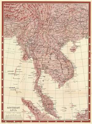
Southeast Asia. Newsmap. Monday, January 17, 1944. Week of January 6 to January 13. 227th Week of the War - 109th Week of U.S. Participation. Volume II No. 39F.
$400.00
Acquire
- Digital Map Information
- Suitable for large format printing
- Full resolution TIFF file
- ICC color profile embedded
- Delivered instantly via download link
This is a 1944 Morale Services Division Newsmap wall map of Southeast Asia. Created for American personnel serving overseas during World War II, the map depicts the region from Hankou, China to Borneo and Sumatra and from Calcutta to Hong Kong. This was a critical, if little-remembered theater of World War II, but little detail concerning the war appears, likely because that information would be severely out of date by the time the map finally reached its intended audience. The map was intended for general educational use concerning the area's geography, cities and towns are labeled throughout. Larger print identifies important cities, which were the ones that soldiers were more likely to recognize, including Singapore, Mandalay, Hong Kong, Macau, Canton (Guangzhou), and Kunming (the Chinese Nationalist capital), to name only a few. Roads that roughly correspond to the famous Burma Road are included as well, although are not labeled as such. (more details)
The war in Europe is won. Now to win in the Pacific.
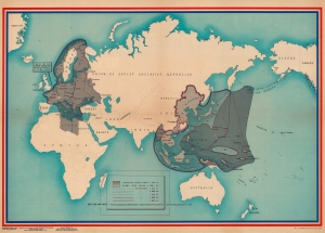
NEWSMAP Overseas Edition For the Armed Forces. V-E Day + 7 Weeks - 184th Week of U.S. Participation in the War. Monday, 2 July 1945. Week of 12 June to 19 June. Vol. IV No 10F.
$375.00
Acquire
- Digital Map Information
- Suitable for large format printing
- Full resolution TIFF file
- ICC color profile embedded
- Delivered instantly via download link
A piece of Allied propaganda created for soldiers, this is a 1945 U.S. Army Information Branch Newsmap map of the battle fronts in Europe and Asia. Published a few months after Germany surrendered, this piece celebrates the achievements of Allied armies in Europe while illustrating how much farther there is to go in Asia and the Pacific. (more details)
Ending the Pacific War.
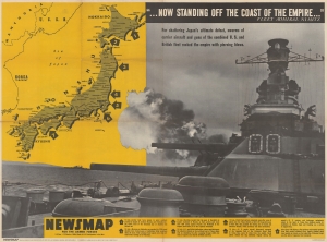
NEWSMAP for the Armed Forces. V-E Day + 12 Weeks - 189th Week of U.S. Participation in the War.
$400.00
Acquire
- Digital Map Information
- Suitable for large format printing
- Full resolution TIFF file
- ICC color profile embedded
- Delivered instantly via download link
This is a 1945 Army Information Branch Newsmap propaganda map of Japan featuring a battleship engaged in firing towards the archipelago. Published during the last few months of World War II (1939 - 1945), this piece emphasizes efforts by the United States and Britain to force Imperial Japan to surrender. (more details)
Published the day the U.S. dropped the atomic bomb on Hiroshima.
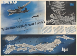
Newsmap. For the Armed Forces. V-E Day + 13 Weeks - 190th Week of U.S. Participation in the War. Monday, 6 August, 1945. Week of 24 July to 31 July. Volume IV No. 16F. 'In a few months we expect to run out of targets in Japan.' / Special Devices.
$800.00
Acquire
- Digital Map Information
- Suitable for large format printing
- Full resolution TIFF file
- ICC color profile embedded
- Delivered instantly via download link
This August 6, 1945 Newsmap illustrates the World War II (1939 - 1945) U.S. strategic bombing campaign against Japan. August 6, also corresponds to the world's first use of an Atomic Bomb against the Japanese at Hiroshima - although that fact is not presented here and was likely not known to the mapmakers. (more details)
Celebrating the First Session of the United Nations General Assembly.
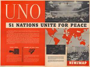
UNO: 51 Nations Unite for Peace. / NEWSMAP. Monday, 21 January, 1946. Week of 8 January to 15 January. Volume IV No. 40F.
$600.00
Acquire
- Digital Map Information
- Suitable for large format printing
- Full resolution TIFF file
- ICC color profile embedded
- Delivered instantly via download link
This is a 1946 Army Information Branch Newsmap map of the world celebrating the First Session of the United Nations General Assembly. A map of the world occupies a little less than one quarter of the sheet with the members of the nascent United Nations (U.N.) (and their colonies) shaded red. A black inset focuses on the area from Boston, Massachusetts, south to Princeton, New Jersey, and red stars mark potential locations for the United Nations' permanent headquarters. A photograph of the opening of the session occupies the upper right quadrant, while an image of the U.S. delegation appears below the map in the lower right corner. On the left side, text provides a short history of the creation of the U.N. and the events of the session. Text and graphics in the lower left corner inform the viewer of the existence of the Security Council and the Economic and Social Council. (more details)