
Baffin, William (sold)

William Baffin (c. 1584 – January 23, 1622) was an English navigator, explorer and cartographer. His efforts to discover a Northwest Passage would earn his fame, largely resulting from his discovery of the bay that bears his name. He is also known for having produced excellent surveys of the Red Sea and the Persian Gulf on behalf of the East India Company, and his collaboration on the most influential map of Northern India to be produced in the seventeenth century. Nothing is known of his early life. Samuel Purchas hailed Baffin as a 'learned-unlearned Mariner and Mathematician... wanting art of words,' conjuring a working sailor whose grasp of survey and drafting came of long experience and not education. He first appears in the historical record in 1612 as chief pilot on Captain James Hall's fourth expedition to Greenland; in the following two years he would serve as in the Muscovy Company whaling fleet around Spitzbergen. In 1615 he was hired by the Company of Merchants of London, Discoverers of the North-West Passage' and sailed as pilot under Captain Robert Bylot, who explored Hudson Strait in search of a Northwest Passage. Baffin's surveys were found to be accurate, confirmed by the explorer Parry in 1821. Returning to the Hudson Strait in 1616 he passed west of Greenland up the Davis Strait, discovering the large bay now known as Baffin's Bay and reaching the furthest point in North America explored by a European until the voyage of Inglefield in 1852. Following his efforts to find a Northwest Passage, he served the East India Company as master's mate aboard the ship Anne Royal. His travels to India between 1617 and 1619 would result in his vaunted surveys of the Red Sea and the Persian Gulf, and his superb map of the Mughal Empire produced in collaboration with Ambassador Sir Thomas Roe. In 1620, he sailed east again, taking part in a naval battle with a combined Portuguese and Dutch fleet which would see his captain killed. Baffin was shot and killed in 1622, as part of a joint effort with Persia to take Portuguese fortresses on Qeshm and Hormuz.
First accurate mapping of the Indus River and western and central India.
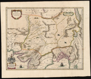
Magni Mogolis Imperium.
sold
- Digital Map Information
- Suitable for large format printing
- Full resolution TIFF file
- ICC color profile embedded
- Delivered instantly via download link
This is an attractive, original color example of Joan and Cornelis Blaeu's 1640 map of the Mughal Empire of Northern India. It is among the most attractively engraved of the 17th-century maps derived from the unacquirable Baffin/Roe map. The map features the first accurate mapping of the Indus River and western and central India. At its heart, the map reveals the vital trade routes between the chief cities of Gujarat, Agra, and Jaisalmer and their linkage to the Silk Road center of Kabul. (more details)
A most attractive Dutch Map of the Mogul Empire.
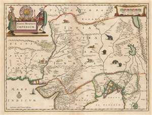
Magni Mogolis Imperium.
sold
- Digital Map Information
- Suitable for large format printing
- DPI: 600
- File Size: 44.94 MB
- File Type: ZIP / TIFF
- ICC color profile embedded
- Delivered instantly via download link
This is an attractive, original color example of Jan Jansson's 1641 map of the Mughal Empire of Northern India. It is the most attractively engraved of the 17th century maps derived from the unacquirable Baffin / Roe map. It features the first accurate mapping of the Indus River, as well as western and central India. At its heart, the map reveals the vital trade routes between the chief cities of Gujarat, Agra, Jaisalmer, and their linkage the Silk Road center of Kabul. (more details)
Updating Baffin's Mughal Empire.
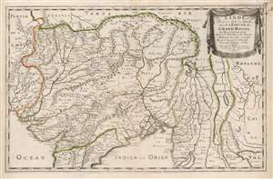
L'Inde deçà et de là Gange, ou est L'Empire do Grand Mogol et Pays Circonvoisins Tirée de Purchas, et de diverses Relations les plus nouvelles.
sold
- Digital Map Information
- Suitable for large format printing
- DPI: 600
- File Size: 44.55 MB
- File Type: ZIP / TIFF
- ICC color profile embedded
- Delivered instantly via download link
This is an attractive example of Nicolas Sanson's 1654 map of the Mughal Empire of Northern India. It is a significant illustration of the early Silk Route trade networks between India and Kabul. The map thus embraces the northern parts of modern India, Pakistan, Afghanistan, Bangladesh, and Burma, as well as parts of Thailand, Laos, and Vietnam. (more details)