
Bartlett, George Hartnell (sold)

George Hartnell Bartlett (May 24, 1838 - March 26, 1923) was an English lithographer active in Westminster, London, New York City, and Boston and is best known for his architectural diagrams. Bartlett was born in Camberwell, London, England. He studied engineering. He also mastered printing and lithography, pioneering the Steam Press in London, c. 1867. In that year, he published a pictorial or 'monumental-style' map of London, somewhat pioneering at the time, which included his own illustrations of important buildings and monuments. In May 1870, he relocated to New York City. There he immediately established himself at 309 Broadway where he partnered with 'Major and Knapp' to publish a similar pictorial map of New York. By 1871, we find him in Boston, where, while visiting, he applied for a teaching position on a whim, and earning the position, remained in Boston. There in 1871 he published a similar map of that city. He also issued a somewhat related map, in 1893, illustrating the Public Libraries of Massachusetts (another edition in 1904). He remained in Boston for the remainder of his career, establishing himself as a leading member of the Boston Lithographic Artists’ Association and from 1883 - 1912 he served as Principal of the Massachusetts State Normal Art School. During this time, he published a well-regarded test on pen and ink drawing. Bartlett applied for U.S. Citizenship in 1883 and was naturalized as a U.S. Citizen on October 24, 1887. His name is sometimes misprinted in sources as 'C. H. Bartlett.' He died at his home in Arlington, Massachusetts, in 1923.
Graphic Traveler's Guide to London.
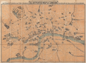
Illustrated Map of London, or Stranger's Guide to the Public Buildings, Theatres, Music Halls, and all Places of Interest.
sold
- Digital Map Information
- Suitable for large format printing
- Full resolution TIFF file
- ICC color profile embedded
- Delivered instantly via download link
This is an 1867 George Hartnell Bartlett pictorial map of London, England, with charming profile illustrations of landmarks. The building profiles were drawn by Bartlett himself and, while not unprecedented, were pioneering in a cartographic context. Bartlett went on to make related maps of New York, Boston, Paris, and Massachusetts, but this is his first and thus most significant work. (more details)
Hundreds of public schools across Massachusetts.
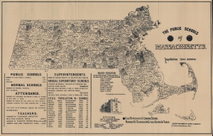
The Public Schools of Massachusetts.
sold
- Digital Map Information
- Suitable for large format printing
- File Size: 52.22 MB
- File Type: ZIP / TIFF
- ICC color profile embedded
- Delivered instantly via download link
This is an 1893 George H. Bartlett map of Massachusetts Common Schools representing the pioneering of American public education in Massachusetts. The common schools mapped here were community-organized public schools with a religious underpinning. They predated the state-funded public school system we know today. This map focuses on the final years of the common school system and pioneering efforts in Massachusetts to centralize and 'normalize' public education under the state banner. Massachusetts was the first state to do so, thus this map documents the developmental stages of public education as we know it today. (more details)