
Beers Family (Fredrick, Silas, James, and Daniel)

The Beers family (Fredrick, Silas, James and Daniel) (fl. c. 1850 - 1886), along with Charles and Augustus Warner, were prominent map publishers working from the 1850s to the late 1880s. Often publishing under the Warner & Beers designation, the combined firms produced a series of important state and county atlases and map of much of the northeastern United States. Many of their regional maps are among the most detailed and well laid out maps ever produced of their respective regions. Because Warner & Beers county maps were often detailed down to the individual homes and landowners, they have become highly sought after by general and family historians. In additional to producing maps of surpassing detail, Warner & Beers also maintained an earlier generation's attention to detail and quality while publishing in an era ever increasingly dominated by the low cost printing methods used by the publishing empires of Rand McNally and George Cram.
Beers Family is also known as: Fredrick, Silas, James, and Daniel
Abreast of West Point.
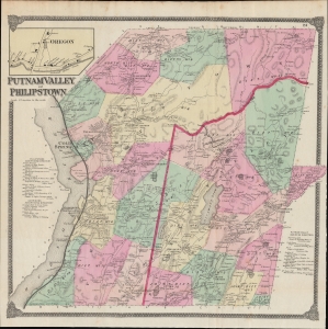
Putnam Valley and Philipstown.
$450.00
Acquire
- Digital Map Information
- Suitable for large format printing
- File Size: 43.1 MB
- File Type: ZIP / TIFF
- ICC color profile embedded
- Delivered instantly via download link
This is F. W. Beers' 1867 hand-colored map of the towns of Putnam Valley and Philipstown, along the Hudson River in Putnam County, New York. (more details)
Heartland of the Hudson Valley.
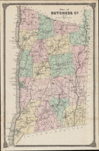
Plan of Dutchess Co. N. Y.
$350.00
Acquire
- Digital Map Information
- Suitable for large format printing
- File Size: 330.2 MB
- File Type: ZIP / TIFF
- ICC color profile embedded
- Delivered instantly via download link
A lovely example of F. W. Beers 1867 map of Dutchess County, New York that appeared in his Atlas of New York and Vicinity from Actual Surveys. This area is known for its scenic beauty, historical significance (especially its association with the Roosevelts), and educational institutions, notably Vassar College. (more details)
Stronghold of the Revolution.
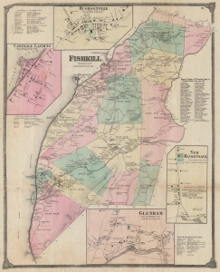
Fishkill Dutchess Co. N.Y.
$400.00
Acquire
- Digital Map Information
- Suitable for large format printing
- File Size: 45.63 MB
- File Type: ZIP / TIFF
- ICC color profile embedded
- Delivered instantly via download link
An example of Frederick W. Beers' 1867 detailed hand-colored map of the town of Fishkill, New York, along the Hudson River. (more details)
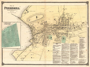
Plan of Peekskill Westchester Co. N.Y.
$350.00
Acquire
- Digital Map Information
- Suitable for large format printing
- File Size: 14.22 MB
- File Type: ZIP / TIFF
- ICC color profile embedded
- Delivered instantly via download link
A very attractive example of F. W. Beer's 1867 map of Peekskill, New York. Details the town of Peekskill from the Hudson River to 'Five Mile Pike.' Offers extraordinary detail at the level of individual buildings. A treasure for genealogists, this map actually ... (more details)
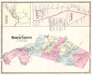
Town of North Castle Westchester Co. N.Y.
$200.00
Acquire
- Digital Map Information
- Suitable for large format printing
- File Size: 2.56 MB
- File Type: ZIP / TIFF
- ICC color profile embedded
- Delivered instantly via download link
This scarce hand colored map is a lithographic engraving of North Castle, Westchester, New York. Map depicts the Westchester cities and town surrounding Armonk, North Castle, Banksville, and Kensico. The extraordinary detail of this map, down to individual ... (more details)
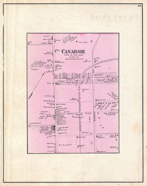
Canarsie, Town of Flat Lands, Kings Co.
$200.00
Acquire
- Digital Map Information
- Suitable for large format printing
- File Size: 4.6 MB
- File Type: ZIP / TIFF
- ICC color profile embedded
- Delivered instantly via download link
A scarce example of Fredrick W. Beers' map parts of the region of Canarsie, Brooklyn, New York City. Published in 1873. Detailed to the level of individual properties and buildings with land owners noted. This is probably the finest atlas map these ... (more details)
Beautiful Map of Flushing, Queens, New York City.
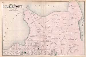
Part of College Point Town of Flushing Queens Co.
$200.00
Acquire
- Digital Map Information
- Suitable for large format printing
- File Size: 8.51 MB
- File Type: ZIP / TIFF
- ICC color profile embedded
- Delivered instantly via download link
A scarce example of Fredrick W. Beers' map of College Point, part of Flushing, Queens, New York. Published in 1873, it covers the College Point area of Flushing, Queens, home to the Asian diaspora in New York City. It covers from 2nd avenue to ... (more details)
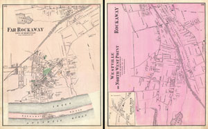
Far Rockaway, Town of Hempstead. / Westville or North West Point, Town ofHempstead, Queens Co. L.I. / Rockaway.
$150.00
Acquire
- Digital Map Information
- Suitable for large format printing
- File Size: 11.92 MB
- File Type: ZIP / TIFF
- ICC color profile embedded
- Delivered instantly via download link
A scarce example of Fredrick W. Beers' map parts of Far Rockaway, Queens, New York City. Published in 1873. Covers from Rockaway beach north to Jamaica Bay. Map of Westville or North West Point and Rockaway on verso. Detailed to the level of ... (more details)
Long Island City, New York.
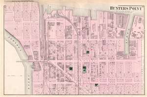
Hunters Point Part of Long Island City.
$200.00
Acquire
- Digital Map Information
- Suitable for large format printing
- File Size: 18.45 MB
- File Type: ZIP / TIFF
- ICC color profile embedded
- Delivered instantly via download link
A scarce example of Fredrick W. Beers' 1873 map of Hunter's Point (Long Island City), Queens, New York. The map depicts part of what is today Long Island City from Pier Street north as far as Nott Avenue. Among the identified locations are the Long Island Railroad depot, several churches, a school, and Standard Oil's 'store room'. Individual lots are identified. This is probably the finest atlas map of Hunters Point, Queens, to appear in the 19th century. (more details)
Probably the finest 19th century atlas map of Jamaica, Queens issued during the 19th century.
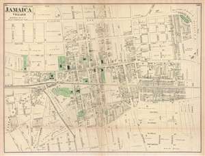
Jamaica Village, Queens Co. L.I.
$250.00
Acquire
- Digital Map Information
- Suitable for large format printing
- File Size: 7.81 MB
- File Type: ZIP / TIFF
- ICC color profile embedded
- Delivered instantly via download link
Probably the finest atlas map of the town of Jamaica to appear in the 19th century, this is an 1873 Fredrick W. Beers map of the town of Jamaica Village, Queens, New York. The map depicts the area from roughly modern-day Highland Avenue to ... (more details)
Early map of Flushing, Queens.
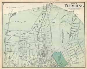
Part of Flushing. Town of Flushing, Queens Co.
$150.00
Acquire
- Digital Map Information
- Suitable for large format printing
- File Size: 4.76 MB
- File Type: ZIP / TIFF
- ICC color profile embedded
- Delivered instantly via download link
A scarce example of Fredrick W. Beers' map parts of Flushing, Queens, New York City. Published in 1873. Oriented to the east. Roughly covers from Bayside Avenue south to Walnut Avenue. Includes Sanford Hall, the Private Asylum. Detailed ... (more details)
Beers' map of Flushing in Queens, New York City.
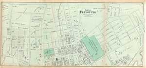
Part of Flushing. Town of Flushing, Queens Co.
$200.00
Acquire
- Digital Map Information
- Suitable for large format printing
- File Size: 12.1 MB
- File Type: ZIP / TIFF
- ICC color profile embedded
- Delivered instantly via download link
A scarce 1873 example of Fredrick W. Beers' map parts of Queens, New York City. Oriented to the east. Roughly covers Boerum Avenue, Brewster Avenue, Parsons Avenue, Sanford Avenue, Jamaica Avenue, Ireland Avenue, Whittier Avenue, ... (more details)
Transitioning to suburbanism.
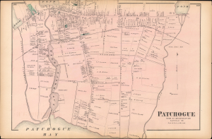
Patchogue Town of Brookhaven Suffolk Co.
$200.00
Acquire
- Digital Map Information
- Suitable for large format printing
- File Size: 14.96 MB
- File Type: ZIP / TIFF
- ICC color profile embedded
- Delivered instantly via download link
This is a 1873 Fredrick W. Beers map of the town of Patchogue, Long Island, New York. The map captures Patchogue shortly after the 1869 arrival of the Long Island Railroad, when the town began a transition from an isolated maritime economy to a connected suburban community. (more details)
Scenic town on eastern Long Island.
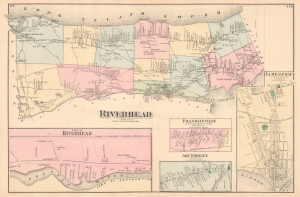
Riverhead Suffolk Co.
$250.00
Acquire
- Digital Map Information
- Suitable for large format printing
- File Size: 15.25 MB
- File Type: ZIP / TIFF
- ICC color profile embedded
- Delivered instantly via download link
This is the 1873 F.W. Beers map of the town of Riverhead, Long Island, New York. (more details)
Early map of Woodhaven, Queens, New York City.
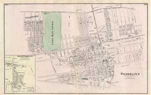
Woodhaven Town of Jamaica Queens Co.
$195.00
Acquire
- Digital Map Information
- Suitable for large format printing
- File Size: 6.96 MB
- File Type: ZIP / TIFF
- ICC color profile embedded
- Delivered instantly via download link
A scarce example of Fredrick W. Beers' map of the town of Woodhaven, Queens, New York City. Published in 1873. Covers from Unionville past the Union Race Course along Atlantic Avenue to Grand Street. Extends as far south as ... (more details)
Large Scale map of Brooklyn and Queens w/ unique advertising.
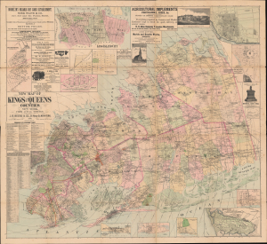
New Map of Kings and Queens Counties New York.
$3,250.00
Acquire
- Digital Map Information
- Suitable for large format printing
- File Size: 222.61 MB
- File Type: ZIP / TIFF
- ICC color profile embedded
- Delivered instantly via download link
A most intriguing large-scale 1886 J. B. Beers folding wall map of western Long Island, including Brooklyn, Queens, and Nassau County. The map reflects enthusiasm for Long Island at the height of the late 19th-century Long Island Real Estate Boom. It also notes Merrick Camp Grounds, underscoring the popularity of Third Awakening revivalism in Long Island. (more details)