
Beers Family (sold) (Fredrick, Silas, James, and Daniel)

The Beers family (Fredrick, Silas, James and Daniel) (fl. c. 1850 - 1886), along with Charles and Augustus Warner, were prominent map publishers working from the 1850s to the late 1880s. Often publishing under the Warner & Beers designation, the combined firms produced a series of important state and county atlases and map of much of the northeastern United States. Many of their regional maps are among the most detailed and well laid out maps ever produced of their respective regions. Because Warner & Beers county maps were often detailed down to the individual homes and landowners, they have become highly sought after by general and family historians. In additional to producing maps of surpassing detail, Warner & Beers also maintained an earlier generation's attention to detail and quality while publishing in an era ever increasingly dominated by the low cost printing methods used by the publishing empires of Rand McNally and George Cram.
AKA: Fredrick, Silas, James, and Daniel
Tarrytown - the setting for the iconic 19th century short story 'The Legend of Sleepy Hollow'!
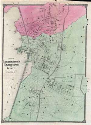
Plan of Beekmantown Tarrytown and Irving West Chester Co. N.Y.
sold
- Digital Map Information
- Suitable for large format printing
- File Size: 10.64 MB
- File Type: ZIP / TIFF
- ICC color profile embedded
- Delivered instantly via download link
This is an 1867 Frederic Beers map of Beekmantown, Tarrytown, and Irving, New York. The map depicts the region along the Hudson River known as the Tappen Zee in extraordinary detail, with individual buildings (with the names of their owners!) illustrated in both ... (more details)
Hamlets along the Hudson.
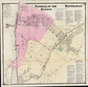
Fishkill on the Hudson / Matteawan.
sold
- Digital Map Information
- Suitable for large format printing
- File Size: 55.29 MB
- File Type: ZIP / TIFF
- ICC color profile embedded
- Delivered instantly via download link
An example of Frederick W. Beers' hand-colored map of Fishkill on the Hudson and Matteawan, consistent with the present-day city of Beacon, New York. The remarkably detailed map provides information on individual properties and businesses, along with their owners, making it an essential source of information on local history. (more details)
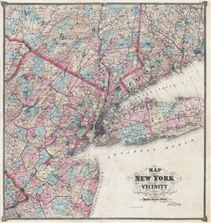
Map of New York and Vicinity.
sold
- Digital Map Information
- Suitable for large format printing
- File Size: 27.89 MB
- File Type: ZIP / TIFF
- ICC color profile embedded
- Delivered instantly via download link
An uncommon large format 1867 F. W. Beers map of New York and Vicinity. Centered on New York City, the map covers from Poughkeepsie to Barnegat Bay and from the Pennsylvania border east to Suffolk County, Long Island, and New Haven Connecticut. Parts of ... (more details)
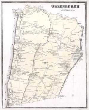
Greenburgh Westchester Co. N.Y.
sold
- Digital Map Information
- Suitable for large format printing
- File Size: 3.06 MB
- File Type: ZIP / TIFF
- ICC color profile embedded
- Delivered instantly via download link
This is the scarce Greenburgh sheet from Beers' 1867 Atlas of Westchester County, New York. When this map was produced 'Greenburgh' consisted of what is today the central Westchester County. Includes White Plains, Scarsdale, Hastings, Dobbs Ferry, ... (more details)
Includes White Plains and Tarrytown.
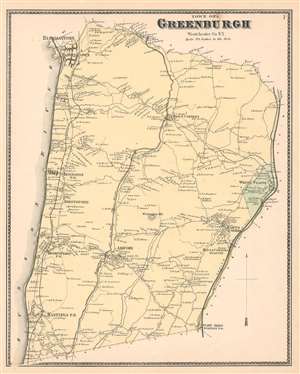
Greenburgh Westchester Co. N.Y.
sold
- Digital Map Information
- Suitable for large format printing
- File Size: 9.37 MB
- File Type: ZIP / TIFF
- ICC color profile embedded
- Delivered instantly via download link
This is the scarce Greenburgh sheet from Beers' 1867 Atlas of Westchester County, New York. When this map was produced 'Greenburgh' consisted of what is today the central Westchester County. Includes White Plains, Scarsdale, Hastings, Dobbs Ferry, Abbotsford, Irvington, Irving, Hall's Corners, Ashford, and other communities between the Harlem River and the Hudson River. Indicates the Croton Aqueducts, the Saw Mill River, and the Sprain Brook. The extraordinary detail of this map, down to individual households with family names, make it a fascinating study for the family researcher or historian. (more details)
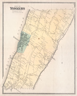
Town of Yonkers Westchester Co. N.Y.
sold
- Digital Map Information
- Suitable for large format printing
- File Size: 3.09 MB
- File Type: ZIP / TIFF
- ICC color profile embedded
- Delivered instantly via download link
This is the scarce Yonkers sheet from Beers' 1867 Atlas of Westchester County, New York. When this map was produced 'Yonkers' consisted of what is today the Bronx, modern day Yonkers, and other communities as far north as Greenbush. Includes ... (more details)
North Part of Hempstead Queens Co. L. I.
sold
- Digital Map Information
- Suitable for large format printing
- File Size: 1.72 MB
- File Type: ZIP / TIFF
- ICC color profile embedded
- Delivered instantly via download link
This scarce and large hand colored map depicts the town of Hempstead, Long Island, New York. Map depicts the populous cities and towns surrounding Hempstead, including Garden city, Valley Stream, Bridgeport, Rockville, Greenwich Point, ... (more details)
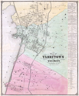
Plan of Tarrytown and Vicinity Westchester Co. N.Y.
sold
- Digital Map Information
- Suitable for large format printing
- File Size: 5.89 MB
- File Type: ZIP / TIFF
- ICC color profile embedded
- Delivered instantly via download link
This is an extraordinary and rare large format F. Beers map of Tarrytown, New York. Map is a hand colored lithographic engraving dating 1868. Tarrytown is a prominent town on the Hudson river and the location of the important Tappan ... (more details)
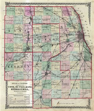
Atlas of Illinois Counties of Cook, Du Page, Kane Kendall and Will.
sold
- Digital Map Information
- Suitable for large format printing
- File Size: 6.63 MB
- File Type: ZIP / TIFF
- ICC color profile embedded
- Delivered instantly via download link
This is a scarce hand colored map of the counties of Cook, Du Page, Kane, Kendall and Will of the state of Illinois issued by Warner and Beers. Depicts the counties in the northern part of the state of Illinois in great detail, ... (more details)

City of Newark Essex Co., N.J.
sold
- Digital Map Information
- Suitable for large format printing
- File Size: 11.43 MB
- File Type: ZIP / TIFF
- ICC color profile embedded
- Delivered instantly via download link
A fine example of the 1872 map of Newark, New Jersey by F. W. Beers. Covers the center of Newark from Elizabeth to Belleville and from Bloomfield to Newark Bay and the Passaic River. Shows streets, city wards, canals, parks, ... (more details)
Issued just one year after the Great Chicago Fire of 1871.
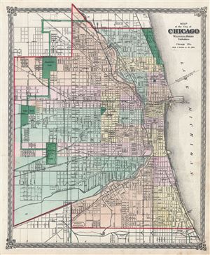
Map of the city of Chicago.
sold
- Digital Map Information
- Suitable for large format printing
- File Size: 10.04 MB
- File Type: ZIP / TIFF
- ICC color profile embedded
- Delivered instantly via download link
A fine c. 1872 map of Chicago issued by Warner and Beers. The map covers from Fullerton and Wrightwood Avenues to the Union Stockyards and from Central Park to Lake Michigan. All streets, wards, rail lines, public ... (more details)
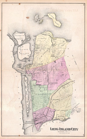
Long Island City, Queens Co.L.I.
sold
- Digital Map Information
- Suitable for large format printing
- File Size: 12.85 MB
- File Type: ZIP / TIFF
- ICC color profile embedded
- Delivered instantly via download link
A scarce example of Fredrick W. Beers' map of the Long Island City, Queens, New York. Published in 1873. Covers from Hunters Point and Long Island City northward past Ravenswood and Dutch Kills to include all of ... (more details)
19th century map of Long Island City, Queens, New York.
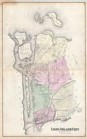
Long Island City, Queens Co. L. I.
sold
- Digital Map Information
- Suitable for large format printing
- File Size: 10.39 MB
- File Type: ZIP / TIFF
- ICC color profile embedded
- Delivered instantly via download link
A scarce example of Fredrick W. Beers' map of the Long Island City, Queens, New York published in 1873. It covers from Hunters Point and Long Island City northward past Ravenswood and Dutch Kills to include all of ... (more details)
Scarce early map of Astoria, Queens, New York City.
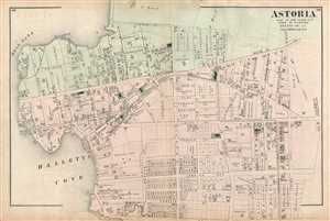
Astoria Part of Long Island City Town of Newtown Queens, Co. L.I.
sold
- Digital Map Information
- Suitable for large format printing
- File Size: 8.3 MB
- File Type: ZIP / TIFF
- ICC color profile embedded
- Delivered instantly via download link
A scarce example of Fredrick W. Beers' map of the southern part of Astoria, Queens, New York. Published in 1873, this magnificent map covers from Hells Gate and Halletts Cove eastward as far as Third Ave and the ... (more details)
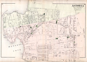
Astoria, Part of Long Island City, Town of Newtown, Queens, Co. L.I.
sold
- Digital Map Information
- Suitable for large format printing
- File Size: 2.37 MB
- File Type: ZIP / TIFF
- ICC color profile embedded
- Delivered instantly via download link
A scarce example of Fredrick W. Beers' map of the southern part of Astoria, Queens, New York. Published in 1873, this magnificent map covers from Hells Gate and Halletts Cove eastward as far as Third Ave and the ... (more details)
Scarce map of Babylon, Long Island.
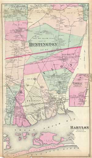
Babylon Suffolk Co. / Half Way Hollow Hills, Part of Huntington.
sold
- Digital Map Information
- Suitable for large format printing
- File Size: 12.89 MB
- File Type: ZIP / TIFF
- ICC color profile embedded
- Delivered instantly via download link
A scarce example of Fredrick W. Beers' map of the southern part of Huntington and Babylon, Long Island, New York. Published in 1873, this magnificent map covers from Amityville to Babylon Cove. Extend as far ... (more details)
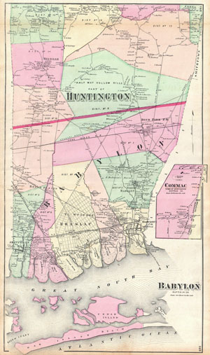
Babylon Suffolk Co.
sold
- Digital Map Information
- Suitable for large format printing
- File Size: 8.26 MB
- File Type: ZIP / TIFF
- ICC color profile embedded
- Delivered instantly via download link
A scarce example of Fredrick W. Beers' map of the southern part of Huntington and Babylon, Long Island, New York. Published in 1873, this magnificent map covers from Amityville to Babylon Cove. Extend as far ... (more details)
Early map of Brookhaven and Fire Island.
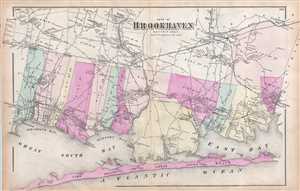
Part of Brookhaven Suffolk Co. L. I.
sold
- Digital Map Information
- Suitable for large format printing
- File Size: 10.2 MB
- File Type: ZIP / TIFF
- ICC color profile embedded
- Delivered instantly via download link
A scarce example of Fredrick W. Beers' map of the southern part of Brookhaven and Fire Island, Long Island, New York. Published in 1873, this magnificent map covers Great South Bay and East Bay and along the ... (more details)
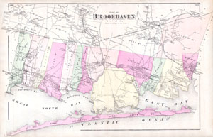
Part of Brookhaven, Sufffolk Co. L.I.
sold
- Digital Map Information
- Suitable for large format printing
- File Size: 5.9 MB
- File Type: ZIP / TIFF
- ICC color profile embedded
- Delivered instantly via download link
A scarce example of Fredrick W. Beers' map of the southern part of Brookhaven, Long Island, New York. Published in 1873, this magnificent map covers Great South Bay and East Bay and along the coast from Blue ... (more details)
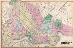
The City of Brooklyn.
sold
- Digital Map Information
- Suitable for large format printing
- File Size: 17 MB
- File Type: ZIP / TIFF
- ICC color profile embedded
- Delivered instantly via download link
A rare example of Fredrick W. Beers' Map Brooklyn, New York. Published in 1873, this map depicts Brooklyn, Greenpoint and Williamsburg. Features detail to the street level showing individual buildings, ... (more details)
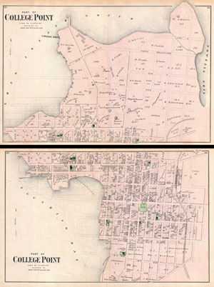
Part of College Point, Town of Flushing, Queens Co. / Part of College Point, Town of Flushing, Queens Co.
sold
- Digital Map Information
- Suitable for large format printing
- File Size: 19.21 MB
- File Type: ZIP / TIFF
- ICC color profile embedded
- Delivered instantly via download link
A scarce example of Fredrick W. Beers' two map set of College Point, Queens, New York. Published in 1873. Bottom sheet covers roughly from what was then 9th Avenue northward as far as what was then 2nd ... (more details)
Two sided map of Sag Harbor and East Hampton, New York.
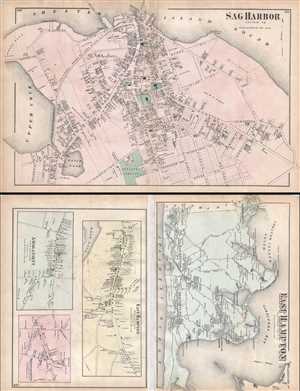
Sag Harbor, Suffolk Co. / East Hampton, Suffolk Co. L.I.
sold
- Digital Map Information
- Suitable for large format printing
- File Size: 19.28 MB
- File Type: ZIP / TIFF
- ICC color profile embedded
- Delivered instantly via download link
A scarce example of Fredrick W. Beers' map of the Sag Harbor and East Hampton, Long Island, New York. Published in 1873, this map is printed on both sides. On the Sag Harbor Side, this magnificent map ... (more details)
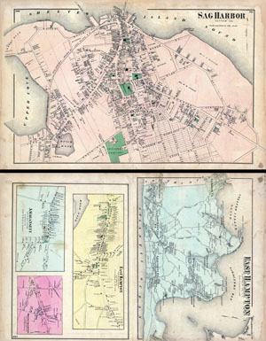
East Hampton, Suffolk Co. L.I. / Sag Harbor, Suffolk Co.
sold
- Digital Map Information
- Suitable for large format printing
- File Size: 25.12 MB
- File Type: ZIP / TIFF
- ICC color profile embedded
- Delivered instantly via download link
A scarce example of Fredrick W. Beers' map of the Sag Harbor and East Hampton, Long Island, New York. Published in 1873, this map is printed on both sides. On the Sag Harbor Side, this magnificent ... (more details)
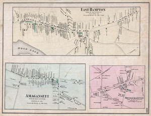
East Hampton, Town of East Hampton, Suffolk Co. Amagansett, Town of East Hampton, Suffolk Co. Bridgehampton, Town of Southampton, Suffolk Co.
sold
- Digital Map Information
- Suitable for large format printing
- File Size: 4.85 MB
- File Type: ZIP / TIFF
- ICC color profile embedded
- Delivered instantly via download link
A rare example of Fredrick W. Beers' Map of the towns of East Hampton, Amagansett, and Bridgehampton. Published in 1873, this is actually three maps on one sheet. The top map details East Hampton, ... (more details)
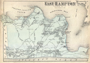
East Hampton Suffolk Co. L.I.
sold
- Digital Map Information
- Suitable for large format printing
- File Size: 5.72 MB
- File Type: ZIP / TIFF
- ICC color profile embedded
- Delivered instantly via download link
A rare example of Fredrick W. Beers' Map of East Hampton, Long Island, New York. Published in 1873, this magnificent map covers the south fork of Long Island from Sag Harbor toe Napeague Harbor and ... (more details)
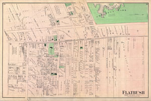
Flatbush Town of Flatbush Kings Co. L.I.
sold
- Digital Map Information
- Suitable for large format printing
- File Size: 14.14 MB
- File Type: ZIP / TIFF
- ICC color profile embedded
- Delivered instantly via download link
A scarce example of Fredrick W. Beers' map of the Flatbush area of Brooklyn, New York. Published in 1873. Oriented to the west. Covers roughly from modern day Regent Place northward as far as the ... (more details)
Beer's plan of Flatbush in Brooklyn, New York City.
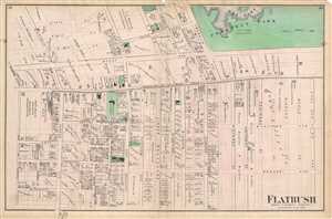
Flatbush Town of Flatbush Kings Co. L.I.
sold
- Digital Map Information
- Suitable for large format printing
- File Size: 10.07 MB
- File Type: ZIP / TIFF
- ICC color profile embedded
- Delivered instantly via download link
A scarce example of Fredrick W. Beers' map of the Flatbush area of Brooklyn, New York published in 1873. Oriented to the west, covers roughly from modern day Regent Place northward as far as the ... (more details)
Beautiful map depicting Canarsie and Jamaica in Brooklyn, New York.
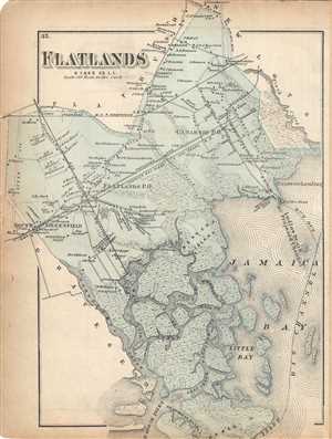
Flatlands, Kings Co. L.I.
sold
- Digital Map Information
- Suitable for large format printing
- File Size: 6.46 MB
- File Type: ZIP / TIFF
- ICC color profile embedded
- Delivered instantly via download link
A scarce example of Fredrick W. Beers' map parts of the region of Flatlands, Brooklyn, New York City. Published in 1873. Includes the communities of Flatlands, South Greenfield, Canarsie and ... (more details)
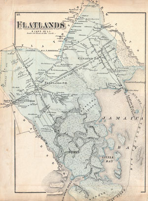
Flatlands, Kings Co. L.I.
sold
- Digital Map Information
- Suitable for large format printing
- File Size: 8.22 MB
- File Type: ZIP / TIFF
- ICC color profile embedded
- Delivered instantly via download link
A scarce example of Fredrick W. Beers' map parts of the region of Flatlands, Brooklyn, New York City. Published in 1873. Includes the communities of Flatlands, South Greenfield, Canarsie ... (more details)
Early map of Flushing and College Point in Queens, New York City.
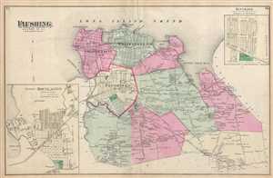
Flushing, Queens Co. L.I.
sold
- Digital Map Information
- Suitable for large format printing
- File Size: 10.46 MB
- File Type: ZIP / TIFF
- ICC color profile embedded
- Delivered instantly via download link
A scarce example of Fredrick W. Beers' map of Flushing and College Point, Queens, New York. Published in 1873. Covers part of what is today northern Queens, New York City, including ... (more details)
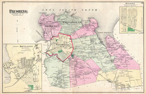
Flushing, Queens Co. L.I.
sold
- Digital Map Information
- Suitable for large format printing
- File Size: 12.47 MB
- File Type: ZIP / TIFF
- ICC color profile embedded
- Delivered instantly via download link
A scarce example of Fredrick W. Beers' map of Flushing and College Point, Queens, New York. Published in 1873. Covers part of what is today northern Queens, New York City, including ... (more details)
Beers' map of Flushing in Queens, New York City.
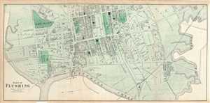
Part of Flushing. Town of Flushing, Queens Co.
sold
- Digital Map Information
- Suitable for large format printing
- File Size: 15.11 MB
- File Type: ZIP / TIFF
- ICC color profile embedded
- Delivered instantly via download link
A scarce example of Fredrick W. Beers' map parts of Flushing, Queens, New York City published in 1873. Oriented to the east, roughly includes Orchard Street, Myrtle Avenue, Bradford ... (more details)
Scarce map of Fort Hamilton in Brooklyn, New York City.
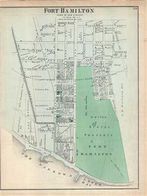
Fort Hamilton, Town of New Utrecht, Kings Co. L.I.
sold
- Digital Map Information
- Suitable for large format printing
- File Size: 5.37 MB
- File Type: ZIP / TIFF
- ICC color profile embedded
- Delivered instantly via download link
A scarce example of Fredrick W. Beers' map parts of the towns of Fort Hamilton, Brooklyn, New York. Published in 1873. Detailed to the level of individual properties and buildings ... (more details)
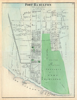
Fort Hamilton, Town of New Utrecht, Kings Co. L.I.
sold
- Digital Map Information
- Suitable for large format printing
- File Size: 7.16 MB
- File Type: ZIP / TIFF
- ICC color profile embedded
- Delivered instantly via download link
A scarce example of Fredrick W. Beers' map parts of the towns of Fort Hamilton, Brooklyn, New York. Published in 1873. Detailed to the level of individual properties and ... (more details)
Map of Glen Cove in Queens, New york City.
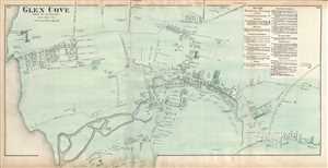
Glen Cove, Town of Oyster Bay, Queens Co.
sold
- Digital Map Information
- Suitable for large format printing
- File Size: 11.78 MB
- File Type: ZIP / TIFF
- ICC color profile embedded
- Delivered instantly via download link
A scarce example of Fredrick W. Beers' map parts of Glen Cove, Queens, New York City published in 1873. It detailed to the level of individual properties and buildings ... (more details)
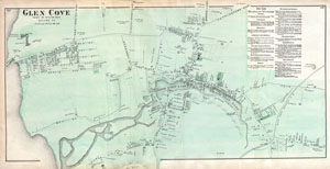
Glen Cove, Town of Oyster Bay, Queens Co.
sold
- Digital Map Information
- Suitable for large format printing
- File Size: 17.5 MB
- File Type: ZIP / TIFF
- ICC color profile embedded
- Delivered instantly via download link
A scarce example of Fredrick W. Beers' map parts of Glen Cove, Queens, New York City. Published in 1873. Detailed to the level of individual properties and buildings ... (more details)
Beautiful early map of Coney Island, New York City.
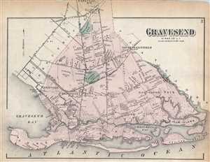
Gravesend Kings Co. L.I.
sold
- Digital Map Information
- Suitable for large format printing
- File Size: 5.89 MB
- File Type: ZIP / TIFF
- ICC color profile embedded
- Delivered instantly via download link
A scarce example of Fredrick W. Beers' map parts of the region of Gravesend, Brooklyn, New York City. Published in 1873. Includes the communities of Unionville, ... (more details)
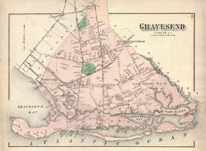
Gravesend, Kings Co. L.I.
sold
- Digital Map Information
- Suitable for large format printing
- File Size: 7.77 MB
- File Type: ZIP / TIFF
- ICC color profile embedded
- Delivered instantly via download link
A scarce example of Fredrick W. Beers' map parts of the region of Gravesend, Brooklyn, New York City. Published in 1873. Includes the communities of Unionville, ... (more details)
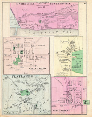
Unionville Guntherville, Town of Gravesend, Kings Co. / Gravesend, Town of Gravesend, Kings Co. / Part of Town of Gravesend, Kings Co. / Flatlands, Town of Flatlands, Kings Co./ New Utrecht, Tn of New Utrecht, Kings Co.
sold
- Digital Map Information
- Suitable for large format printing
- File Size: 6.32 MB
- File Type: ZIP / TIFF
- ICC color profile embedded
- Delivered instantly via download link
A scarce example of Fredrick W. Beers' map of the communities of Unionville, Guntherville, Gravesend, Flatlands and New Utrecht, Brooklyn, New York City. Five ... (more details)
Perhaps the finest 19th century map of these Brooklyn communities.
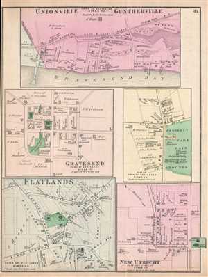
Unionville Guntherville, Town of Gravesend, Kings Co. / Gravesend, Town of Gravesend, Kings Co. / Part of Town of Gravesend, Kings Co. / Flatlands, Town of Flatlands, Kings Co./ New Utrecht, Tn of New Utrecht, Kings Co.
sold
- Digital Map Information
- Suitable for large format printing
- File Size: 4.25 MB
- File Type: ZIP / TIFF
- ICC color profile embedded
- Delivered instantly via download link
This is an 1873 Fredrick W. Beers map of the communities of Unionville, Guntherville, Gravesend, Flatlands and New Utrecht, which are now part of the borough ... (more details)
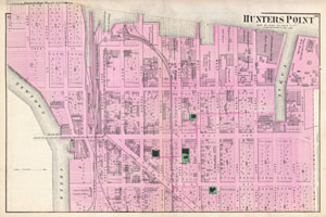
Hunters Point, Part of Long Island City.
sold
- Digital Map Information
- Suitable for large format printing
- File Size: 14.03 MB
- File Type: ZIP / TIFF
- ICC color profile embedded
- Delivered instantly via download link
A scarce example of Fredrick W. Beers' map of the Hunter's Point (Hunters Point), Queens, New York. Published in 1873. Covers part of what is today Long ... (more details)
Beautiful map of Hunters Point, part of Long Island City in New York.
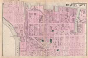
Hunters Point Part of Long Island City.
sold
- Digital Map Information
- Suitable for large format printing
- File Size: 9.38 MB
- File Type: ZIP / TIFF
- ICC color profile embedded
- Delivered instantly via download link
A scarce example of Fredrick W. Beers' map of the Hunter's Point (Long Island City), Queens, New York. Published in 1873. Covers part of what is today ... (more details)
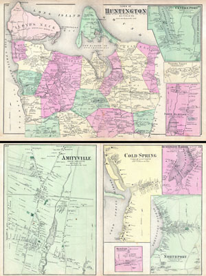
Town of Huntington, Suffolk Co. / Amityville, Town of Huntington, Suffolk Co. / Cold Spring, Town of Huntington, Suffolk Co.
sold
- Digital Map Information
- Suitable for large format printing
- File Size: 22.53 MB
- File Type: ZIP / TIFF
- ICC color profile embedded
- Delivered instantly via download link
A scarce example of Fredrick W. Beers' map of Huntington, Long Island, New York. Published in 1873. Covers the Huntington area from Cold Spring ... (more details)
Beers' map depicting Huntington, Long Island.
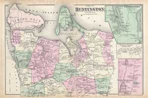
Town of Huntington, Suffolk Co.
sold
- Digital Map Information
- Suitable for large format printing
- File Size: 13.11 MB
- File Type: ZIP / TIFF
- ICC color profile embedded
- Delivered instantly via download link
A scarce example of Fredrick W. Beers' map of Huntington, Long Island, New York published in 1873. It covers the Huntington area from Cold Spring ... (more details)
Early map exhibiting Islip as well as Fire Island.
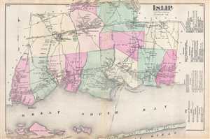
Islip Suffolk County.
sold
- Digital Map Information
- Suitable for large format printing
- File Size: 8.92 MB
- File Type: ZIP / TIFF
- ICC color profile embedded
- Delivered instantly via download link
A scarce example of Fredrick W. Beers' map of the Islip, Fire Island, and Sayville, Long Island, New York. Published in 1873. Islip side covers ... (more details)
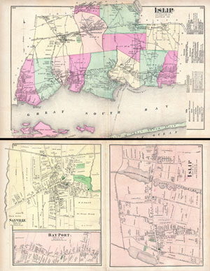
Islip, Suffolk, Co. / Islip, Town of Islip, Suffold Co. / Bay Port, Town of Islip, Suffold Co. / Sayville, Town of Islip, Suffold Co.
sold
- Digital Map Information
- Suitable for large format printing
- File Size: 22.82 MB
- File Type: ZIP / TIFF
- ICC color profile embedded
- Delivered instantly via download link
A scarce example of Fredrick W. Beers' map of the Islip and Sayville, Long Island, New York. Published in 1873. Islip side covers from Babylon ... (more details)
Early mapping of Rockaway Beach and Jamaica Bay.
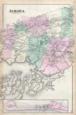
Jamaica.
sold
- Digital Map Information
- Suitable for large format printing
- File Size: 11.34 MB
- File Type: ZIP / TIFF
- ICC color profile embedded
- Delivered instantly via download link
A scarce example of Fredrick W. Beers' map of greater Jamaica, Queens, New York City, including Rockaway Beach. Published in 1873. Covers ... (more details)
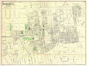
Jamaica Village, Queens Co. L.I.
sold
- Digital Map Information
- Suitable for large format printing
- File Size: 12.81 MB
- File Type: ZIP / TIFF
- ICC color profile embedded
- Delivered instantly via download link
A scarce example of Fredrick W. Beers' map of the town of Jamaica Village, Queens, New York. Published in 1873. Covers roughly from ... (more details)
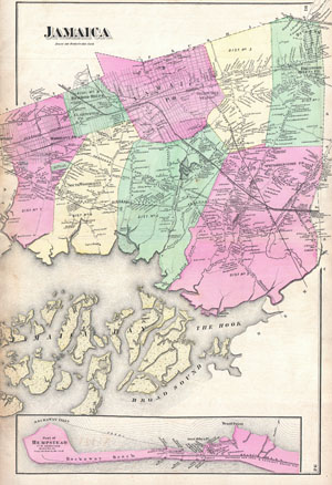
Jamaica.
sold
- Digital Map Information
- Suitable for large format printing
- File Size: 14.8 MB
- File Type: ZIP / TIFF
- ICC color profile embedded
- Delivered instantly via download link
A scarce example of Fredrick W. Beers' map of Jamaica, Queens, New York City. Published in 1873. Covers roughly from Jamaica Bay ... (more details)
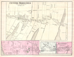
Center Moriches Town of Brookhaven Suffolk Co.
sold
- Digital Map Information
- Suitable for large format printing
- File Size: 2.2 MB
- File Type: ZIP / TIFF
- ICC color profile embedded
- Delivered instantly via download link
This scarce and large hand colored map depicts the town of Moriches, Long Island, New York. Map depicts the cities and towns of ... (more details)