
Blachford, Robert (sold)

Robert Blachford (1775 - c. 1852) was an Irish maker of blueback nautical charts active in the middle part of the 19th century. Compared with many major nautical chart publishers in London, little is known of Blachford. Around 1802, he married Elizabeth Moore, the daughter of John Hamilton Moore (1738 - 1807), a prolific producer of navigational textbooks and nautical charts. Blachford must have been introduced to nautical chart-making by Moore, but his partnership with the latter was short-lived and dissolved two years later in 1804. By 1805, Blachford had established his own firm located at 137 Minories, London. Initially, Blachford's business seems to have been poor, and he produced charts only sporadically until about 1808, when he opened a new shop at 114 Minories. From this location, he published about 20 - 30 known charts, primarily focusing on the North Sea and the Baltic. Most of these were based on Moore's earlier work but fully re-engraved by Samuel Stockley (who also, incidentally, engraved for William Heather). With such a meager publication history, it is unsurprising that Blachford declared bankruptcy in May of 1819. Shortly thereafter, Blachford was back in business and partnered with William Lane. This partnership was also short-lived, issuing about 15 charts before being dissolved in 1821. Around 1827, Blachford again reappeared, this time at his old stomping ground, the Minories (116), an office he would maintain for the next 25 years. Robert, this time, partnered with William Blachford, presumably a relative, though the relationship is unclear. The firm issued numerous charts focused on the British coastal trade. The rough, damp conditions synonymous with this trade are the reason that few Blachford charts from this period survive. Around 1835, Robert and William Blachford retired, passing the business on to Michael Blachford (1807 - 1889), who partnered with the stationer and draftsman James Imray (1803 - 1870). Today, Imray continues to publish maritime charts as "Imray, Laurie, Norie and Wilson".
Manuscript Whaler's Annotations in Gulf of Mexico.
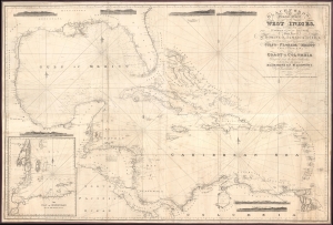
Blachfords, New General Chart of the West Indies, Including the Caribee and Virgin Islands, Porto Rico, St. Domingo, Jamaica and Cuba. The Windward Passages gulfs of Florida and Mexico, Bay of Honduras, And Coast of Colombia Compiled from the best Authorities, Including the surveys of Mr. A. de Mayne R.N., Mr. Lockwood etc.
sold
- Digital Map Information
- Suitable for large format printing
- File Size: 113.86 MB
- File Type: ZIP / TIFF
- ICC color profile embedded
- Delivered instantly via download link
A spectacular 1838 / 1843 Blachford blueback nautical map of the West Indies, including Florida, the Gulf of Mexico, the Caribbean, and Central America. This beautiful map features pencil manuscript annotations in the Gulf of Mexico that strongly suggest whaling. (more details)
Remarkable working blueback chart of the English Channel.
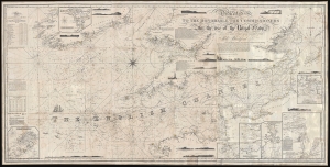
[The English Channel.] Dedicated to the Honorable The Commissioners For Inspecting Charts for the use of the Royal Navy.
sold
- Digital Map Information
- Suitable for large format printing
- Full resolution TIFF file
- ICC color profile embedded
- Delivered instantly via download link
A stunning, enormous, and rare 1853 nautical chart or maritime map of the English Channel by Robert Blachford, considered by some to be the father of the Blueback Chart. (more details)
One of only two known surviving examples of a scarce chart.
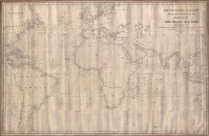
An Outline Chart for the Purpose of Marking off the Track of a Ship.
sold
- Digital Map Information
- Suitable for large format printing
- Full resolution TIFF file
- ICC color profile embedded
- Delivered instantly via download link
A large 1846 blueback nautical chart or maritime map of the world by Robert Blachford. Centered on a large and prominent Africa, this map covers most of the world excluding the Arctic climes from roughly the Orkney Islands to the Falkland Islands and from Yucatan (Mexico) to Borneo and Western Australia. Blachford intended this map for marking the route of a ship along the more common maritime routes - to the Americas and around Africa to India and the East Indies. It notably does not include the Pacific, an area in which Blachford had little interest. Notations in pencil indicate that this chart was used to mark off repeat voyages between England and the Americas, specifically New England and the West Indies. (more details)
Rare chart by an uncommon but important English blueback maker.
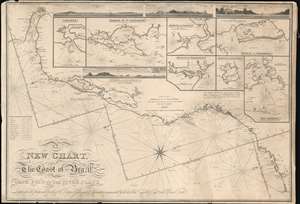
A New Chart, The Coast of Brazil, Cape Frio to the River Plate.
sold
- Digital Map Information
- Suitable for large format printing
- DPI: 600
- File Size: 65.21 MB
- File Type: ZIP / TIFF
- ICC color profile embedded
- Delivered instantly via download link
A very rare 1847 Robert Blachford blueback nautical chart or maritime map of the Coast of Brazil from the Rio de la Plata (Buenos Aires) to Rio de Janeiro. The chart includes four profile recognition views and seven inset charts including: Rio Janeiro; Harbor of Marambaia; Harbor of Port Frio; Harbor of Paranagua; Harbor of Santos; Harbor of St. Catharina; and Cananea. The cartography is attributed to Rear-Admiral Donald Campbell (1752 - 1819), briefly commandant of the Brazilian squadron of the Portuguese navy during the early 19th century. Campbell, although Scottish, was in the employ of the Portuguese Navy, as the British had interest in defending the Brazil trade against possible French attack during the transition of the Portuguese monarchy to the New World. (more details)