
Blackwood and Sons (sold)

Blackwood and Sons (fl. 1804 - c. 1900) published out of Edinburgh and London throughout the 19th century - roughly from 1804 to 1898. The founder of the firm Scotsman William Blackwood (November 20, 1776 - September 16, 1834), was of humble origins, but his business acumen and dedication to the printing trade pushed his firm to prominence. He is most noted for publishing Blackwood's Scottish Magazine, one of the most important early magazines of 19th century England. In addition to his career as a prominent publisher, Blackwood took an active interest in civic matters and was elected Commissioner of Police in 1828. Following his death the firm was taken over by his sons, Alexander, John, and Robert Blackwood, who changed the imprint to "Blackwood and Sons". The firm was subsequently passed down through the heirs, most of the Blackwood name, until the late 19th century.
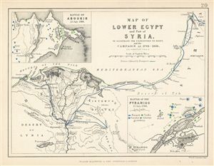
Map of Lower Egypt and Part of Syria. To Illustrate the Expedition to Egypt, and the Campaign of 1798-1801.
sold
- Digital Map Information
- Suitable for large format printing
- DPI: 300
- File Size: 1.71 MB
- File Type: ZIP / TIFF
- ICC color profile embedded
- Delivered instantly via download link
This is a fine example of Blackwood's 1852 map of Lower egypt and parts of Israel / Palestine (here labeled Syria). It covers the northern parts of egypt and the Nile Delta from the Mediterranean Sea to Upper egypt and includes parts of modern day Israel / ... (more details)
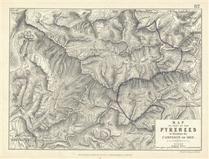
Map of Part of the Pyrenees to illustrate the Campaign of 1813.
sold
- Digital Map Information
- Suitable for large format printing
- DPI: 300
- File Size: 3.19 MB
- File Type: ZIP / TIFF
- ICC color profile embedded
- Delivered instantly via download link
This is a fine example of Blackwood's 1852 map showing part of the Pyrenees Mountain ranges illustrating the campaign of 1813. The boundary line between France and Spain is hand colored in blue and red. Various important forts and buildings are marked. ... (more details)
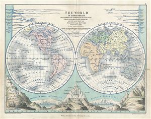
The World in Hemispheres.
sold
- Digital Map Information
- Suitable for large format printing
- DPI: 300
- File Size: 2.99 MB
- File Type: ZIP / TIFF
- ICC color profile embedded
- Delivered instantly via download link
This is a fine example of Blackwood's 1852 map of the world in hemispheres. It depicts the Western and eastern Hemispheres with countries named, but their borders not depicted. The bottom portion of the map depicts the comparative heights of the ... (more details)