
Blaeu, Willem Janszoon
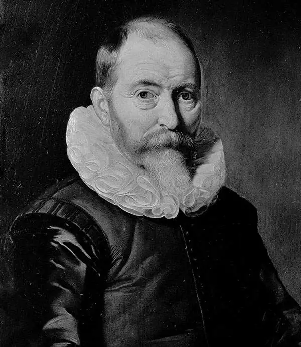
Willem Janszoon Blaeu (1571 - October 18, 1638), also known as Guillaume Blaeu and Guiljelmus Janssonius Caesius, was a Dutch cartographer, globemaker, and astronomer active in Amsterdam during the late 16th and early 17th centuries. Blaeu was born 'Willem Janszoon' in Alkmaar, North Holland to a prosperous herring packing and trading family of Dutch Reformist faith. As a young man, he was sent to Amsterdam to apprentice in the family business, but he found the herring trade dull and instead worked for his cousin 'Hooft' as a carpenter and clerk. In 1595, he traveled to the small Swedish island of Hven to study astronomy under the Danish Enlightenment polymath Tycho Brahe. For six months he studied astronomy, cartography, instrument making, globe making, and geodesy. He returned to Alkmaar in 1596 to marry and for the birth of his first son, Johannes (Joan) Blaeu (1596 – 1673). Shortly thereafter, in 1598 or 1599, he relocated his family to Amsterdam where he founded the a firm as globe and instrument makers. Many of his earliest imprints, from roughly form 1599 - 1633, bear the imprint 'Guiljelmus Janssonius Caesius' or simply 'G: Jansonius'. In 1613, Johannes Janssonius, also a mapmaker, married Elizabeth Hondius, the daughter of Willem's primary competitor Jodocus Hondius the Elder, and moved to the same neighborhood. This led to considerable confusion and may have spurred Willam Janszoon to adopt the 'Blaeu' patronym. All maps after 1633 bear the Guiljelmus Blaeu imprint. Around this time, he also began issuing separate issue nautical charts and wall maps – which as we see from Vermeer's paintings were popular with Dutch merchants as decorative items – and invented the Dutch Printing Press. As a non-Calvinist Blaeu was a persona non grata to the ruling elite and so he partnered with Hessel Gerritsz to develop his business. In 1619, Blaeu arranged for Gerritsz to be appointed official cartographer to the VOC, an extremely lucrative position that that, in the slightly more liberal environment of the 1630s, he managed to see passed to his eldest son, Johannes. In 1633, he was also appointed official cartographer of the Dutch Republic. Blaeu's most significant work is his 1635 publication of the Theatrum orbis terrarum, sive, Atlas Novus, one of the greatest atlases of all time. He died three years later, in 1638, passing the Blaeu firm on to his two sons, Cornelius (1616 - 1648) and Johannes Blaeu (September 23, 1596 - December 21, 1673). Under his sons, the firm continued to prosper until the 1672 Great Fire of Amsterdam destroyed their offices and most of their printing plates. Willem's most enduring legacy was most likely the VOC contract, which ultimately passed to Johannes' son, Johannes II, who held the position until 1617. As a hobbyist astronomer, Blaeu discovered the star now known as P. Cygni.
El Dorado.
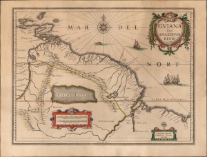
Guiana sive Amazonum Regio.
$750.00
Acquire
- Digital Map Information
- Suitable for large format printing
- Full resolution TIFF file
- ICC color profile embedded
- Delivered instantly via download link
This is an original color example of Willem Blaeu's 1629 map of Guiana in its German Atlas Major edition. The map is noteworthy for its bold depiction of El Dorado and the apocryphal Lake Parima. (more details)
Classic Dutch Gold Age Map Africa: Old Color highlighted with Gold!
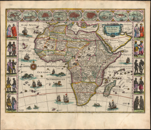
Africae nova descriptio. Auct: Guiljelmo Blaeuw.
$5,000.00
Acquire
- Digital Map Information
- Suitable for large format printing
- Full resolution TIFF file
- ICC color profile embedded
- Delivered instantly via download link
This is a superb, original-color, second-state example of Willem Blaeu's 1630 carte à figure atlas map of Africa, in its 1640 Latin-text atlas edition. It is one of the most desirable maps of the Dutch Golden Age. Norwich hailed it rightly as 'one of the most decorative and popular of all the early maps of Africa.' (more details)
Cartographic Design Genius - two maps, at different scales, superimposed upon one another.
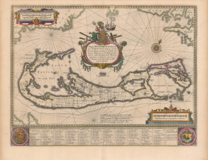
Mappa Aestivarvm Insularum, alias Barmudas.
$2,500.00
Acquire
- Digital Map Information
- Suitable for large format printing
- DPI: 600
- File Size: 51.37 MB
- File Type: ZIP / TIFF
- ICC color profile embedded
- Delivered instantly via download link
This is the classic 17th-century Dutch map of Bermuda: Willem Blaeu's map of the 'Summer Isles', here with superb old color. Engraved in 1630, Blaeu's version of Richard Norwood's chart is the most richly decorative to see print. Moreover, it is a marvel of cartographic design, in fact being two maps, on different scales, superimposed upon one another. (more details)
Mapping Gascony.
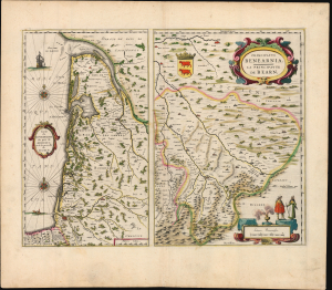
Carte du Bourdelois, du pais de Medoc, et de la prevosté de Born./ Principatus Benearnia. La Principaute de Bearn.
$450.00
Acquire
- Digital Map Information
- Suitable for large format printing
- Full resolution TIFF file
- ICC color profile embedded
- Delivered instantly via download link
This is Willem Blaeu's 1631 map of the Basque country of Gascony in southwestern France, including the wine country of Bordeaux and Medoc. It is printed along with a map focusing on the Principality of Béarn, also part of the Duchy of Gascony. The region is now the western part of Nouvelle-Aquitaine, mainly the départements of Gironde, Landes, and Pyrénées-Atlantique. (more details)
The classic Dutch map of the Balearic Islands.
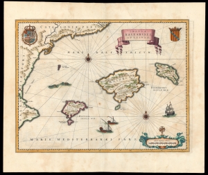
Insulae Balearides et Pytiusae.
$1,500.00
Acquire
- Digital Map Information
- Suitable for large format printing
- DPI: 600
- File Size: 38.95 MB
- File Type: ZIP / TIFF
- ICC color profile embedded
- Delivered instantly via download link
This is a beautiful example of Willem Blaeu's 1634 map of Majorca, Minorca, and Ibiza (Ibiça). It is the first folio atlas map dedicated to the Balearic Islands, and the standard for the mapping of the islands in the Dutch Golden Age. (more details)
The first edition of one of the most distinctive maps of the Dutch Golden Age.
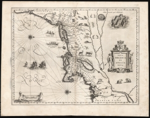
Nova Belgica Et Anglia Nova.
$5,000.00
Acquire
- Digital Map Information
- Suitable for large format printing
- Full resolution TIFF file
- ICC color profile embedded
- Delivered instantly via download link
This is the rare 1634 first atlas edition of Willem Blaeu's foundational map of the American Northeast, presenting the regions settled by the Dutch (New Netherlands) and the English (New England). Uniquely oriented to the west, Blaeu's map covers the American coast from Virginia, past New York and Long Island to Cape Cod, New England, and Quebec. The map is the first of the region to depict the fur-bearing and food animals of the region accurately, and it does so in profusion. Between this imagery and the fleet of trade ships heading towards the coast, the decorative elements vividly emphasize the region's resource wealth. (more details)
Classic Dutch Golden Age Map of America.
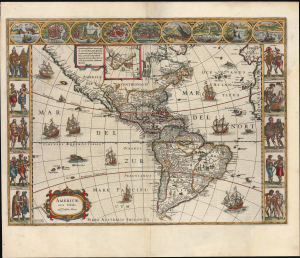
Americae Nova Tabula. Auct. Guilielmo Blaeuw.
$3,500.00
Acquire
- Digital Map Information
- Suitable for large format printing
- Full resolution TIFF file
- ICC color profile embedded
- Delivered instantly via download link
This is the essential Dutch map of America: Willem Janszoon Blaeu's 1635 carte-á-figures of the Western Hemisphere. It is among the most desirable printed maps, encapsulating in one piece the most sought-after aesthetic qualities of the Dutch Golden Age of Cartography. The present example dates to 1638, an early atlas edition. (more details)
The Mythical Kingdom of Prester John, in a Superb Example with a Bold Strike.
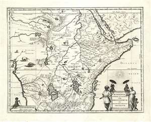
Aethiopia Superior vel Interior vulgo Abissinorum sive Presbiteri Joannis Imperium.
$950.00
Acquire
- Digital Map Information
- Suitable for large format printing
- DPI: 600
- File Size: 21.51 MB
- File Type: ZIP / TIFF
- ICC color profile embedded
- Delivered instantly via download link
This is the map of the mythical Kingdom of Prester John in eastern Africa, issued by Willem Blaeu in 1635, in a beautiful example. The map covers from the Bight of Benin to the Indian Ocean and from Arabia and the Red Sea to Mozambique. It includes two decorative cartouches, as well as stylized images of African fauna, including elephants, monkeys, and ostriches. While the African coast exhibits considerable advances over earlier maps of the region, the interior of Africa exhibits a cartography primarily based on the literature of antiquity and little changed from the days of Ptolemy, and its primary subject matter is that of legend. (more details)
Classic Dutch Map of Prussia.
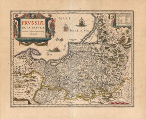
Prussiae Nova Tabula Auctore Gasparo Henneberg Erlichensi.
$650.00
Acquire
- Digital Map Information
- Suitable for large format printing
- DPI: 600
- File Size: 63.08 MB
- File Type: ZIP / TIFF
- ICC color profile embedded
- Delivered instantly via download link
A beautiful, original-color example of Willem Blaeu's map of Prussia, among the maps first added to the Appendix in 1630. It depicts the region now comprised of northern Poland (as far south as Toruń on the Vistula River), the Russian province of Kaliningrad, and western Lithuania. Detail spans from just west of Gdansk to Augustów in the east. The northeast limits of the map are marked with the region of Samogitia, and the Lithuanian coastal town of Palanga. (more details)
'One of the most important maps of America ever produced.' -Burden
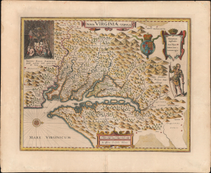
Nova Virginiae Tabula.
$3,000.00
Acquire
- Digital Map Information
- Suitable for large format printing
- Full resolution TIFF file
- ICC color profile embedded
- Delivered instantly via download link
A beautiful, original-color example of Guillaume Blaeu's 1635 map of the Virginia colony and the Chesapeake Bay. The map represents a combination of exceptional cartographic achievement and meaningful wishful thinking - suggesting possible connections to the Pacific from Virginia. (more details)
Scandinavia during the Thirty Years' War (1618 - 1648).
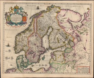
Suecia, Dania, et Norvegia Regna Europae Septentrionalia, iuxta Archetypum Andreae Burei de Boo, Secretarii Regij, et supremi Regni Sueciae Architecti.
$1,250.00
Acquire
- Digital Map Information
- Suitable for large format printing
- Full resolution TIFF file
- ICC color profile embedded
- Delivered instantly via download link
This is a 1635 edition of Willem Blaeu's map of Scandinavia at the height of the Thirty Years' War. It is based on Anders Bure's 1626 mapping of the region, which swiftly became the dominant mapping of the northern parts of Europe and was not replaced as an authority for more than a century. On the strength of his seminal map and its long tenure as the state-of-the-art map of the northern regions of Europe, Bure is hailed as the Father of Swedish Cartography. The scope of the map includes Denmark, Norway, the greater Swedish Empire, the Baltic coasts of Germany, Poland and Livonia, and the Russian Empire. (more details)
Humorous yet puzzling cartouche.
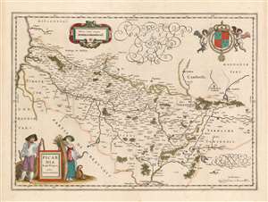
Picardia Regio Belgica, Auctore Ioanne Surhonio.
$300.00
Acquire
- Digital Map Information
- Suitable for large format printing
- DPI: 600
- File Size: 20.02 MB
- File Type: ZIP / TIFF
- ICC color profile embedded
- Delivered instantly via download link
This is Willem Blaeu's map of Picardy, easily the most entertaining map ever produced of this region of northern France. The map focuses on the Somme River valley. Amiens, St. Quentin, and La Fere are given particular emphasis. Putti bear a superb coat of arms with Fleurs-de-lis aloft in the upper right, and the scales are presented in a strapwork frame. (more details)
Bold example of a scarce map of China, Japan and Korea.
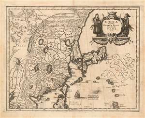
China Veteribus Sinarum Regio nunc Incolis Tame dicta.
$900.00
Acquire
- Digital Map Information
- Suitable for large format printing
- DPI: 600
- File Size: 10.63 MB
- File Type: ZIP / TIFF
- ICC color profile embedded
- Delivered instantly via download link
This is a scarce 1638 Matthais Merian map of China and Japan with an insular Korea. The map is beautifully engraved, decorated with a Chinese junk, a Dutch sailing ship, and a sea monster; the elegant cartouche is flanked by a man and woman in (presumably) Chinese robes. The Great Wall features prominently. The Philippine island of Luzon is shown, as is Formosa (Taiwan.) (more details)
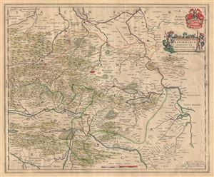
Mansfeldia Comitatus Auctore Tilemanno Stella Sig.
$275.00
Acquire
- Digital Map Information
- Suitable for large format printing
- DPI: 300
- File Size: 15.56 MB
- File Type: ZIP / TIFF
- ICC color profile embedded
- Delivered instantly via download link
This beautiful 1655 map by Willem Blaeu represents Mansfeld and its surrounding regions, located in the western part of eastern Germany. Centered on Mansfeld, the map covers from Bernburg south as far as Kindelbruck, and from Stolberg eastward to Halle. Important ... (more details)
17th Century Map of the Emilia-Romagna region.
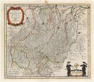
Ducato di Modena Regio et Carpi Col Dominio della Carfagnana.
$750.00
Acquire
- Digital Map Information
- Suitable for large format printing
- Full resolution TIFF file
- ICC color profile embedded
- Delivered instantly via download link
A beautiful, original color example of Willem and Joan Blaeu's map of the Emilia-Romagna region, focusing on the cities of Parma, Regio, and Modena. At the north and east extremes of the map, the cities of Mirandola, Ferrara, and Bologna are pictured as well. The superb copperplate is the product of the house of Blaeu at their height, with its delicately engraved cities, pictorially represented mountains and forests, and meticulously detailed cities, towns, and villages. Among its details is a road, connecting Parma, Regio, and Moden. The other regional maps would continue this road to Piacenza and Bologna, and beyond. Though not named, the course of the road corresponds to the Roman road known as the Via Aemilia. (more details)