
Boulton, Solomon (sold)

Solomon Boulton (fl. c. 1750-1775), sometimes written as 'Bolton,' was an English cartographer active in the middle part of the 18th century. Bolton's most notable works are the adaptions of Jean Baptiste Bourguignon d'Anville (1697 - 1782) maps published in conjunction with Malachy Postlethwayte's Dictionary of Commerce. These were later reprinted and embellished by Sayer and Bennett, and again by Laurie and Whittle.
Quirky 18th century British four-sheet wall map identifying the Biblical paradise of Ophir.
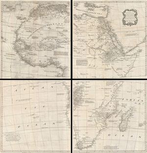
Africa, Performed by the Sr. D'Anville under the Patronage of the Duke of Orleans.
sold
- Digital Map Information
- Suitable for large format printing
- DPI: 300
- File Size: 56.05 MB
- File Type: ZIP / TIFF
- ICC color profile embedded
- Delivered instantly via download link
A curious and uncommon four panel wall map 1755 map of Africa by the english publisher M. Postlethwayte. A derivative of D'Anville's map of 1749, Postlethwayte's map covers the entire continent of Africa from the Mediterranean to the Cape of Good Hope and from ... (more details)
Quirky 18th century British multi-sheet wall map of the Near and Middle East.
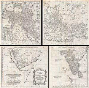
First Part of Asia, being Turkey, Arabia, Persia, most of India and Tartary.
sold
- Digital Map Information
- Suitable for large format printing
- DPI: 300
- File Size: 43.02 MB
- File Type: ZIP / TIFF
- ICC color profile embedded
- Delivered instantly via download link
A curious and uncommon four panel wall map 1786 map of India, Persia, and Arabia by the english publisher M. Postlethwayte. Published in four separate panels, this map can be either joined as a single massive map as assembled, as above, in separate panels. As a ... (more details)
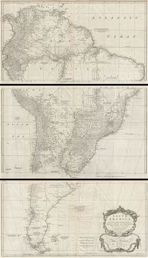
South America. Performed Under the Patronage of Louis Duke of Orleans First Prince of the Blood.
sold
- Digital Map Information
- Suitable for large format printing
- DPI: 300
- File Size: 57.7 MB
- File Type: ZIP / TIFF
- ICC color profile embedded
- Delivered instantly via download link
A curious and uncommon three panel 1755 wall map of South America by the English publisher M. Postlethwayte. A derivative of D'Anville's earlier map, Postlethwayte's map covers the entire continent from the Lesser Antilles and Panama to Cape Horn. Published ... (more details)
The most important map of Africa printed in the 18th century.
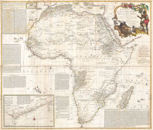
Africa, with all its States, Kingdoms, republics, Regions, Islands, & cca. Improved and Inlarged form D’Anville’s Map to which has been added A particular Chart of the Gold Coast wherein are Distinguished all the European Forts, and Factories by S. Boulton.
sold
- Digital Map Information
- Suitable for large format printing
- Full resolution TIFF file
- ICC color profile embedded
- Delivered instantly via download link
This is most likely the most important map of Africa produced in the 18th century. Printed at the height of the slave trade in 1787 by the Robert Sayer firm of London, England. Largely based upon the earlier D'Anville map, this map has been enlarged and expanded ... (more details)
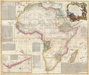
Africa, with all its States, Kingdoms, Republics, Regions, Islands, & cca. Improved and Inlarged form D’Anville’s Map to which has been added A Particular Chart of the Gold Coast wherein are Distinguished all the European Forts, and Factories by S. Boulton and also A Summary Description relative to the Trade adn Natural Produce, Manners and Customs of the African Continent and Islands.
sold
- Digital Map Information
- Suitable for large format printing
- DPI: 300
- File Size: 69.71 MB
- File Type: ZIP / TIFF
- ICC color profile embedded
- Delivered instantly via download link
This is probably the most important map of Africa produced in the 18th century. Largely based upon the earlier D'Anville map, this map has been enlarged and expanded by Samuel Boulton. Depicts the continent in full with insets of the Gold Coast (or Ivory ... (more details)