
Bowen, Emanuel

Emanuel Bowen (1694 - May 8, 1767) had the high distinction to be named Royal Mapmaker to both to King George II of England and Louis XV of France. Bowen was born in Talley, Carmarthen, Wales, to a distinguished but not noble family. He apprenticed to Charles Price, Merchant Taylor, from 1709. He was admitted to the Merchant Taylors Livery Company on October 3, 1716, but had been active in London from about 1714. A early as 1726 he was noted as one of the leading London engravers. Bowen is highly regarded for producing some of the largest, most detailed, most accurate and most attractive maps of his era. He is known to have worked with most British cartographic figures of the period including Herman Moll and John Owen. Among his multiple apprentices, the most notable were Thomas Kitchin, Thomas Jeffreys, and John Lodge. Another apprentice, John Oakman (1748 - 1793) who had an affair with and eventually married, Bowen's daughter. Other Bowen apprentices include Thomas Buss, John Pryer, Samuel Lyne, his son Thomas Bowen, and William Fowler. Despite achieving peer respect, renown, and royal patronage, Bowen, like many cartographers, died in poverty. Upon Emanuel Bowen's death, his cartographic work was taken over by his son, Thomas Bowen (1733 - 1790) who also died in poverty.
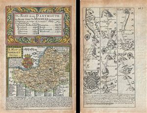
A Map of Somerset Shire. The Road from Darmouth in Devon Shire to Minhead in Somerset S.
$175.00
Acquire
- Digital Map Information
- Suitable for large format printing
- DPI: 300
- File Size: 3.19 MB
- File Type: ZIP / TIFF
- ICC color profile embedded
- Delivered instantly via download link
This is a scarce 1736 example of John Owen and Emanuel Bowen's map of the County of Somerset, England. The map is printed on both sides. The map on recto features a detailed map of the County of Somerset (commonly known as Somersetshire until the late 19th ... (more details)
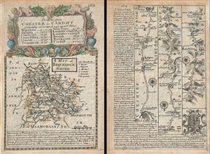
A Map of Brecknock Shire. The Road from Chester to Cardiff.
$175.00
Acquire
- Digital Map Information
- Suitable for large format printing
- DPI: 300
- File Size: 3.27 MB
- File Type: ZIP / TIFF
- ICC color profile embedded
- Delivered instantly via download link
This is a scarce 1736 example of John Owen and Emanuel Bowen's map of the County of Brecknockshire, Wales. The map is printed on both sides. The map on recto features a detailed map of the County of Brecknockshire (also known as Brecknock or the County of ... (more details)
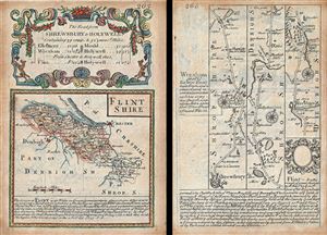
Flintshire. The Road from Shrewsbury to Holywell.
$175.00
Acquire
- Digital Map Information
- Suitable for large format printing
- DPI: 300
- File Size: 3.2 MB
- File Type: ZIP / TIFF
- ICC color profile embedded
- Delivered instantly via download link
This is a scarce 1736 example of John Owen and Emanuel Bowen's map of the County of Flintshire, Wales. The map is printed on both sides. The map on recto features a detailed map of the County of Flintshire with a decorative title cartouche ornamented with ... (more details)
Based on Chinese Sources.
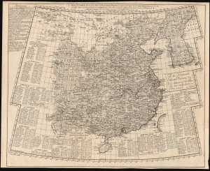
A Map of China, drawn from those of the particular provinces made on the spot by the Jesuit missionaries...
$3,500.00
Acquire
- Digital Map Information
- Suitable for large format printing
- DPI: 600
- File Size: 63.06 MB
- File Type: ZIP / TIFF
- ICC color profile embedded
- Delivered instantly via download link
This is Emanuel Bowen's rare 1738 map of China and Korea, derived from the geography of Jean Baptiste Bourguignon d'Anville. It is not a direct copy of D'Anville's maps but rather is a distillation of Chinese provincial maps included in Du Halde's 1737 Nouvel atlas de la Chine, which Bowen reproduced in the 1738 English edition of that work. Via D'Anville, this is one of the best 18th-century maps of China originating from Chinese sources. (more details)
One of the earlist obtainalbe maps of the Galapagos.
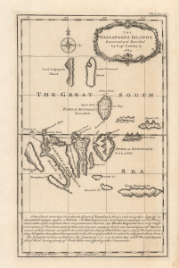
The Gallapagos Islands Discovered and Described by Capt. Cowley in 1684.
$1,250.00
Acquire
- Digital Map Information
- Suitable for large format printing
- Full resolution TIFF file
- ICC color profile embedded
- Delivered instantly via download link
This 1744 Emmanuel Bowen map of the Galápagos Islands is one of the earliest specific maps of the remote archipelago, later made famous by Charles Darwin and the voyage of HMS Beagle. Based on 1683 survey work by Captain William Ambrose Cowley, this is the first substantial English mapping of the Galápagos. This map represents a critical stage in the cartographic history of the Galápagos, being the definitive cartography of the islands until Darwin and FitzRoy's 1835 voyage. (more details)
Early representation of Bering Geography.
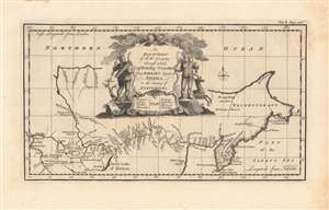
An exact chart of all the countries through which Capt. Behring travelled...
$350.00
Acquire
- Digital Map Information
- Suitable for large format printing
- DPI: 600
- File Size: 17.47 MB
- File Type: ZIP / TIFF
- ICC color profile embedded
- Delivered instantly via download link
This is a 1744 John Harris / Emanuel Bowen map of Siberia, highlighting discoveries made by Vitus Bering's expeditions. This was among the first maps of Siberia produced in the wake of Bering's 'Great Northern Expedition,' (1733 - 1742), demonstrating improved geographical information about the Kamchatka Peninsula and the region as a whole. (more details)
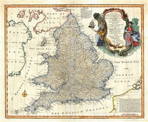
A New and very Accurate Map of South Britain, or England and Wales.
$650.00
Acquire
- Digital Map Information
- Suitable for large format printing
- DPI: 300
- File Size: 10.7 MB
- File Type: ZIP / TIFF
- ICC color profile embedded
- Delivered instantly via download link
This is a beautiful 1747 map of South Britain, or England and Wales, drawn by the British cartographer Emanuel Bowen. It depicts the entirety of England and Wales, including the Isle of Man. The map is extremely detailed, noting cities, boroughs, ... (more details)
Beautiful 18th century map of European Russia.
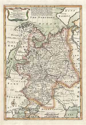
A New and Accurate Map of Moscovy or Russia in Europe.
$400.00
Acquire
- Digital Map Information
- Suitable for large format printing
- DPI: 300
- File Size: 5.26 MB
- File Type: ZIP / TIFF
- ICC color profile embedded
- Delivered instantly via download link
This is a beautiful 1747 map of European Russia by the English cartographer Emmanuel Bowen. It depicts the European portion of Russia extending from the Gulf of Finland to the Ural Mountains. The map offers excellent detail throughout showing ... (more details)
The English Confront Spain.
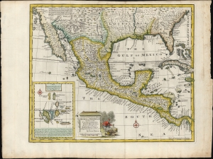
A New and Accurate Map of Mexico or New Spain together with California, New Mexico etc. Drawn from the best Modern Maps and Charts and Regulated by Astronl. Obsrvrn. By Eman: Bowen.
$1,200.00
Acquire
- Digital Map Information
- Suitable for large format printing
- File Size: 17.14 MB
- File Type: ZIP / TIFF
- ICC color profile embedded
- Delivered instantly via download link
This is Emmanuel Bowen's c. 1747 map of Mexico and the southern part of what would become the United States, an area at this time contested between Spain and England. The whole is rife with interesting anti-Spanish propaganda. (more details)
Success and failure of British mapping in the Americas.
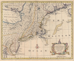
A New and Accurate Map of New Jersey, Pensilvania, New York and New England with the adjacent Countries.
$1,200.00
Acquire
- Digital Map Information
- Suitable for large format printing
- DPI: 600
- File Size: 30.31 MB
- File Type: ZIP / TIFF
- ICC color profile embedded
- Delivered instantly via download link
A 1747 Emmanuel Bowen map of the New England and Middle-Atlantic colonies, covering New Jersey, New York, Pennsylvania, Maine, New Hampshire, and Connecticut. Covering from the Chesapeake Bay to Lake Champlain and Lake Ontario to Nova Scotia, this map exemplifies the successes and failures of 18th-century English mapping in the American colonies. It also makes evident the challenges of the European map publisher in piecing together disparate reports and mappings into a single cohesive cartographic entity. (more details)
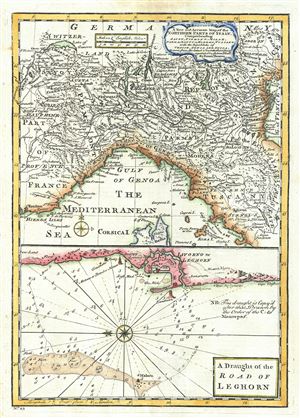
A New and Accurate Map of the Northern Parts of Italy. A Draught of the Road of Leghorn.
$250.00
Acquire
- Digital Map Information
- Suitable for large format printing
- DPI: 300
- File Size: 4.56 MB
- File Type: ZIP / TIFF
- ICC color profile embedded
- Delivered instantly via download link
This is a beautiful map of northern Italy, issued in 1747 by the British cartographer Emanuel Bowen. Essentially two maps on a single sheet, the upper map covers northern Italy from Lake Geneva in Switzerland to the Island of Elba. It ... (more details)
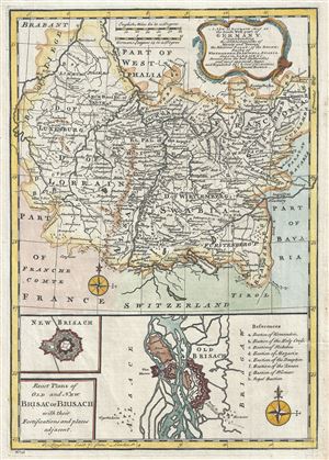
A New and Accurate Map of the South West part of Germany. Comprehending the Archbishoprics of Mentz and Treves, the Electoral Palat, of the Rhine, Duchy of Wirtemberg, Franconia, Swabia, Alsace, Lorrain etc.
$150.00
Acquire
- Digital Map Information
- Suitable for large format printing
- DPI: 300
- File Size: 4.25 MB
- File Type: ZIP / TIFF
- ICC color profile embedded
- Delivered instantly via download link
This is beautiful 1747 map of the southwestern part of Germany by the British cartographer Emanuel Bowen. It covers the southwestern parts of Germany along with parts of modern day France and Luxemburg. The Duchy of Luxemburg, ... (more details)
A richly detailed Africa.
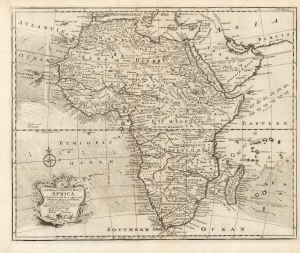
A New and Correct Map of Africa Drawn from the most Approved Modern Maps and Charts, and adjusted by Astronomical Observations, representing also the course of the Trade Winds Monsoons etc. By Eman. Bowen 1748.
$750.00
Acquire
- Digital Map Information
- Suitable for large format printing
- DPI: 600
- File Size: 36.9 MB
- File Type: ZIP / TIFF
- ICC color profile embedded
- Delivered instantly via download link
This is Emanuel Bowens' updated 1748 map of Africa. It depicts the continent in rich detail, particularly with respect to indigenous peoples, kingdoms, fortifications, and mines. It is not an amendment of the 1747 Bowen map of the continent, but an entirely new plate, and while it shares many characteristics of the earlier map, there is matter that is entirely new to it.
Most apparently, Bowen has included in the south Atlantic and the Indian Oceans the prevailing winds, and the directions of the seasonal monsoon winds. These were of particular relevance to ships sailing from Europe to India and were derived from the maps of the trade winds produced at the end of the seventeenth century by William Dampier. (more details)
Most apparently, Bowen has included in the south Atlantic and the Indian Oceans the prevailing winds, and the directions of the seasonal monsoon winds. These were of particular relevance to ships sailing from Europe to India and were derived from the maps of the trade winds produced at the end of the seventeenth century by William Dampier. (more details)
State-of-the-art 18th Century Cartography.
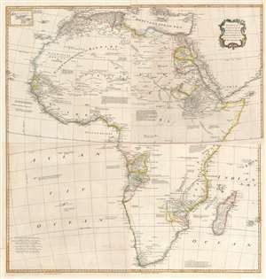
Africa, Performed by the Sr. D'Anville under the Patronage of the Duke of Orleans.
$1,000.00
Acquire
- Digital Map Information
- Suitable for large format printing
- Full resolution TIFF file
- ICC color profile embedded
- Delivered instantly via download link
This large and evocative four-sheet 1755 wall map of Africa captures a transitional period in European understanding of African geography. It was bound, in its four separate sheets, in the second volume of Malachy Postlethwayte's The Universal Dictionary of Trade and Commerce. The map is the work of Solomon Boulton, who drafted the map as a largely faithful translation of the illustrious French cartographer Jean-Baptiste Bourguignon d’Anville's 1749 map of the continent. D'Anville was an extremely careful mapmaker, meticulous in detail and scrupulous in the data presented in his work, and for the most part Boulton preserves these qualities while translating the original text and adding an attractive rococo cartouche. (more details)