
Bradford, Lodowick Harrington (sold)
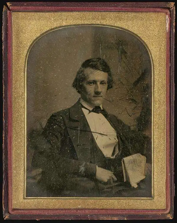
Lodowick Harrington Bradford (November 10, 1820 - December 13, 1885) was a Boston based engraver lithographer active in the second half of the 19th century. Bradford was born in Boston, Massachusetts. He studied as a line engraver before transitioning to the then new art of lithography. He even invented his own photolithographic ambrotype process that created a durable photographic picture on lithographic stone. In 1849 he partnered with Ebenezer Tappen (1815 - 1854) to form the Boston firm of Tappan and Bradford. The partnership remained active until Tappan's untimely death in January, 1854. From 1854 to 1859 Bradford continued to operate the firm, but the imprint changed to 'L. H. Bradford and Company.' It is not clear who the 'and Company' was, possibly Tappan's heirs? From late 1859 until his 1870, he printed under 'L. H. Bradford.' His last known lithographs appeared in 1860, but he did continue copper and steel engraving until his death. Bradford was married to Martha Brown, from an old Gloucester Family. After his wedding in 1849, he divided his time between Gloucester and Boston. In Gloucester he made the acquaintance of the local painter Fitz Henry Lane (1804 - 1865) and worked with him to produce several views in the 1850s. He died on the road between Boston and Gloucester in 1885.
One of only 3 state maps issued by Walling.
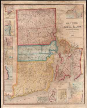
Map of the State of Rhode Island and Providence Plantations.
sold
- Digital Map Information
- Suitable for large format printing
- File Size: 103.61 MB
- File Type: ZIP / TIFF
- ICC color profile embedded
- Delivered instantly via download link
A scarce 1855 wall map of Rhode Island by the civil engineer Henry F. Walling. Centered on Narragansett Bay, the map covers the state and offers eleven detailed insets of various cities. Walling identifies countless individual estates and homesteads throughout - making this a treasure for anyone researching family history or mid-19th Rhode Island land holdings. Roads, counties, topography, railroads, lakes, and rivers are noted. Narragansett Bay features numerous depth soundings, no doubt drawn from the work of the U.S. Coast Survey. The insets, from top left detail Woonsocket, Pawtucket, Warren, Bristol, Westerly Village, Smithville (Scituate), Wickford, Block Island, Greenwich, Newport, and of course Providence. In the Providence inset the campus of Brown University is identified. (more details)
Bleeding Kansas map issued just one month after the Sack of Lawrence.
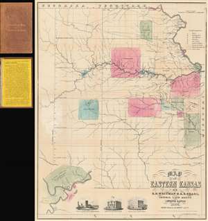
Map of Eastern Kansas.
sold
- Digital Map Information
- Suitable for large format printing
- File Size: 24.02 MB
- File Type: ZIP / TIFF
- ICC color profile embedded
- Delivered instantly via download link
An iconic and historically important map of Eastern Kansas during the 'Free Soil' and 'Bleeding Kansas' or 'Bloody Kansas' era, published just one month after the Sacking of Lawrence. This rare and important 1856 map by the prominent abolitionists Albert D. Searle, Edmund Burke Whitman, and John Punchard Jewett covers the eastern part of Kansas from the 6th Principal Meridian or 97° 22' 08'' W to the Missouri Border and the Missouri River, and from Nebraska to, roughly, the modern day northern border of Oklahoma. The map is intended to promote 'free state' emigration to Kansas as counterbalance to a similar effort by 'slave states' to move their own settlers into the territory. Zones highlighted with color reference American Indian lands - suggesting that emigrants avoid these territories and settle away from 'Indian troubles.' In the lower left there is an inset of Fort Riley on the Missouri River, identified as the 'Geographical Center of U. S. Possessions.' At the base are vignette illustrations of Constitution Hall in Topeka, and before and after images of Eldridge House, also known as the 'Free State Hotel,' which was burned to the ground by pro-slavery vigilantes. (more details)