
Carey, Henry Charles (sold)
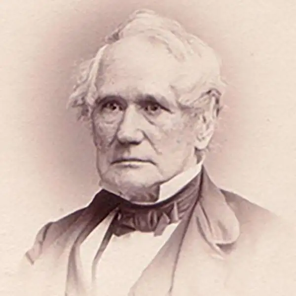
Henry Charles Carey (December 15, 1793 - October 13, 1879) was an American economist and publisher. The leading 19th-century economist of the American school of capitalism, Carey was born in Philadelphia, Pennsylvania and was the son of Mathew Carey (1760 - 1839), who was also an influential political reformer, editor, publisher, and economist. Henry Charles Carey took over the family publishing firm in 1825 after his father retired, and, partnering with his brother-in-law Isaac Lea (1792 - 1886), formed the imprint Carey and Lea. Carey retired from publishing c. 1838 and focused on his career as an economist. He was a prolific writer on the subject and published numerous works on economics between 1835 and 1876. Carey and Lea became one of the most successful publishing houses in America, publishing, among others, American editions of the works of Walter Scott and James Fenimore Cooper, The Encyclopedia Americana and a dictionary of German lexicon.
First map of Florida as a United States Territory
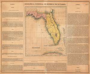
Geographical, Statistical, and Historical Map of Florida.
sold
- Digital Map Information
- Suitable for large format printing
- DPI: 600
- File Size: 29.86 MB
- File Type: ZIP / TIFF
- ICC color profile embedded
- Delivered instantly via download link
Arguably the first map of Florida as a United States Territory. This is the 1822 first edition example of Henry Charles Carey and Isaac Lea's map of Florida, drawn by Lucas, Fielding, Jr. (1781-1854). The map depicts the region from the Perdido River to the Atlantic Ocean, and from Alabama and Georgia to the Florida Keys. The map presents Florida at a fairly early state of survey and settlement. It shows only two counties, Escambia and St. Johns. (Jackson and Duval were created in 1822 but do not appear here). In the north of Florida a number of towns appear - St. Augustine, Pensacola and St. Pedro, for example - but native settlements and forts predominate. The bulk of the peninsula shows little habitation. Roads, rivers, lakes and swamps are also labeled. The river system running the length of the peninsula is highly conjectural.
As with all the maps of the Carey and Lea atlas, this one is bordered on left and right with detailed and vigorously composed descriptions of the territory. The 'Historical Sketch' on the right hand side of the map takes the reader from Cabot's arrival in 1496 to the formation of the Territory in July of 1821 (formally declared thus by Congress March 20, 1822). (more details)
As with all the maps of the Carey and Lea atlas, this one is bordered on left and right with detailed and vigorously composed descriptions of the territory. The 'Historical Sketch' on the right hand side of the map takes the reader from Cabot's arrival in 1496 to the formation of the Territory in July of 1821 (formally declared thus by Congress March 20, 1822). (more details)
First map of the State of Maine
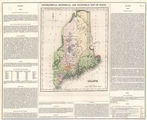
Geographical, Statistical, and Historical Map of Maine.
sold
- Digital Map Information
- Suitable for large format printing
- DPI: 600
- File Size: 21.69 MB
- File Type: ZIP / TIFF
- ICC color profile embedded
- Delivered instantly via download link
The first printed map of the State of Maine. This is the 1822 first edition example of Henry Charles Carey and Isaac Lea's map of Maine, engraved by Joseph Yeager, (1792-1859). As is typical of the Carey and Lea atlas, the map is presented in full wash color, surrounded by explicatory text. Nine counties are shown, and are distinguished from one another both by dotted lines and color coding. In addition to the towns, rivers, lakes and other such expected details, the map marks (by means of flags, also colored distinctly) 'Places Remarkable for Battles, Sieges' et cetera, which are described and dated in the text. These are predominantly conflicts with Native American tribes, though they include one Revolutionary War battle and five incidents from the War of 1812. (more details)
One of the earliest maps to depict Florida with more than two counties.
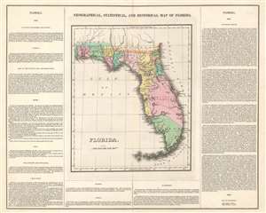
Geographical, Statistical, and Historical Map of Florida.
sold
- Digital Map Information
- Suitable for large format printing
- DPI: 600
- File Size: 20.08 MB
- File Type: ZIP / TIFF
- ICC color profile embedded
- Delivered instantly via download link
This is a rare 1827 Henry Charles Carey and Isaac Lea map of Florida and is one of the first maps to show more than two counties in the state. The map depicts the region from the Perdido River to the Atlantic Ocean and from Alabama and Georgia to the Florida Keys. Highly detailed, numerous locations are labeled throughout the map, including St. Augustine, Tallahassee, and Pensacola. Counties are shaded different colors to allow for easy differentiation. Roads, rivers, and lakes are also labeled. (more details)