
Clason, George Samuel
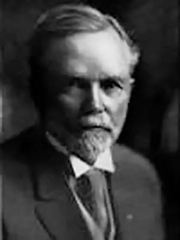
George Samuel Clason (November 7, 1874 - 1957) was born in the city of Louisiana, Missouri in 1874. As a young man, Clason studied at the University of Nebraska before joining the United States Army in 1898 to fight in the Spanish American War. After the war, he moved to Denver, Colorado where in 1905 he founded the Clason Map Company, thus starting his lucrative publishing career. Clason initially focused on mining and mineral maps - capitalizing on the Colorado and Nevada mining industry, but quickly transitioned to railroad maps, city maps, and by the 1920s, road maps. As the company expanded, Clason opened a secondary office in Chicago, Illinois - then a rising map publishing center and railroad hub. At least one other satellite office was opened in Los Angeles. Among his many achievements, Clason is credited with producing the first modern road atlas of the United States. In the late 1920s, Clason also published a series of get-rich-quick pamphlets in the form of parables. The most famous of these is The Richest Man in Babylon. This tells the story of Arkad, a citizen of Babylon famed for his great wealth and generosity who shares his wit and wisdom with his fellow Babylonians. In 1949, Clason moved to Napa, California to retire and found a social club for retired gentlemen.
Colorado Gold Rush.
Topographical Map Gilpin County Colo. Mineral Belt.
$900.00
Acquire
- Digital Map Information
- Suitable for large format printing
- Full resolution TIFF file
- ICC color profile embedded
- Delivered instantly via download link
This is a 1906 chromolithograph bird's-eye view map of Gilpin County, Colorado. The view records Gilpin's transition from a mining region to a mecca for outdoor and adventure tourism. (more details)
Salt Lake City at the beginning of the 20th Century.
Map of Salt Lake City Utah.
$400.00
Acquire
- Digital Map Information
- Suitable for large format printing
- Full resolution TIFF file
- ICC color profile embedded
- Delivered instantly via download link
This is a 1909 Clason Map Company city plan or map of Salt Lake City, Utah. The Temple Block, situated in the upper left, is labeled and the Temple, Tabernacle, and Assembly Hall are illustrated and labeled as well. Streets and city blocks are identified, along with the post office, Liberty Park, the State University of Utah (today's University of Utah), and the State Capital Grounds. Fort Douglas Military Reservation dominates the upper right quadrant with Newhouse Park just outside its boundaries. The City Cemetery, Hebrew Cemetery, Catholic Cemetery, and Mt. Olivet Cemetery are all labeled as well. (more details)
Earliest 'Green Guide' of Washington.
Clason's Guide Map of Washington / Clason's Guide to Washington with Map.
$450.00
Acquire
- Digital Map Information
- Suitable for large format printing
- File Size: 26.34 MB
- File Type: ZIP / TIFF
- ICC color profile embedded
- Delivered instantly via download link
This is a 1911 pocket map of Washington state prepared by the Clason Map Company, the earliest such map of Washington prepared by the company. (more details)
Rare Map of Los Angeles Promoting Competing Expositions in San Diego and San Francisco.
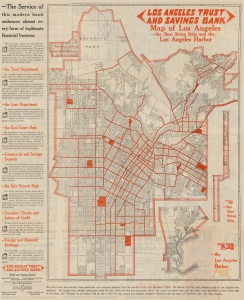
Map of Los Angeles City, also a District Map showing Automobile Roads, etc. - and a Map of the 1915 Exposition Trail / Map of Los Angeles, the Shoe String Strip and the Los Angeles Harbor.
$500.00
Acquire
- Digital Map Information
- Suitable for large format printing
- Full resolution TIFF file
- ICC color profile embedded
- Delivered instantly via download link
A scarce 1915 map of Los Angeles produced by the Clason Map Company. While focusing on L.A., it also promotes two concurrent, competing international expositions held that year in San Francisco and San Diego. (more details)
Wonderful early highway map of California.
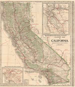
Clason's Map of California.
$350.00
Acquire
- Digital Map Information
- Suitable for large format printing
- File Size: 57.92 MB
- File Type: ZIP / TIFF
- ICC color profile embedded
- Delivered instantly via download link
This is a large and highly detailed c. 1920 Clason Map Company pocket format map of California. This map depicts the entire state of California with green highlighting to distinguish county borders and national forest lands. Inset submaps in the upper right and lower left quadrants focus on the San Francisco Bay area and the vicinity of Los Angeles, respectively. An index set along the map's left-hand border offers population statistics and a key to various cities throughout the state. (more details)
Green guide of the Evergreen State.
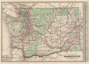
Clason's guide map of Washington.
$400.00
Acquire
- Digital Map Information
- Suitable for large format printing
- Full resolution TIFF file
- ICC color profile embedded
- Delivered instantly via download link
This is a very nice example of Clason's c. 1920 Washington State road and railway map. It highlights the state's infrastructure, while also showing information on national parks, Indian reservations, and administrative divisions. (more details)
Wyoming - come one, come all!
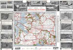
Resource Map of Wyoming.
$500.00
Acquire
- Digital Map Information
- Suitable for large format printing
- Full resolution TIFF file
- ICC color profile embedded
- Delivered instantly via download link
This c. 1922 Clason Map Company and Wyoming State Board of Immigration promotional resource map of Wyoming. The map was published to encourage immigration and development to the beautiful yet remote state. Uniform coding throughout highlights the states rich natural resources: red identifies oil fields, dark green marks irrigated land, light green identifies proposed and developing irrigation areas, and blue areas identify national forests. Yellowstone National Park is illustrated and labeled in the upper left corner of the state. Photographs of Wyoming's farming, ranching, and mining form the border. These images include a chicken ranch, bee hives, and fields of sunflowers, onions, and sugar beets. (more details)
The Bank of Italy in Los Angeles.
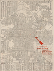
Map of Los Angeles and Vicinity Compliments of Bank of Italy.
$225.00
Acquire
- Digital Map Information
- Suitable for large format printing
- Full resolution TIFF file
- ICC color profile embedded
- Delivered instantly via download link
This is a 1924 Clason Map Company city plan or map of Los Angeles, California, issued for the Bank of Italy. Depicting from Griffith Park to Iowa Avenue and from Holt Street to the Flood Control Channel, streets throughout are labeled. Red overprinting highlights the four Bank of Italy branches in Los Angeles and red text provides the cross streets where each branch is located. A street index occupies both upper corners and the entire section below the border. (more details)