
Clason, George Samuel (sold)
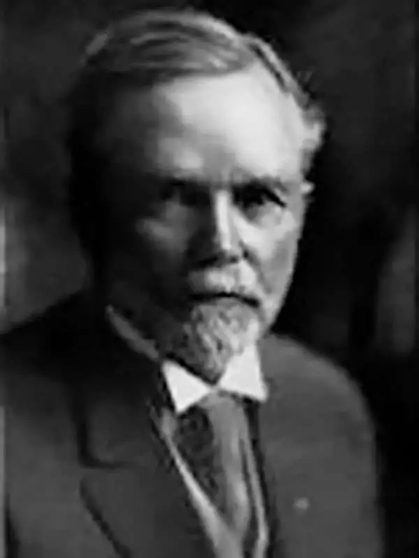
George Samuel Clason (November 7, 1874 - 1957) was born in the city of Louisiana, Missouri in 1874. As a young man, Clason studied at the University of Nebraska before joining the United States Army in 1898 to fight in the Spanish American War. After the war, he moved to Denver, Colorado where in 1905 he founded the Clason Map Company, thus starting his lucrative publishing career. Clason initially focused on mining and mineral maps - capitalizing on the Colorado and Nevada mining industry, but quickly transitioned to railroad maps, city maps, and by the 1920s, road maps. As the company expanded, Clason opened a secondary office in Chicago, Illinois - then a rising map publishing center and railroad hub. At least one other satellite office was opened in Los Angeles. Among his many achievements, Clason is credited with producing the first modern road atlas of the United States. In the late 1920s, Clason also published a series of get-rich-quick pamphlets in the form of parables. The most famous of these is The Richest Man in Babylon. This tells the story of Arkad, a citizen of Babylon famed for his great wealth and generosity who shares his wit and wisdom with his fellow Babylonians. In 1949, Clason moved to Napa, California to retire and found a social club for retired gentlemen.
Important view illustrating the Colorado Gold Rush.
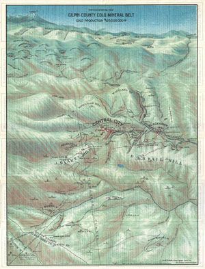
Topographical Map Gilpin County Colo. Mineral Belt Gold Production $125,000,000.00.
sold
- Digital Map Information
- Suitable for large format printing
- File Size: 20.3 MB
- File Type: ZIP / TIFF
- ICC color profile embedded
- Delivered instantly via download link
This is a stunning 1904 broadside bird's eye view or map of Gilpin County, Colorado. Centered on Central City, this view extends as far north as Rollinsville and Arapahoe Peak, as far south as Bellevue Mountain, as far east as Randolph Mill, and west as far as ... (more details)
Richly Detailed Plan of Denver, Printed In Denver.
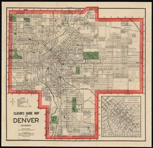
Clason's Guide Map of Denver Colorado.
sold
- Digital Map Information
- Suitable for large format printing
- File Size: 31.47 MB
- File Type: ZIP / TIFF
- ICC color profile embedded
- Delivered instantly via download link
An attractive example of George Clason's 1907 guidebook and map of Denver, Colorado. This map covers the growing city from Berkley Lake to Yale Avenue and from Sloans Lake to Yosemite Street. Though the map has not expanded yet to include Aurora (as it would be in later editions) the municipality is marked in manuscript along Colfax Avenue between Ulster and Wabash streets. An inset in the lower right quadrant details the Denver Business District. (more details)
Richly Detailed Plan of Denver, Printed In Denver: Highlighting the City's Green Spaces
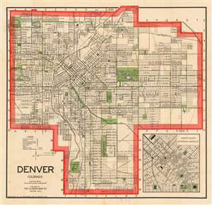
Denver Colorado.
sold
- Digital Map Information
- Suitable for large format printing
- File Size: 28.93 MB
- File Type: ZIP / TIFF
- ICC color profile embedded
- Delivered instantly via download link
An attractive example of George Clason's 1907 guidebook and map of Denver, Colorado. This map covers the growing city from Berkley Lake to Yale Avenue and from Sloans Lake to Yosemite Street. Concentric circles mark each mile's distance from Union Depot. Though the map has not expanded yet to include Aurora (as it would be in later editions) the municipality is marked in manuscript along Colfax Avenue between Ulster and Wabash streets. An inset in the lower right quadrant details the Denver Business District. (more details)
Highlights the Allied losses after the German Spring Offensive and their gains during the Hundred Days Offensive.
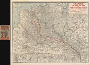
Clason's War Map of the Western Front.
sold
- Digital Map Information
- Suitable for large format printing
- File Size: 60.23 MB
- File Type: ZIP / TIFF
- ICC color profile embedded
- Delivered instantly via download link
This is a 1918 Clason Map Company map of northern France illustrating the movements of the front line in World War I through late October 1918. Unlike World War II, World War I was fought along mostly static lines of trenches in northern France and Belgium from 1914 through 1918. The map depicts the region from the English Channel and Dieppe to Strasburg (Strassburg) in Alsace, then part of Germany, and from Holland and the North Sea to Colmar. Red overprinting is used to illustrate the battle line at seven different times during the four-year slaughter. The furthest line depicts the farthest advance of the German army, when they reached within thirty kilometers of the center of Paris before their advance was stopped by the French at the First Battle of the Marne. This is the battle that includes the fabled taxis of Paris ferrying soldiers to the battlefield. Dashed lines also trace the German offensives of March and June 1918, collectively known as the Spring Offensive. The two thin solid lines mark the battle lines of October 7, 1918 and October 14, 1918, which were part of the Hundred Days Offensive, a campaign that began in August 1918 with the Battle of Amiens. Following the Allied success in the Battle of Amiens, the Germans fell back to the Hindenburg Line, a well-fortified defensive line that was established in 1917 and is illustrated and labeled here. The Hundred Days Offensive, in fact a series of battles that pushed back the Central Powers, eventually led to the end of the war. The final, bold battle line reinforces how far the Germans and other Central Powers had been pushed back since the beginning of the Hundred Days Offensive. (more details)
Allied losses after the German Spring Offensive and Allied gains during the Hundred Days Offensive.
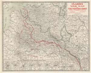
Clason's War Map of the Western Front.
sold
- Digital Map Information
- Suitable for large format printing
- Full resolution TIFF file
- ICC color profile embedded
- Delivered instantly via download link
This is a 1918 Clason Map Company map of northern France illustrating the movements of the front line in World War I through mid October 1918. Unlike World War II, World War I was fought along mostly static lines of trenches in northern France and Belgium from 1914 through 1918. The map depicts the region from the English Channel and Dieppe to Strasburg (Strassburg) in Alsace, then part of Germany, and from Holland and the North Sea to Colmar. Red overprinting is used to illustrate the battle line at five different times during the four-year slaughter. The furthest line depicts the farthest advance of the German army, when they reached within thirty kilometers of the center of Paris before their advance was stopped by the French at the First Battle of the Marne. This is the battle that includes the fabled taxis of Paris ferrying soldiers to the battlefield. Dashed lines also trace the German offensives of March and June 1918, collectively known as the Spring Offensive. The thin solid line marks the battle line of October 7, 1918 which was part of the Hundred Days Offensive, a campaign that began in August 1918 with the Battle of Amiens. Following the Allied success in the Battle of Amiens, the Germans fell back to the Hindenburg Line, a well-fortified defensive line that was established in 1917 and is illustrated and labeled here. The Hundred Days Offensive, in fact a series of battles that pushed back the Central Powers, eventually led to the end of the war. The final, bold battle line marks the progress made by the Hundred Days Offensive through October 14, 1918. (more details)
Highlights the Allied losses after the German Spring Offensive and their gains during the Hundred Days Offensive.
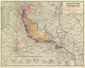
Clason's War Map of the Western Front.
sold
- Digital Map Information
- Suitable for large format printing
- Full resolution TIFF file
- ICC color profile embedded
- Delivered instantly via download link
This is a 1918 Clason Map Company map of northern France illustrating the movements of the front line in World War I through early September 1918. Unlike World War II, World War I was fought along mostly static lines of trenches in northern France and Belgium from 1914 through 1918. The map depicts the region from the English Channel and Dieppe to Strasburg (Strassburg) in Alsace, then part of Germany, and from Holland and the North Sea to Colmar. Red overprinting is used to illustrate the battle line at five different times during the four-year slaughter. The furthest line depicts the farthest advance of the German army, when they reached within thirty kilometers of the center of Paris before their advance was stopped by the French at the First Battle of the Marne. This is the battle that includes the fabled taxis of Paris ferrying soldiers to the battlefield. Dashed lines also trace the German offensives of March and June 1918, collectively known as the Spring Offensive. The line of X's marks the Allied campaign that began in August 1918 with the Battle of Amiens. Following the Allied success in the Battle of Amiens, the Germans fell back to the Hindenburg Line, a well-fortified defensive line that was established in 1917 and is illustrated and labeled here. The Hundred Days Offensive, in fact a series of battles that pushed back the Central Powers, eventually led to the end of the war. (more details)
Scarce, early folding map of Wyoming.
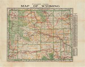
Clason's Guide Map of Wyoming.
sold
- Digital Map Information
- Suitable for large format printing
- File Size: 25.4 MB
- File Type: ZIP / TIFF
- ICC color profile embedded
- Delivered instantly via download link
An uncommon 1920 pocket map of Wyoming, by George Clason. The map covers the entire state of Wyoming including Yellowstone National Park, and the surrounding Teton National Forest, Wyoming National Forest, Washakie National Forest, and Shoshone National Forest. The map is divided into its counties; these, and cities and towns are named on a list to the right of the map with coordinates keyed to the map itself. The list includes the population numbers for each named place. Automobile roads throughout the map are marked in red; oil and gas fields are also indicated in orange. (more details)
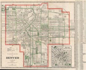
Clason's Guide Map of Denver Colorado.
sold
- Digital Map Information
- Suitable for large format printing
- File Size: 16.94 MB
- File Type: ZIP / TIFF
- ICC color profile embedded
- Delivered instantly via download link
A beautiful example of George Clason's 1919 guidebook and map of Denver, Colorado. This map covers all of Denver from Berkley Lake to englewood and from Sloans Lake to Aurora. An inset in the lower right quadrant details the Denver Business District. A street ... (more details)
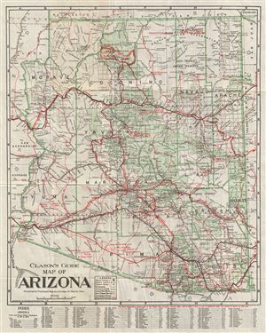
Clason's Guide Map of Arizona.
sold
- Digital Map Information
- Suitable for large format printing
- File Size: 13.89 MB
- File Type: ZIP / TIFF
- ICC color profile embedded
- Delivered instantly via download link
This is a fine example of the Guide Map of Arizona by G. S. Clason. Issued to accompany Clason's Arizona Green Guide , this folding map covers the entire state of Arizona. A legend near the bottom of the map shows the state capital, (Phoenix) county lines, ... (more details)
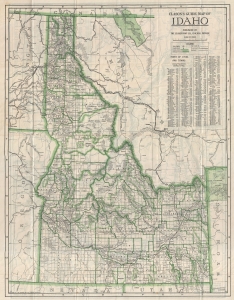
Clason's Guide Map of Idaho.
sold
- Digital Map Information
- Suitable for large format printing
- File Size: 14.64 MB
- File Type: ZIP / TIFF
- ICC color profile embedded
- Delivered instantly via download link
This is an attractive example of G. S. Clason's c. 1920 Guide Map of Idaho. Issued to accompany Clason's Idaho Green Guide , this folding map covers the entire state of Idaho. An index on the upper right quadrant of the map lists cities and towns with ... (more details)
Wonderful early highway map of California.
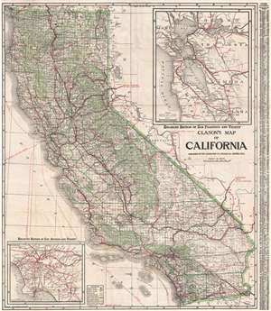
Clason's Map of California.
sold
- Digital Map Information
- Suitable for large format printing
- File Size: 28.85 MB
- File Type: ZIP / TIFF
- ICC color profile embedded
- Delivered instantly via download link
A large and highly detailed c. 1920 pocket format map of California by the Clason Map Company. This map covers the entire stain of California with green highlighting to distinguish county borders and national forest lands. Inset submaps in the upper right and lower left quadrants focus on the San Francisco Bay area and the vicinity of Los Angeles, respectively. An index set along the map's left-hand border offers population statistics and a key to various cities throughout the state. (more details)
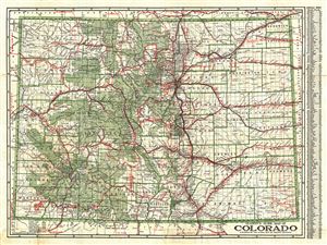
Clason's Guide Map of Colorado.
sold
- Digital Map Information
- Suitable for large format printing
- File Size: 19.51 MB
- File Type: ZIP / TIFF
- ICC color profile embedded
- Delivered instantly via download link
This is a beautiful 1920 map of Colorado by George Clason. The map covers the entire state in great detail, including the White River National Forest, Hayden National Forest, Colorado National Forest, among others. Throughout, the map notes railroads, ... (more details)
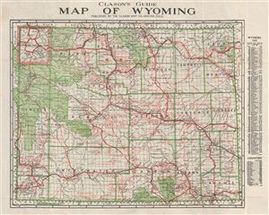
Clason's Guide Map of Wyoming.
sold
- Digital Map Information
- Suitable for large format printing
- File Size: 15.95 MB
- File Type: ZIP / TIFF
- ICC color profile embedded
- Delivered instantly via download link
An uncommon 1920 pocket map of Wyoming by George Clason. The map covers the entire state of Wyoming including Yellowstone National Park, and the surrounding Teton National Forest, Wyoming National Forest, Washakie National Forest, and Shoshone National ... (more details)

Clason's Map of California.
sold
- Digital Map Information
- Suitable for large format printing
- File Size: 36.31 MB
- File Type: ZIP / TIFF
- ICC color profile embedded
- Delivered instantly via download link
A large and highly detailed c. 1920 pocket format map of California by the Clason Map Company. This map covers the entire stain of California with green highlighting to distinguish county borders and national forest lands. Inset submaps in the upper right and lower left quadrants focus on the San Francisco Bay area and the vicinity of Los Angeles, respectively. An index set along the map's left-hand border offers population statistics and a key to various cities throughout the state. (more details)
Promoting Bradenton, 'The Friendly City'.
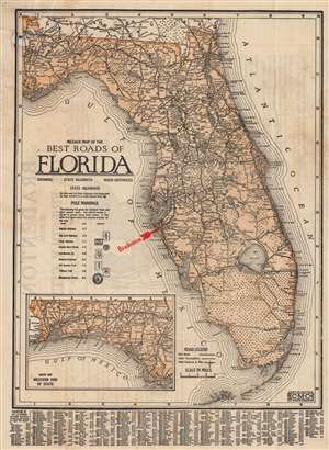
Milage Map of the Best Roads of Florida.
sold
- Digital Map Information
- Suitable for large format printing
- Full resolution TIFF file
- ICC color profile embedded
- Delivered instantly via download link
This is a c. 1922 Clason Map Company road map of Florida issued to promote real estate development in Bradenton, just south of Tampa. The map covers all of Florida, with the west Florida panhandle included via an inset. The map details major roadways throughout the state as well as roads under construction, such as Tamiami Trail across the Everglades from Miami. Just to the north is the Seminole Indian Reservation known as 'Big Cypress'. (more details)
Florida's Suburb of Hills and Lakes.
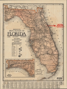
Milage Map of the Best Roads of Florida.
sold
- Digital Map Information
- Suitable for large format printing
- File Size: 12.3 MB
- File Type: ZIP / TIFF
- ICC color profile embedded
- Delivered instantly via download link
This is the c. 1922 Clason folding road map of Florida. It corresponds with the Florida Land Boom of the 1920s and was issued to promote real estate development in the Daytona Highlands neighborhood of Daytona Beach. (more details)
An attractive city map of Los Angeles, California.
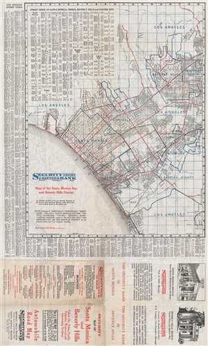
Map of Santa Monica Bay and Beverly Hills District.
sold
- Digital Map Information
- Suitable for large format printing
- File Size: 12.08 MB
- File Type: ZIP / TIFF
- ICC color profile embedded
- Delivered instantly via download link
This is a 1924 Clason Map Company map of Santa Monica and Beverly Hills, California. The map depicts the region from Santa Monica Bay to Beverly Hills and Los Angeles County and from Los Angeles to Playa del Rey. Palms, Culver City, Sawtelle, and Venice ... (more details)
Promoting Orlando during the Florida Land Boom.
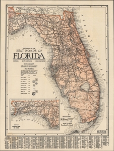
Milage Map of the Best Roads of Florida.
sold
- Digital Map Information
- Suitable for large format printing
- Full resolution TIFF file
- ICC color profile embedded
- Delivered instantly via download link
This is the c. 1924 Clason folding road map of Florida. It corresponds with the 1920s Florida Land Boom and was issued to promote real estate development in the Orwin Manor neighborhood of Orlando and Winter Park. (more details)
Illustrates both Wrigley Field and Comiskey Park!
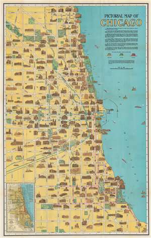
Pictorial Map of Chicago.
sold
- Digital Map Information
- Suitable for large format printing
- Full resolution TIFF file
- ICC color profile embedded
- Delivered instantly via download link
This is an attractive 1926 Clason Map Company pictorial city plan or map of Chicago, Illinois. Depicting from Howard Street south to East and West 87th Street, important buildings throughout are illustrated in profile, including the Field Museum, The Art Institute, the Museum of Natural History, Wrigley Field (labeled as Cubs Ball Park), and Comiskey Park (labeled White Sox Ball Park). Similar vignettes illustrate hotels, schools, hospitals, office buildings, churches, and numerous other buildings. The city's parks, cemeteries, and golf and polo clubs are illustrated and colored green. Pink, green, and red lines trace the motor coach routes through the North Site, West Side, and South Side, respectively. (more details)
Illustrates both Wrigley Field and Comiskey Park!
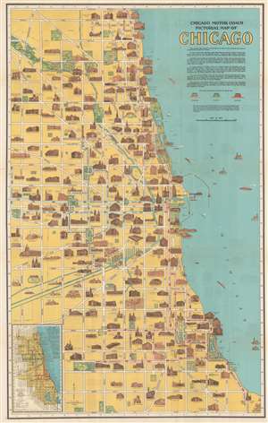
Chicago Motor Coach Pictorial Map of Chicago.
sold
- Digital Map Information
- Suitable for large format printing
- Full resolution TIFF file
- ICC color profile embedded
- Delivered instantly via download link
This is an attractive c. 1927 Clason Map Company pictorial city plan or map of Chicago, Illinois. Depicting from Howard Street south to East and West 87th Street, important buildings throughout are illustrated in profile, including the Field Museum, The Art Institute, the Museum of Natural History, Wrigley Field (labeled as Cubs Ball Park), and Comiskey Park (labeled White Sox Ball Park). Similar vignettes illustrate hotels, schools, hospitals, office buildings, churches, and numerous other buildings. The city's parks, cemeteries, and golf and polo clubs are illustrated and colored green. Published for the Chicago Motor Coach Company, pink, green, and red lines trace the motor coach routes through the North Site, West Side, and South Side, respectively. (more details)
Al Capone's Chicago.
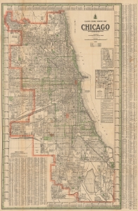
Clason's Double Indexed Map of Chicago. / Clason's Chicago Map.
sold
- Digital Map Information
- Suitable for large format printing
- Full resolution TIFF file
- ICC color profile embedded
- Delivered instantly via download link
This is a c. 1930 Clason city plan or map of Chicago, Illinois. This map details Chicago near the end of notorious gangster Al Capone's time as boss of the Chicago Outfit. (more details)
Beautiful pictorial map depicting downtown Chicago, the Loop District and the Magnificent Mile.
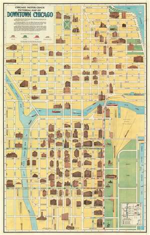
Chicago Motor Coach Pictorial Map of Downtown Chicago.
sold
- Digital Map Information
- Suitable for large format printing
- File Size: 49.76 MB
- File Type: ZIP / TIFF
- ICC color profile embedded
- Delivered instantly via download link
This is an attractive c. 1940 map or plan of Chicago, Illinois issued by the Clason Map Co., Illinois. Centered on the Chicago River, coverage extends from Harrison Street north to the intersection of Rush Street and Bellevue Place, west as far as Canal Street, and east to Lake Michigan. It details the downtown Chicago, including the Magnificent Mile and the Chicago Loop.
Important buildings, representing leading hotels, department stores, public buildings, churches, clubs, theaters, office buildings and industrial plants, are shown in vignette profile. Individual streets are named, with parks, coach routes and railroads identified. Beautiful illustrations of ships and sailboats are included in the river and lake. An inset in the lower right quadrant notes the starting points of all coach lines running downtown. An explanation below the title notes the significance of downtown Chicago and the areas depicted here. (more details)
Important buildings, representing leading hotels, department stores, public buildings, churches, clubs, theaters, office buildings and industrial plants, are shown in vignette profile. Individual streets are named, with parks, coach routes and railroads identified. Beautiful illustrations of ships and sailboats are included in the river and lake. An inset in the lower right quadrant notes the starting points of all coach lines running downtown. An explanation below the title notes the significance of downtown Chicago and the areas depicted here. (more details)
Beautiful pictorial map depicting downtown Chicago, the Loop District and the Magnificent Mile.
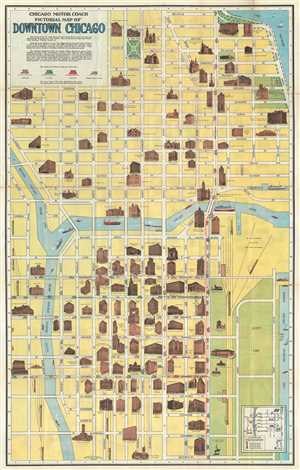
Chicago Motor Coach Pictorial Map of Downtown Chicago.
sold
- Digital Map Information
- Suitable for large format printing
- Full resolution TIFF file
- ICC color profile embedded
- Delivered instantly via download link
This is an attractive c.1940 map or plan of Chicago, Illinois issued by The Clason Map Co., Illinois. It covers from Harrison Street north to Bellevue Place and west as far as Canal St., depicting downtown Chicago, including the Magnificent Mile and ... (more details)