
Collin, Charles-Étienne (sold)

Charles-Étienne Collin (1770 - 1840) was a French engraver active in Paris during the late 18th and early 19th centuries. Collin was born in Paris to a long line of important French engravers dating back to Jean Collin. He was the son of Bernard Collin (1737 - 1791), son of Jean. Collin engraved for the seminal 1809 - 1822 Description de l'Egypte and extensively for the Dépôt de la Marine. He was contracted by his cousin by marriage, Phillipe Buache (1700 - 1773), for his exceptional engraving mastery to work for the Dépôt de la Marine from at least August 1793. He worked with his brother, Jean-Louis Collin (1775 - 1858), from 1800 to 1803. His son, also Charles-Étienne Collin or just Étienne Collin II (1790 - 1852), apprenticed under him and worked with him from 1821 to 1829. Under Charles-Étienne Collin (1770 - 1840) and then his son, the firm was located in Paris at N° 45, Rue de la Harpe - the last known work attributed to 'E. Collin' appeared in 1831. Distinguishing between the 'Collin' family of engravers on Dépôt de la Marine charts is difficult. The elder Étienne Collin (1770 - 1840) typically signed his work 'E. Collin' or later 'E. Collin père'. His son signs some of his work as 'E. Collin' and others as 'C.E. Collin fils.' There is some evidence of another generation of Collin engravers, also Charles-Étienne Collin, signing his work as 'C. E. Collin' between 1840 and 1875.
Red Sea and French attempts to sieze control of the India Ocean.
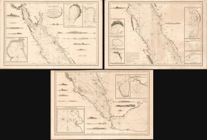
Carte Générale de la Mer Rouge...
sold
- Digital Map Information
- Suitable for large format printing
- Full resolution TIFF file
- ICC color profile embedded
- Delivered instantly via download link
This is a c. 1799 set of three nautical maps or charts covering the Red Sea, produced by the French Dépôt Général de la Marine. At the time, the Red Sea had become a key strategic waterway due to Napoleon's invasion of Egypt and the wider geopolitical struggles of the French Revolutionary Wars, prompting significant remapping. (more details)
1800 Depot de la Marine Nautical Chart or Map of the Rio de la Plata (Argentina, Buenos Aires, Monte
Finely engraved chart of the Rio de la Plata.
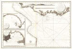
Carte de La Riviere de La Plata depuis son Embouchure jusqu'a Buenos-Ayres d'apres les Plans leves en 1789 et 1794.
sold
- Digital Map Information
- Suitable for large format printing
- Full resolution TIFF file
- ICC color profile embedded
- Delivered instantly via download link
This is an extremely scarce large format c. 1800 French nautical chart or maritime map of the Rio de la Plata, Argentina and Uruguay. The chart is noteworthy for the extraordinary engraving mastery it exhibits - a hallmark of the engraver Charles-Étienne Collin (1770 - 1840). This elegantly presented map covers the entire estuary from Los Cerros de San Juan to the Laguna de Rocha and extends south to approximately 55 degrees south latitude. The chart includes the important ports of Buenos Aires, Sacramento, Montevideo, and Maldonado, among others. The detail is primarily coastal, extending only about 10 miles inland, but the terrestrial detail offered throughout, including topography rendered in hachure, is extraordinary. Nautically, the map offers a multitude of soundings and outlines several shoals. Two large inset maps offer extraordinary detail focused on the ports of Maldonado and Montevideo, both in modern-day Uruguay. Shore profiles line the top of the map. (more details)
Most trafficked and contested part of the West Indies.
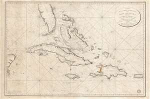
Carte de la Partie Occidentale des Îles Antilles Comprenant St. Domingue, La Jamaique, Cuba et Îles et Bancs de Bahama avec les Débouqumens de toutes ces Îles Dressée d'apres les nouvelles Observations des Espagnols et Publiée Par Ordre du Xontre-Amiral Decrès Ministre de la Marine et des Colonies au Dépôt général de la Marine, en 1801.
sold
- Digital Map Information
- Suitable for large format printing
- DPI: 600
- File Size: 39.35 MB
- File Type: ZIP / TIFF
- ICC color profile embedded
- Delivered instantly via download link
A scarce and elegantly engraved 1801 nautical map of Florida and the Greater Antilles, including Cuba, the Bahamas, Santo Domingo, Puerto Rico, and Jamaica, issued by the official French hydrographic office, the Dépôt de Marine. The map covers from the eastern Yucatan to Puerto Rico and from just north of Cape Canaveral, Florida, to the banks south of Jamaica - thus embracing the most heavily trafficked and contested waters in the West Indies. (more details)
Planning the Thiers Wall - Original Manuscript!
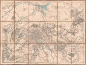
Carte Militaire des Environs de Paris relative aux traveaux de défense éxécutés ou projetés en 1815.
sold
- Digital Map Information
- Suitable for large format printing
- Full resolution TIFF file
- ICC color profile embedded
- Delivered instantly via download link
This is a unique c. 1815 Charles-Étienne Collin map of Paris, France, with unique c. 1841 manuscript updates by General Louis Doguereau illustrating the planned fortification of Paris or, as it became known, the Thiers Wall (Enceinte de Thiers), one of the greatest follies of military engineering ever conceived. As head of the École d'Application de l'Artillerie et du Génie, Doguereau was part of the 8-man Commission des Fortifications organized to design the wall in 1840-41. (more details)