
Crocker, Henry Smith (sold)
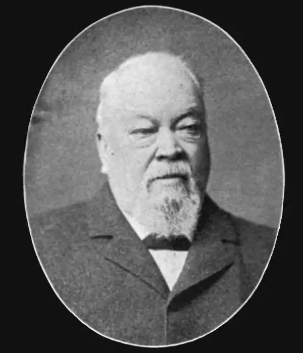
Henry Smith Crocker (January 31, 1832 - July 18, 1904) was an American printer, publisher, and railroad investor active in northern California in the middle to late 19th century. Crocker followed the Gold Rush to California, settling in Sacramento in the 1850s. He established his printing concern, H. S. Crocker, in 1856. Apparently his first office was little more than a tent with a small sign. Crocker relocated to San Francisco in 1871. He became extremely wealthy almost overnight by leveraging his ties to the Central Pacific Railroad, which is brother, Charles Crocker (1822 - 1888) founded. In 1885, Crocker constructed a large five-story printing factory, powered by his own private steam plant, then the largest and most sophisticated printing concern on the west coast. Crocker's prosperity continued and by the time he died in 1904, he was the head of a large and wealthy family. Although Crocker passed on, his company, H.S. Crocker, continued to operate and remains active to this day.
Wawona Tree 2 years after the 'tunnel' was cut.
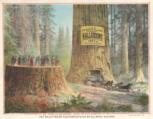
Big Trees of California. Height 435 Feet, Diamater 40 Feet.
sold
- Digital Map Information
- Suitable for large format printing
- Full resolution TIFF file
- ICC color profile embedded
- Delivered instantly via download link
A striking 1893 H. S. Crocker and N. W. Griswold chromolithograph illustration of Yosemite's Mariposa Grove giant sequoias advertising Kallidont (mouthwash) and Griswold's publication Beauties of California. (more details)
The earliest map of California to illustrate Viticulture!
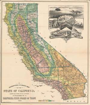
Geographical and Climatic Map of the State of California.
sold
- Digital Map Information
- Suitable for large format printing
- File Size: 54.31 MB
- File Type: ZIP / TIFF
- ICC color profile embedded
- Delivered instantly via download link
One of the earliest depictions of viticulture (wine-making) in California, this is the 1888 Henry Smith Crocker and California State Board of Trade map of California. The large cartouche in the upper right features centrally large fields of grapes. The map itself offers color-coding to highlight different areas of the state based on the mean annual temperature. Thick blue lines outline counties, and individual townships are illustrated. Railroad lines and major roads snake their way across the state, and rivers, lakes, mountains are represented and labeled as well. (more details)
One of the earliest cartographic depictions of Wine Making in California!
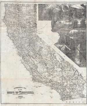
Geographical Map of the State of California Compiled from Actual Surveys.
sold
- Digital Map Information
- Suitable for large format printing
- File Size: 21.27 MB
- File Type: ZIP / TIFF
- ICC color profile embedded
- Delivered instantly via download link
A stunning separately issued 1893 decorative map of California issued to promote the Crocker family business interests in the development and settlement of California. It features an early cartographic representation of wine making in California. While the mapmaker, Henry Smith Crocker was on the surface a printer, his business interests were inextricably linked to those of this brother, Central Pacific railroad magnate Charles Crocker (1822 - 1888). H. S. Crocker used his publishing and printing empire to propagandize the Central Pacific as well as the general virtues of California as a place to resettle - this map being one such example, probably issued as a booster publication for the California exhibit at the Chicago Columbian Exposition of 1893. (more details)
One of the earliest cartographic depictions of Wine Making in California!
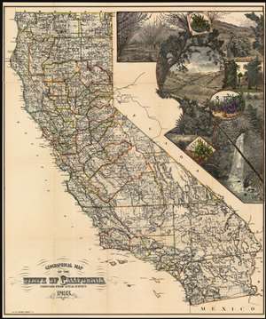
Geographical Map of the State of California Compiled from Actual Surveys.
sold
- Digital Map Information
- Suitable for large format printing
- File Size: 82.39 MB
- File Type: ZIP / TIFF
- ICC color profile embedded
- Delivered instantly via download link
A stunning separately issued 1893 decorative map of California issued to promote the Crocker family business interests in the development and settlement of California. It is also among the earliest, if not the earliest, cartographic representation of wine making in California. While the mapmaker, Henry Smith Crocker was on the surface a printer, his business interests were inextricably linked to those of this brother, Central Pacific railroad magnate Charles Crocker (1822 - 1888). H. S. Crocker used his publishing and printing empire to propagandize the Central Pacific as well as the general virtues of California as a place to resettle - this map being one such example, probably issued as a booster publication for the California exhibit at the Chicago Columbian Exposition of 1893. (more details)
One of the earliest depictions of California Wine Making on a map.
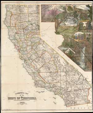
Geographical Map of the State of California Compiled from Actual Surveys.
sold
- Digital Map Information
- Suitable for large format printing
- File Size: 53.86 MB
- File Type: ZIP / TIFF
- ICC color profile embedded
- Delivered instantly via download link
A stunning separately-issued 1893 decorative map of California issued to promote the Crocker family business interests in the development and settlement of California. It is alone one of the earliest cartographic representations of viticulture in California. While the mapmaker, Henry Smith Crocker was on the surface a printer, his business interests were inextricably linked to those of this brother, Central Pacific railroad magnate Charles Crocker (1822 - 1888). H. S. Crocker used his publishing and printing empire to propagandize the Central Pacific as well as the general virtues of California as a place to resettle - this map being one such example, probably issued as a booster publication for the California exhibit at the 1893 Chicago Columbian Exposition. (more details)
One of the earliest depictions of California Wine Making on a map.
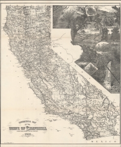
Geographical Map of the State of California Compiled from Actual Surveys.
sold
- Digital Map Information
- Suitable for large format printing
- File Size: 128.3 MB
- File Type: ZIP / TIFF
- ICC color profile embedded
- Delivered instantly via download link
A stunning separately-issued 1893 decorative map of California issued to promote the Crocker family business interests in the development and settlement of California. It is alone one of the earliest cartographic representations of viticulture in California. While the mapmaker, Henry Smith Crocker was on the surface a printer, his business interests were inextricably linked to those of this brother, Central Pacific railroad magnate Charles Crocker (1822 - 1888). H. S. Crocker used his publishing and printing empire to propagandize the Central Pacific as well as the general virtues of California as a place to resettle - this map being one such example, probably issued as a booster publication for the California exhibit at the 1893 Chicago Columbian Exposition. (more details)
'No temple made with hands can compare.'
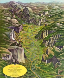
Yosemite Valley. / A Pic-Tour Map Yosemite Valley what to do... where to go... what to see.
sold
This is a 1963 pictorial folding view of Yosemite Valley in Yosemite National Park, California, by Milton Cavagnaro and Leo Holub. (more details)