
Wit, Frederik de

Frederik de Wit (1629 - 1706) was a Dutch Golden Age cartographer active in the second half of the 17th and the early 18th centuries. De Wit was born of middle class Protestant stock in the western Netherlandish town of Gouda. He relocated to Amsterdam sometime before 1648, where he worked under Willem Blaeu. His first attributed engraved map, a plan of Haarlem for Antonius Sanderus' Flandria Illustrata, was issued around this time. He struck out on his own in 1654. The first chart that De Wit personally both drew and engraved was most likely his 1659 map of Denmark, REGNI DANIÆ Accuratissima delineatio Perfeckte Kaerte van ‘t CONJNCKRYCK DENEMARCKEN. His great wall map of the world and most famous work, Nova Totius Terrarum Orbis Tabula appeared one year later. Following the publication of his wall map De Wit quickly rose in prominence as a both cartographer and engraver. He married Maria van der Way in 1661 and through her became a citizen of Amsterdam in 1662. Around this time he also published his first major atlas, a composite production ranging in size from 17 to over 150 maps and charts. Other atlases and individual maps followed. In 1689 De Wit was granted a 15 year Privilege by the Dutch States General. (An early copyright that protected the recipient's rights to print and publish.) He was recognized with the honorific 'Good Citizen' in 1694. De Wit died in 1706 after which his wife Maria continued publishing his maps until about 1710. De Wit's son, Franciscus, had no interest in the map trade, instead choosing to prosper as a stockfish merchant. On her own retirement, Maria sold most De Wit maps and plates at a public auction. Most were acquired by Pieter Mortier and laid the groundwork for the 1721 rise of Covens and Mortier, the largest Dutch cartographic publishing house of the 18th century.
Scarce, attractive decorative map.

Nova Europae descriptio Auct. F. de Wit.
$1,700.00
Acquire
- Digital Map Information
- Suitable for large format printing
- DPI: 600
- File Size: 23.75 MB
- File Type: ZIP / TIFF
- ICC color profile embedded
- Delivered instantly via download link
This is a scarce 1660 Dutch carte à figures map of Europe, engraved by Frederick de Wit. This beautifully engraved work was one of a handful of maps that De Wit would have considered his showcase works as he struck out on his own as a mapmaker, after having worked for many years with the Blaeu family. Although in general terms the style is reminiscent of his former teachers', it differs both from the corresponding map in Blaeu's atlases and those of Blaeu's primary competitors, Hondius and Jansson. (more details)
'Most Attractive of its Time' -Shirley
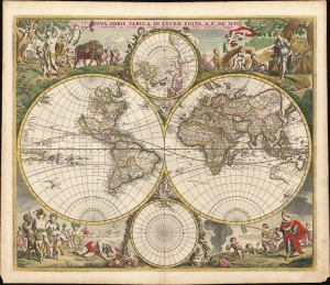
Nova Orbis Tabula In Lucem Edita, A. F. de Wit.
$6,000.00
Acquire
- Digital Map Information
- Suitable for large format printing
- Full resolution TIFF file
- ICC color profile embedded
- Delivered instantly via download link
This is a striking c. 1689 example, in original color, of Frederick De Wit's classic double hemisphere map of the world. Shirley praised it as 'one of the most attractive of its time'. It features many of the tropes of 17th-century Dutch mapmaking: Insular California, imaginary islands, etc., as well as new discoveries, such as Western Australia, and cartographic reconsiderations, among them the removal of the imaginary Terra Australis. (more details)
'Most Attractive of its Time' -Shirley
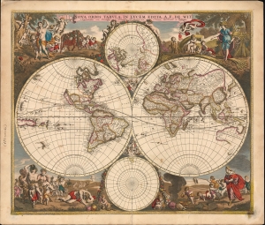
Nova Orbis Tabula In Lucem Edita, A. F. de Wit.
$5,500.00
Acquire
- Digital Map Information
- Suitable for large format printing
- File Size: 31.77 MB
- File Type: ZIP / TIFF
- ICC color profile embedded
- Delivered instantly via download link
This is a striking c. 1689 example, in original color, of Frederick De Wit's classic double hemisphere map of the world. Shirley praised it as 'one of the most attractive of its time'. It features many of the tropes of 17th-century Dutch mapmaking: Isular California, imaginary islands, etc., as well as new discoveries, such as Western Australia, and cartographic reconsiderations, among them the removal of the imaginaryTerra Australis. (more details)
Scarce, separately issued 'carte-á-figures' of America.

Nova Totius Americae Descriptio Auct. F. de Wit.
$5,500.00
Acquire
- Digital Map Information
- Suitable for large format printing
- Full resolution TIFF file
- ICC color profile embedded
- Delivered instantly via download link
This is Frederic De Wit's scarce, separately issued 1660 carte à figures map of America. This beautifully engraved map was one of a handful produced by De Wit to showcase his skill as he struck out on his own as a mapmaker, after having worked for many years under the Blaeu family. It represents a synthesis of traditional imagery with state-of-the-art geographical ideas. It was not intended for any particular atlas, although surviving examples occasionally appear bound into other works, including Doncker's Zee-Atlas. (more details)
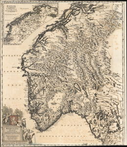
A Groundbreaking Dutch Map of Norway.
Nova Totius Angliae, Scotiae, et Hiberniae Tab: Auctore Frederick de Wit.
$500.00
Acquire
- Digital Map Information
- Suitable for large format printing
- File Size: 29.65 MB
- File Type: ZIP / TIFF
- ICC color profile embedded
- Delivered instantly via download link
This beautifully engraved map is Frederick De Wit's c. 1688 map of Norway. Ginsberg's typically coy praise should ring loudly: 'We Wit's map of Norway... attests to his originality and skill. Here is a representation that truly merits being called a map of the country,' that country being Norway. None of this map's precursors focused so well on Norway itself, and with such detail as this. (more details)
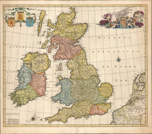
Dutch Golden Age Map of the British Isles.
Nova Totius Angliae, Scotiae, et Hiberniae Tab: Auctore Frederick de Wit.
$650.00
Acquire
- Digital Map Information
- Suitable for large format printing
- File Size: 21.41 MB
- File Type: ZIP / TIFF
- ICC color profile embedded
- Delivered instantly via download link
This beautifully engraved map is Frederick De Wit's c. 1680 map of the British Isles. Between its artful presentation and up-to-date cartography, it represents a classic of the Dutch Golden Age of Mapmaking. (more details)
Sicily and its Harbors.
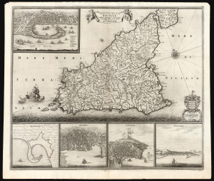
Insula sive Regnum Siciliae Urbibus praecipuis exornatum Urbibus praecipuis exonatum et novissime editum per F. de Wit.
$2,400.00
Acquire
- Digital Map Information
- Suitable for large format printing
- File Size: 30.75 MB
- File Type: ZIP / TIFF
- ICC color profile embedded
- Delivered instantly via download link
This is Frederick De Wit's c. 1671 map of Sicily, one of the most beautiful depictions of the Kingdom of Sicily produced in the Golden Age of Dutch Mapmaking - both in its delineation of Sicily itself and its bird's-eye views of five of Sicily's principal ports. (more details)
Masterfully Engraved Nautical Chart.
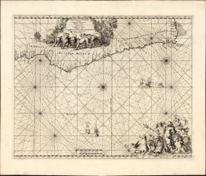
Cimbebas et Caffariae Littora a Catenbela ad Promontorium Bonae Spei/ Pascaerte van Cimbebas en Caffares Streckende van Catembala tot Cabo de Bona Esperanca Gedruckt tot Amsterdam by Frederick de Wit.
$750.00
Acquire
- Digital Map Information
- Suitable for large format printing
- File Size: 24.04 MB
- File Type: ZIP / TIFF
- ICC color profile embedded
- Delivered instantly via download link
This is Frederic De Wit's c. 1675 nautical chart of the southwest coast of Africa, from approximately the river Loge in Angola to the Cape of Good Hope. The chart presents what could be construed as the gateway to the Indian Ocean. De Wit's precise engraving is embellished by the superb etching of Romeyn de Hooghe. (more details)
Graphic illustration of the Slave Trade.
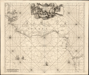
Tractus Littorales Guineae a Promontorio Verde usque ad Sinum Catenbelae.
$950.00
Acquire
- Digital Map Information
- Suitable for large format printing
- File Size: 21.83 MB
- File Type: ZIP / TIFF
- ICC color profile embedded
- Delivered instantly via download link
This is Frederic De Wit's c. 1675 nautical chart of western Africa, extending from modern-day Mauritania to Angola. The map foregrounds the mouth of the River Congo in the south while detailing the complicated coastline between the Rivers Senegal, Gambia, and a 'Rio Grande,' probably the Geba in modern Guinea-Bissau. The whole of this region, and that of Senegal in the north, is historically the Slave Coast: a prime source of African people sold into slavery as part of the Atlantic Slave Trade. (more details)
Dominant Mapping of Italy of the 17th Century. First State.
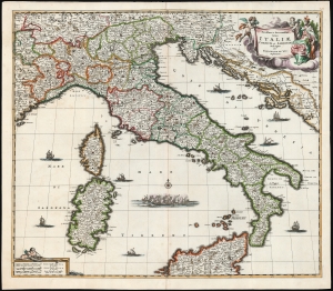
Novissima et Accuratissima totius Italiae, Corsicae et Sardiniae Descriptio Per Fredericum De Wit Amstelodami.
$1,250.00
Acquire
- Digital Map Information
- Suitable for large format printing
- Full resolution TIFF file
- ICC color profile embedded
- Delivered instantly via download link
This is a first-state example of Frederik de Wit's map of Italy, engraved as early as 1671. (more details)
Rare Unrecorded Plate.
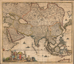
Accuratissima totius Asiae Tabula Recens Emendata Per Fredericum De Wit Amstelodami.
$1,500.00
Acquire
- Digital Map Information
- Suitable for large format printing
- File Size: 28.32 MB
- File Type: ZIP / TIFF
- ICC color profile embedded
- Delivered instantly via download link
This is an unrecorded, likely pirated map based on Frederic De Wit's c. 1680 map of Asia. While cartographically identical to the De Wit, there are enough variations in the engraving to conclude that it was printed from a different plate not referenced elsewhere. (more details)
Dominant Mapping of Italy of the 17th Century.
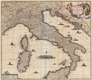
Novissima et Accuratissima totius Italiae, Corsicae et Sardiniae Descriptio Per Fredericum De Wit Amstelodami.
$850.00
Acquire
- Digital Map Information
- Suitable for large format printing
- Full resolution TIFF file
- ICC color profile embedded
- Delivered instantly via download link
This is an attractive map of Italy, engraved as early as 1671 by Frederik De Wit. The map covers the Italian Peninsula in its entirety including the Dalmatian coast, at the time controlled by the Republic of Venice, as well as the islands of Corsica, Sardinia, and part of Sicily. As with virtually every map of Italy produced in the seventeenth century, De Wit follows the model established by Magini's monumental 1608 Italia Nuova. Magini's map was justifiably influential, rendering the whole of Italy and its islands in magnificent detail with their river systems clearly presented and mountains shown pictorially. (more details)
One of the most desirable and attractive 17th century maps of Malta.
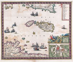
Insula Malta accuratissime Delineata, Urbibus, et Fortalitiis.
$1,575.00
Acquire
- Digital Map Information
- Suitable for large format printing
- DPI: 300
- File Size: 13.71 MB
- File Type: ZIP / TIFF
- ICC color profile embedded
- Delivered instantly via download link
A fine c. 1680 map of Malta and Gozo by the Dutch Golden Age cartography Frederick De Wit. This is one of the most decorative maps of Malta to appear in the 18th century. Centered on Malta and Gozo, it covers the surrounding seas as far north as Sicily and ... (more details)
Empires of the East.
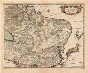
Tabula Tartariae et majoris partis Regni Chinae edita a F. de Wit.
$750.00
Acquire
- Digital Map Information
- Suitable for large format printing
- DPI: 600
- File Size: 51.08 MB
- File Type: ZIP / TIFF
- ICC color profile embedded
- Delivered instantly via download link
This beautifully engraved and colored map is Frederick de Wit's 1680 map of Central Asia and the Far East, including Persia, China, Japan and Siberia. It reaches from the eastern Caspian Sea to the Pacific, and from the mouth of the Ganges in the south to the mouth of the Ob in Siberia. This represented the state of the art of Dutch cartography of northeastern Asia prior to the groundbreaking map of Nicolaas Witsen. The treatment of Japan and Yedso reflects the journey of Maarten Gerritsz Vries and the northeastern bulge evident on the maps of Blaeu and Jansson has been truncated here. The regions of central Asia are replete with descriptive texts, some of which were retained from the 15th century maps of Fra Mauro, and even from the narrative of Marco Polo. These focus particularly on the empire of the Grand Khan, and on various putative Christian kingdoms. The Great Wall of China is depicted. (more details)
Sweden at the Height of Empire.
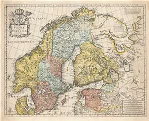
Tabula Regnorum Sueciae et Norvegiae.
$950.00
Acquire
- Digital Map Information
- Suitable for large format printing
- DPI: 600
- File Size: 63.66 MB
- File Type: ZIP / TIFF
- ICC color profile embedded
- Delivered instantly via download link
This is Frederick de Wit's map of Scandinavia. It is based on Anders Bure's 1626 mapping of the region, which swiftly became the dominant mapping of the northern parts of Europe and was not replaced as an authority for more than a century. On the strength of his seminal map and its long tenure as the state-of-the-art map of the northern regions of Europe, Bure is hailed as the Father of Swedish Cartography. The scope of the map includes Denmark, Norway, the greater Swedish Empire, the Baltic coasts of Germany, Poland and Livonia, and the Russian Empire - including 'Lapponia Moscovitica,' the portions of Lapland occupied by Russia. (more details)
End of Ottoman Expansion into Europe.
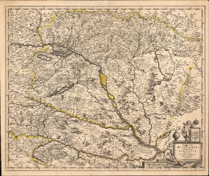
Regnum Hungaria in Omnes suos Comitatus Accurate Divisum et Editum Per F. De Wit Amstelodami.
$450.00
Acquire
- Digital Map Information
- Suitable for large format printing
- File Size: 30.19 MB
- File Type: ZIP / TIFF
- ICC color profile embedded
- Delivered instantly via download link
This is a c. 1688 Frederic De Wit map of Hungary and the surrounding region, including parts of modern-day Austria, Slovakia, Croatia, and Serbia. The map was issued at the height of the Great Turkish War (1683 - 1699), which ravaged the region, but a string of European victories ended Ottoman expansion into Europe. (more details)
Cutting Edge Asian Geography for an English Audience.
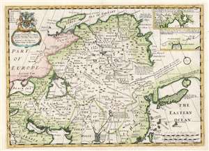
A New Map of Great Tartary, and China, with the adjoyning Parts of Asia.
$550.00
Acquire
- Digital Map Information
- Suitable for large format printing
- DPI: 600
- File Size: 40.85 MB
- File Type: ZIP / TIFF
- ICC color profile embedded
- Delivered instantly via download link
This is Edward Wells' 1700 map of central and northern Asia. The map spans from the near east - Mesopotamia and Persia, and the frontier of Muscovy - to Siberia and Tartary, as well as China, Korea, and Japan. (more details)
The opening stages of the War of Spanish Succession.
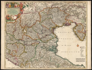
Dominii Veneti In Italia in Partes Accurate divisi ac Statuum Ducum Parmae, Mutinae, Mantuae et Mirandolae Novissima descriptio.
$850.00
Acquire
- Digital Map Information
- Suitable for large format printing
- DPI: 600
- File Size: 80.43 MB
- File Type: ZIP / TIFF
- ICC color profile embedded
- Delivered instantly via download link
This is a beautiful, original color example of Frederick de Wit's c. 1701 map of the region controlled by the Republic of Venice. While the map was initially engraved as early as 1682, this is an amended state of the map showing many changes - some noting changes to the wetlands at the mouth of the River Po, and some recording the opening battles of the War of Spanish Succession (1701 - 1714). (more details)
Attractive map of the Flemish regions of Belgium.
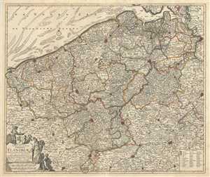
Novissima et Accuratissima Comitatus Flandriae Tabula, in qua Novae Lineae, et omnes Urbes, cum suis veris Munitionibus quae Gallis, Hispanis, Batavisqe parent.
$900.00
Acquire
- Digital Map Information
- Suitable for large format printing
- Full resolution TIFF file
- ICC color profile embedded
- Delivered instantly via download link
This is an attractive c.1721 map of Flanders by Frederik De Wit. The map depicts western portions of modern day Belgium and northern France along with parts of Holland, a region commonly known as Flanders at the time. Extends from Zeeland south to Arras in ... (more details)
Beautiful early map depicting the Nile Delta in Egypt.
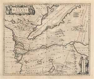
Nova Aegypti Tabula.
$400.00
Acquire
- Digital Map Information
- Suitable for large format printing
- Full resolution TIFF file
- ICC color profile embedded
- Delivered instantly via download link
This is a beautiful map of northern Egypt and the Red Sea by Frederik De Wit. Centered on the Nile River, the map is oriented with east on top and covers the Nile delta in northern regions of the Egypt. The entire map is depicted in extraordinary detail, ... (more details)
Beautiful map featuring the division of the Crown of Castile.
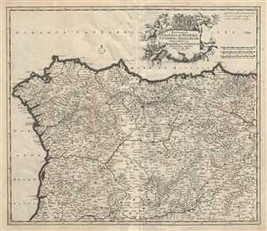
Regnorum Castellae Veteris, Legionis, et Gallaeciae principatuumq Biscaiae, et Asturiarum Accuratissima Descriptio.
$400.00
Acquire
- Digital Map Information
- Suitable for large format printing
- Full resolution TIFF file
- ICC color profile embedded
- Delivered instantly via download link
This is a scarce c.1721 map of northwest Spain by Frederik De Wit. The map depicts the northern divisions under the Crown of Castile, including the part of the Kingdom of Leon, the Kingdom of Castile, the Principality of Asturias, the Kingdom of Galicia ... (more details)
Map of the historic region of Pomerania in Germany and Poland.
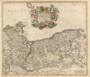
Ducatus Pomeraiae Tabula Generalis, in qua sunt Ducatus Pomeraniae, Stettinensis, Cassubiae, Vandaliae et Bardensis, Principatus Rugiae ac Insulae Comitatus Guskoviensis, et Dominia Louwenburgense, Wolgastense et Butoviense.
$1,000.00
Acquire
- Digital Map Information
- Suitable for large format printing
- Full resolution TIFF file
- ICC color profile embedded
- Delivered instantly via download link
This is a scarce c.1721 map of Pomerania in modern day Germany and Poland by Frederik De Wit. It covers from Stralsund in Germany east as far as Gdansk in Poland and south to Berlin. Bornhom Island is also included. Important cities of Berlin, Szczecin ... (more details)
Beautiful Covens and Mortier edition of the De Wit map of Brabant.
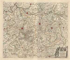
Pars Meridionalis Brabantiae continens Dominium Merchliniense Ducatum Arschotanum.
$300.00
Acquire
- Digital Map Information
- Suitable for large format printing
- Full resolution TIFF file
- ICC color profile embedded
- Delivered instantly via download link
This is an attractive c.1721 map of the southern part of the Duchy of Brabant by Frederik De Wit. The map depicts part of modern day Belgium, which was at the time this map was made, part of the Duchy of Brabant. It covers the vicinity of Brussels and ... (more details)
Map of the historic County of Namur.
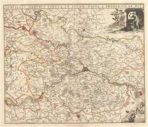
Comitatus Namurci Tabula in Lucem.
$200.00
Acquire
- Digital Map Information
- Suitable for large format printing
- Full resolution TIFF file
- ICC color profile embedded
- Delivered instantly via download link
This is an attractive c.1721 map of the County of Namur by Frederik De Wit. Centered on the fortified city of Namur, the map extends from Fortaine (Fortaine-l’Eveque) to Huy and from Gembloux to Florennes. The entire region is depicted in ... (more details)
Venice and her Neighbors.
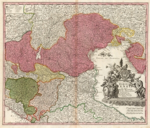
Dominii Veneti cum vicinis Parmae Mutinae Mantuae et Mirandol Statibus Nova Descriptio edita Ioh. Baptista Homanno.
$500.00
Acquire
- Digital Map Information
- Suitable for large format printing
- DPI: 600
- File Size: 65.3 MB
- File Type: ZIP / TIFF
- ICC color profile embedded
- Delivered instantly via download link
This is a handsome c.1730 Homann map of northeast Italy, the region dominated by the Republic of Venice, whose territories are highlighted here in pink. (more details)
Magnificent chart with masterful engraving.
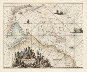
Occidentalior Tractus Indiarum Orientalium à Promontorio Bonae Spei ad C. Comorin.
$825.00
Acquire
- Digital Map Information
- Suitable for large format printing
- DPI: 600
- File Size: 24.08 MB
- File Type: ZIP / TIFF
- ICC color profile embedded
- Delivered instantly via download link
This is Frederic De Wit's map of Africa, Arabia, and part of India, in a handsome example of its scarce 1745 edition printed by Renier and Joshua Ottens. The map represents a key passage in the East India trade routes across the Indian Ocean. It is, moreover, a fine example of the highpoint of Dutch engraving - the work of master engraver Romeyn De Hooghe. (more details)