
Estruch, Juan (sold)

Juan Estruch (1820 - 1883) was a Catalan line engraver active in Madrid with the Dirección Hidrografía in the middle part of the 19th century. Estruch was born in Barcelona and studied engraving under his father, Doming Estruch y Jordan (1796 - 1851) also an engraver, and at the Escuela de Comercio y Bellas Artes, gradating in 1836. He then traveled to Italy to study under master engraver D. Pablo Toschi de Parma. He returned to Spain in 1840 and by about 1845 had taken a position with the Dirección Hidrografía. In addition to his work for the Dirección Hidrografía, he completed commercial portrait and certificate engraving, and map engraving for Vincente López and Francisco Coello. By 1872 he was the first engraver a the Depósito Hidrográfico.
Spain recognizes the Republic of Texas?
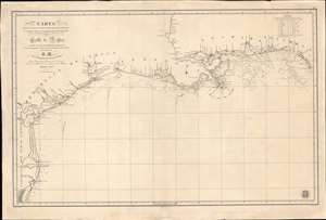
Carta de Las Costas de la Escambia, Alabama y Bocas del rio Misisipi, La Luisiana, tejas, Con la Provincia del Nuevo Santander en el Golfo de Mejico.
sold
- Digital Map Information
- Suitable for large format printing
- DPI: 600
- File Size: 1349.98 MB
- File Type: ZIP / TIFF
- ICC color profile embedded
- Delivered instantly via download link
An unusual 1846 Spanish Direccion Hidrografía nautical chart of the Gulf of Mexico recognizing the Republic of Texas. It is one of very few official Spanish publications to name the Republic of Texas, which Spain never formally recognized. The map emerged during a time of strife, both for Texas, which was involved in its own Texan Revolution (1835 - 1836) followed by the Mexican American War (1846 - 1848), but also in Spain, which was devolving into the Second Carlist War (1846 - 1849). Nonetheless, its production points to the complexity of Spanish-Texan relations during the Revolutionary years, when Texas was blockading Mexican trade and the Spanish West Indies in dire need of fresh trading partners. (more details)
Rare map of the Virgin Islands in the final days of the Danish West Indies.
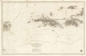
Carta Esférica de Parte de Las Islas Virgenes desde la Culebra a La Tortola.
sold
- Digital Map Information
- Suitable for large format printing
- File Size: 72.25 MB
- File Type: ZIP / TIFF
- ICC color profile embedded
- Delivered instantly via download link
A stunningly engraved 1859 Dirección Hidrografía nautical chart or maritime map of the Virgin Islands, including the U.S. Virgin Islands of St. Thomas and St. John. Centered on St. Thomas, the map covers from Isla de Culbera (Puerto Rico) to the island of Tortola (British Virgin Islands), and from Jost Van Dyke as far south as Vieques. The chart exhibits meticulously rendered topography and illustrates cities and towns in exacting detail, showing individual streets, blocks, and even important buildings throughout. At sea, there are countless soundings and other information useful to the navigator. (more details)