
Freedman, Samuel (sold)

Samuel Freedman (September 15, 1880 - 19xx) was a Russian-American printer and publisher active in New York City during the first half of the 20th century. Born in Bolnik, Lithuania, Freedman immigrated to the United States in 1887. Freedman owned his own printing shop by 1925 and continued to operate it through at least 1940. He was married to Anna Freedman, with whom he had at least three children, two daughters, and one son. We have been unable to locate any death records.
Spectacular early edition of an iconic Depression Era New York City view.
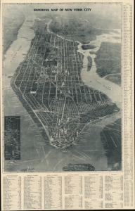
Supervue of New York.
sold
- Digital Map Information
- Suitable for large format printing
- Full resolution TIFF file
- ICC color profile embedded
- Delivered instantly via download link
This is a spectacular 1932 Edward V. Spofford / Samuel Freedman bird's-eye 'Supervue' map of New York City. Despite being issued at the height of the Great Depression, this view highlights New York City's resilience, prosperity, and multicultural dynamism. (more details)
Spectacular first edition of an iconic Depression Era New York City view.
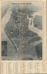
Supervue of New York.
sold
- Digital Map Information
- Suitable for large format printing
- Full resolution TIFF file
- ICC color profile embedded
- Delivered instantly via download link
This is a spectacular 1932 first edition Edward V. Spofford / Samuel Freedman bird's-eye 'Supervue' map of New York City. Despite being issued at the height of the Great Depression, this view highlights New York City's resilience, prosperity, and multicultural dynamism. (more details)
Identifies numerous locations around Manhattan - including Central Park and the Empire State Building!
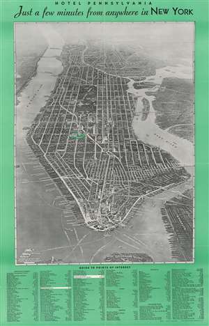
Supervue of New York. / Hotel Pennsylvania Jua a few minutes from anywhere in New York.
sold
- Digital Map Information
- Suitable for large format printing
- Full resolution TIFF file
- ICC color profile embedded
- Delivered instantly via download link
This is a stunning 1934 Samuel Freeman bird's eye view of New York City. The view covers all of Manhattan Island and extends from Liberty Island and the northern end of Governor's Island to the Harlem River, along with parts of New Jersey, the Bronx, Queens and ... (more details)
Iconic Depression Era New York City view.
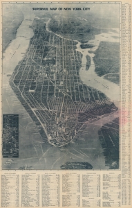
Supervue of New York.
sold
- Digital Map Information
- Suitable for large format printing
- Full resolution TIFF file
- ICC color profile embedded
- Delivered instantly via download link
This is a spectacular 1934 edition of the 1932 first edition of the Edward V. Spofford / Samuel Freedman bird's-eye 'Supervue' map of New York City. Despite being issued at the height of the Great Depression, this view highlights New York City's resilience, prosperity, and multicultural dynamism. (more details)
Identifies numerous locations around Manhattan - including Central Park and the Empire State Building!
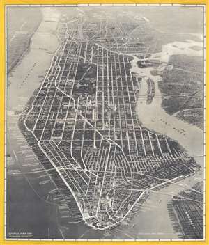
Supervue of New York.
sold
- Digital Map Information
- Suitable for large format printing
- File Size: 13.53 MB
- File Type: ZIP / TIFF
- ICC color profile embedded
- Delivered instantly via download link
This is a stunning Samuel Freedman 1936 bird's eye view of New York City. The view covers all of Manhattan Island and extends from Liberty Island and the northern end of Governor's Island to the Harlem River, along with parts of New Jersey, the Bronx, Queens ... (more details)
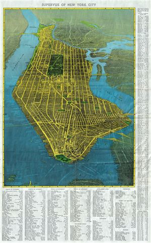
Supervue of New York City
sold
- Digital Map Information
- Suitable for large format printing
- File Size: 22.35 MB
- File Type: ZIP / TIFF
- ICC color profile embedded
- Delivered instantly via download link
This is a stunning 1937 bird's eye view map or view of New York City, by Samuel Freedman. The view covers all of Manhattan Island and extends from Liberty Island and the northern end of Governor's Island to Harlem River. It also covers parts of New Jersey, ... (more details)
Identifies numerous locations around Manhattan - including Central Park and the Empire State Building!
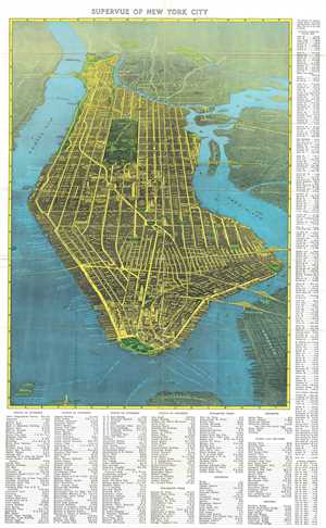
Supervue of New York City.
sold
- Digital Map Information
- Suitable for large format printing
- Full resolution TIFF file
- ICC color profile embedded
- Delivered instantly via download link
This is a stunning Samuel Freedman 1937 bird's eye view map or view of New York City. The view covers all of Manhattan Island and extends from Liberty Island and the northern end of Governor's Island to the Harlem River. It also covers parts of New Jersey, ... (more details)
A spectacular bird's eye view of Manhattan.
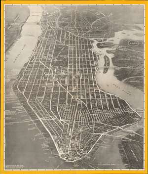
Supervue of New York.
sold
- Digital Map Information
- Suitable for large format printing
- File Size: 34.02 MB
- File Type: ZIP / TIFF
- ICC color profile embedded
- Delivered instantly via download link
This is a spectacular 1937 Samuel Freedman bird's eye view Supervue map of New York City. Depicting the entirety of Manhattan from the Harlem River to Battery Park, the map illustrates and identifies myriad world-famous sites. Among these are the Empire State Building, the Chrysler Building, Grand Central Station, and the Metropolitan Museum of Art. Neighborhoods and districts throughout the borough are referenced as well, including Greenwich Village, Little Italy, Chelsea, the Theatre District, and the Financial District. White lines highlight the city's iconic street grid and block letters label most of the streets and avenues. Broadway, Fifth Avenue, and Park Avenue shine brighter than the rest. The Brooklyn Bridge, Manhattan Bridge, and Williamsburg Bridge are all drawn in profile. A note in Queens promotes the World's Fair, which would open in 1939. (more details)