
Garnier, F.A. (sold)

F.A. Garnier (1803 - 1863) was a French cartographer who published the Atlas sphéroidal et universel de géographie in 1862 as his only work. It is said that he spent fifteen years creating the maps for the atlas.
The Earth is round!
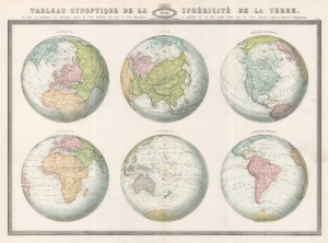
Tableau Synoptique de la Sphéricité de la Terre ou Plan en perspective des principaux Aspects du Globe Terrestre, pris dans les deux Hémisphères, et reproduits sur une plus grande échelle dans les Cartes suivantes, d'après la Projection Orthographique.
sold
- Digital Map Information
- Suitable for large format printing
- File Size: 33.04 MB
- File Type: ZIP / TIFF
- ICC color profile embedded
- Delivered instantly via download link
This is the 1860 F. A. Garnier map of the Earth in a visual summary of the Earth's sphericity from multiple angles. (more details)
Details both the North and South Poles and attempts to explain Earth's magnetic properties.
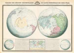
Tableau des régions circumpolaires ou carte sphéroïdal des deux pôles.
sold
- Digital Map Information
- Suitable for large format printing
- File Size: 52.31 MB
- File Type: ZIP / TIFF
- ICC color profile embedded
- Delivered instantly via download link
This is an 1860 F.A. Garnier map of the North and South Poles in two hemispheres. Depicting the Earth as if cut in half along the Equator, both poles are illustrated in detail, and features nearing the Equator are distorted. Numerous locations are identified around the poles, particularly around the still relatively unknown Antarctic continent. Garnier includes a detailed description of the map's geography along the bottom border. (more details)
One of the rarest and most decorative mid-19th century French maps of the United States.
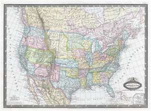
États-Unis de l'Amérique du Nord. Limites en 1860.
sold
- Digital Map Information
- Suitable for large format printing
- File Size: 8.76 MB
- File Type: ZIP / TIFF
- ICC color profile embedded
- Delivered instantly via download link
This is a strikingly beautiful 1860 F. A. Garnier map of the United States and depicts the U.S. from the Pacific Ocean to the Atlantic Ocean and from Canada to Mexico. Beautifully colored, this map displays several aspects of classic American territorial ... (more details)
Thematic map of the world's ocean currents and wind patterns.
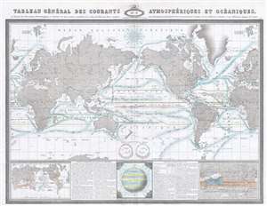
Tableau Général des Courants Atmosphériques et Océaniques, ou Résumé des Observations Meteorologiques et Nautique les plus récentes, recueillies à la surface du Globe par divers voyageurs, pour déterminer la direction des Vents et la marche des Courants sous les différentes latitudes et aux différentes époques de l'année.
sold
- Digital Map Information
- Suitable for large format printing
- File Size: 21.01 MB
- File Type: ZIP / TIFF
- ICC color profile embedded
- Delivered instantly via download link
This is an 1860 F.A. Garnier thematic map of the world's winds and ocean currents. The map depicts the world from Greenland across Europe and Asia to the Pacific Ocean and the Americas and then across the Atlantic Ocean to Europe and Africa. As this ... (more details)