
Gillray, James (sold)
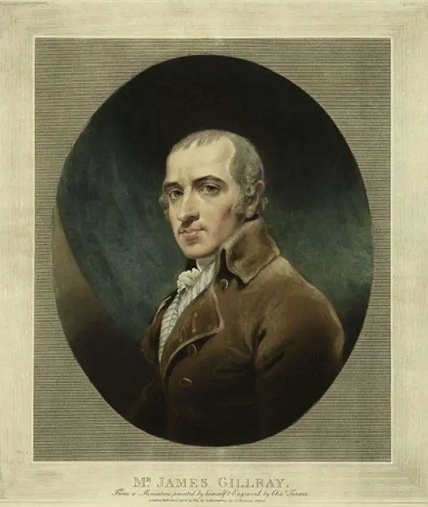
James Gillray (August 13, 1757- June 1, 1815), commonly consider the 'Father of the Political Cartoon' was a British printmaker, engraver, caricaturist, and satirical cartographer active in the late 18th and early 19th centuries. Gillray was born in Chelsea, London and trained as a letter-engraver, an occupation at which he had considerable skill but little interest. Instead he took to spending his time with itinerant theater troops – a pastime that no doubt influenced his later work. After returning to London he was admitted to the Royal Academy. From this point on Gillray was supported primarily through his etchings, most of which were published by Miss Hannah Humphrey. Although Gillray and Humphrey lived together for many years, they curiously never married. The main corpus of his influential work was published between 1792 and 1810. His popular caricatures, of which there are between 1000 and 1700, typically took the form of political satire. In late middle age Gillray's eyesight began to deteriorate due to alcoholism. It is also said that, while working on his last plate, Interior of a Barber's Shop in Assize Time he descended into insanity, although the nature of his supposed 'madness' is unclear. Nonetheless, after this piece, dated 1811, he produced no further work. He died in 1815 shortly before the Battle of Waterloo. Much of Gillray's work was profane in nature and suppressed, until reissued in 1851 by George Bohn.
A scatological map of England and France.
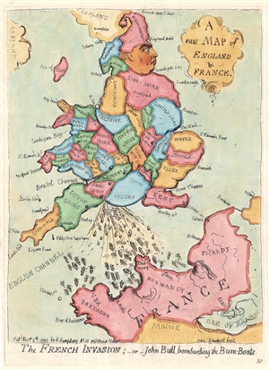
A new Map of England & France. / The French Invasion; or John Bull, bombarding the Bum-Boats.
sold
- Digital Map Information
- Suitable for large format printing
- DPI: 300
- File Size: 2.95 MB
- File Type: ZIP / TIFF
- ICC color profile embedded
- Delivered instantly via download link
A wonderful example of the 1851 George Bohn restrike of James Gillray's 1793 satirical caricature map of England, Wales, and France. An expression of the political tensions of the era, this map takes the form of George III of England, facing to the right and boldly railing his right foot (Kent), to stamp on France, itself taking the form of a face. The King is wearing a fool's cap composed of 'Northumberland.' Wales represents the king's flying coattails. The map illustrates, in the words of a Tate London Cataloger, George III crapping
vigourously on the coast of France, dispersing a number of tiny gunboats (…) The image is gross, but the King’s evacuations are heroic, patriotic and contemptuous, expressing the feelings of the brutish but uncensored John Bull, whom he here embodies.The map of course illustrates the pervading fear in England of a Napoleonic invasion. Among George III expulsions are the words 'British Declaration', referring to George's promise to return Toulon (held by Royalists aided by British and Spanish forces) to French on the restoration of the Bourbon monarchy. (more details)
Scatological map of England and France.
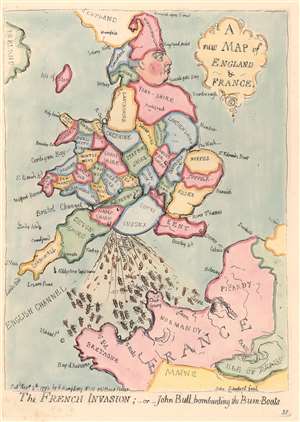
A New Map of England and France. / The French Invasion; or John Bull, bombarding the Bum-Boats.
sold
- Digital Map Information
- Suitable for large format printing
- DPI: 300
- File Size: 1.97 MB
- File Type: ZIP / TIFF
- ICC color profile embedded
- Delivered instantly via download link
A wonderful example of the 1851 George Bohn restrike of James Gillray's 1793 satirical caricature map of England, Wales, and France. An expression of the political tensions of the era, this map takes the form of George III of England, facing to the right and boldly raising his right foot (Kent), to stamp on France, itself taking the form of a face. The King is wearing a fool's cap composed of 'Northumberland.' Wales represents the king's flying coattails. The map illustrates, in the words of a Tate London Cataloger, George III
crapping vigorously on the coast of France, dispersing a number of tiny gunboats (…) The image is gross, but the King’s evacuations are heroic, patriotic and contemptuous, expressing the feelings of the brutish but uncensored John Bull, whom he here embodies.The map of course illustrates the pervading fear in England of a Napoleonic invasion. Among George III's expulsions are the words 'British Declaration', referring to George's promise to return Toulon (held by Royalists aided by British and Spanish forces) to the French on the restoration of the Bourbon monarchy. (more details)
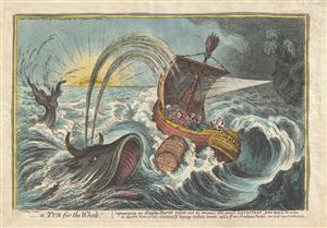
A Tub for the Whale; representing an Empty Barrel tossed out to amuse the great Leviathan - John Bull, in order to divert him from instantly laying violent hands upon ye new Coalition Packet.
sold
- Digital Map Information
- Suitable for large format printing
- Full resolution TIFF file
- ICC color profile embedded
- Delivered instantly via download link
This is a scarce 1806 hand color aquatint and etching of a Tub for the Whale, by James Gillray. The lengthy title references the preface of Jonathan Swift's satire A Tale of a Tub , published in 1704. In the etching, we see a whale with horns – John Bull ... (more details)