
Hayward, George (sold)

George Hayward (fl. c. 1850 - 1870) was an American lithographer based in New York City in the middle to late 19th century. Hayward's imprint appears on numerous 19th century maps associated with the Manual of the Corporation of New York, published at various times by David T. Valentine and Joseph Shannon. He also did similar work for William Bishop and Henry McCloskey of Brooklyn. He was involved in various partnerships, publishing at various times as Hayward, States and Koch (171 Pearl Street), Hayward and Lepine (171 Pearl St). Today he is memorialized by Heyward Street in South Williamsburg, Brooklyn.
Hat City.
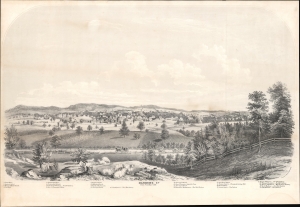
Danbury, Ct. taken from Hayes' Hill.
sold
- Digital Map Information
- Suitable for large format printing
- Full resolution TIFF file
- ICC color profile embedded
- Delivered instantly via download link
This is a c. 1858 lithograph bird's-eye view of Danbury, Connecticut, by George Hayward. The view illustrates Danbury at its height as a major center of hat making. (more details)
The first published representation of the 1668 Nicolls Map of Manhattan.
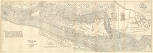
The Nicolls Map.
sold
- Digital Map Information
- Suitable for large format printing
- File Size: 51.09 MB
- File Type: ZIP / TIFF
- ICC color profile embedded
- Delivered instantly via download link
An attractive example of D. T. Valentine and George Hayward's 1863 reissue of the 1668 Nichols Plan or Map of Manhattan and New York City. When the English conquered New Amsterdam in 1664, they were ill equipped to administer their new colony - renamed New York after James, the Duke of York. English New York's first governor, Richard Nicolls, commissioned the first reasonably accurate survey of Manhattan and New York. The survey covers from the northernmost tip of Manhattan to Staten Island and incorporates parts of Long Island, modern day Westchester, and New Jersey. (more details)
The first published representation of the 1668 Nicolls Map of Manhattan.
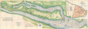
The Nicolls Map.
sold
- Digital Map Information
- Suitable for large format printing
- File Size: 27.14 MB
- File Type: ZIP / TIFF
- ICC color profile embedded
- Delivered instantly via download link
An attractive example of D. T. Valentine and George Hayward's 1863 reissue of the 1668 Nichols Plan or Map of Manhattan and New York City. When the English conquered New Amsterdam in 1664, they were ill equipped to administer their new colony - renamed New York after James, the Duke of York. English New York's first governor, Richard Nicolls, commissioned the first reasonably accurate survey of Manhattan and New York. The survey covers from the northernmost tip of Manhattan to Staten Island and incorporates parts of Long Island, modern day Westchester, and New Jersey. (more details)
Vaux and Olmstead's 1867 redesign of Fort Green Park, Brooklyn
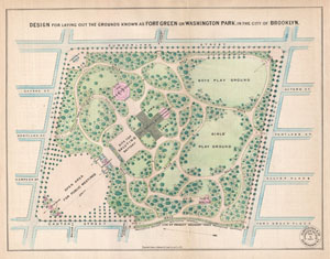
Design for the Laying Out of the Grounds known as Fort Green or Washington Park, in the City of Brooklyn.
sold
- Digital Map Information
- Suitable for large format printing
- File Size: 2.86 MB
- File Type: ZIP / TIFF
- ICC color profile embedded
- Delivered instantly via download link
A rare 1867 example Vaux and Olmsted's map of Washington Park or, as it is now known, Fort Greene Park, Brooklyn. Oriented to the east, the map depicts the park as a whole and includes pathways, lakes, buildings, individual trees, rocks, and elevation measurements. The streets and avenues surrounding the park are also noted. The layout of Fort Greene Park shown here reflects Vaux and Olmsted's 1867 redesign. (more details)
Vaux and Olmstead's 1867 redesign of Fort Green Park, Brooklyn
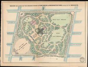
Design for the Laying Out of the Grounds known as Fort Green or Washington Park, in the City of Brooklyn.
sold
- Digital Map Information
- Suitable for large format printing
- File Size: 8.68 MB
- File Type: ZIP / TIFF
- ICC color profile embedded
- Delivered instantly via download link
A rare 1867 example Vaux and Olmsted's map of Washington Park or, as it is now known, Fort Greene Park, Brooklyn. Oriented to the east, the map depicts the park as a whole and includes pathways, lakes, buildings, individual trees, rocks, and elevation measurements. The streets and avenues surrounding the park are also noted. The layout of Fort Greene Park shown here reflects Vaux and Olmsted's 1867 redesign. (more details)
One of the first maps of Prospect Park.
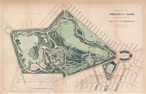
Design for Prospect Park as Proposed to be Laid Out for The City of Brooklyn.
sold
- Digital Map Information
- Suitable for large format printing
- Full resolution TIFF file
- ICC color profile embedded
- Delivered instantly via download link
A rare 1868 first edition of Calvert Vaux and Frederick Law Olmsted's map of Prospect Park, Brooklyn. Issued just months after its October 1867 completion, this is one of the first published maps to depict the design of Prospect Park. The map depicts the park as a whole and includes pathways, lakes, buildings, individual trees, rocks, and elevation measurements. The streets and avenues surrounding the park are also noted. (more details)
One of the first maps of Prospect Park.
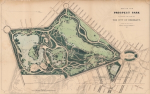
Design for Prospect Park as Proposed to be Laid Out for The City of Brooklyn.
sold
- Digital Map Information
- Suitable for large format printing
- File Size: 13 MB
- File Type: ZIP / TIFF
- ICC color profile embedded
- Delivered instantly via download link
A rare 1868 first edition of Calvert Vaux and Frederick Law Olmsted's map of Prospect Park, Brooklyn. Issued just months after its October 1867 completion, this is one of the first published maps to depict the design of Prospect Park. The map depicts the park as a whole and includes pathways, lakes, buildings, individual trees, rocks, and elevation measurements. The streets and avenues surrounding the park are also noted. (more details)
First year of construction of Prospect Park.
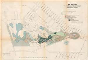
Map Showing Progress of the Works Indicated Below. Up to January 1st, 1868.
sold
- Digital Map Information
- Suitable for large format printing
- File Size: 13.33 MB
- File Type: ZIP / TIFF
- ICC color profile embedded
- Delivered instantly via download link
A rare 1868 Calvert Vaux and Frederick Law Olmsted map of Prospect Park, Brooklyn. Illustrating progress made on the park between its opening in 1867 and January 1868, the map depicts the park as a work in progress. Light green shaded areas represent completed areas. Diagonal green lines represent areas where work was in progress. White zones are coded for planned development. The original topography is illustrated as well. Roads (both in progress and finished), walks and bridle roads (both in progress and finished), and 'water surfaces' (both in progress and finished) are illustrated.. (more details)
The first map of any parkway, anywhere - in this case Brookln's Eastern Parkway.
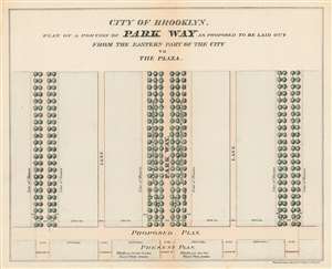
City of Brooklyn. Plan of a Portion of Park Way as Proposed to be Laid out From the Eastern Part of the City to The Plaza.
sold
- Digital Map Information
- Suitable for large format printing
- File Size: 2.9 MB
- File Type: ZIP / TIFF
- ICC color profile embedded
- Delivered instantly via download link
A rare 1868 example Vaux and Olmsted's preliminary plan for Eastern Parkway, Brooklyn. This may well be the first published plan of Eastern Parkway, and indeed any parkway anywhere, which began construction about 2 years after this initial layout was published. (more details)