
Hobbs, John Stratton (sold)

John Stratton Hobbs (January 1, 1813 - December 19, 1874) was a British engraver, hydrographer, chart maker, and blueback publisher active in England in the mid-19th century. Hobbs was born in London, the son of William Henry Hobbs, a ship broker of Globe Street, St. George in the East. Much of his work is associated with the firms of John William Norie (1774 - 1843) and Charles Wilson (1807 - 1882). Hobbs compiled charts and engraved for Norie until his death in 1843, when he became head of the hydrographic department of the successor firm, Noire and Wilson. He was elected to the Royal Geographical Society 9 November 1846.
Rare working nautical chart of the Canadian Maritimes.
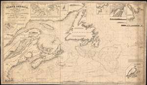
A Chart of the Coast of North America, from the Strait of Belle Isle to Boston including the Banks and Island of Newfoundland, The Gulf and River of St. Lawrence, Nova Scotia, Bay of Fundy, and c.
sold
- Digital Map Information
- Suitable for large format printing
- Full resolution TIFF file
- ICC color profile embedded
- Delivered instantly via download link
A scarce 1848 John Stratton Hobbs British blueback nautical chart or maritime map of the Canadian Maritime Provinces and the Gulf of St. Lawrence. The map covers from Labrador to Boston, including Newfoundland, Nova Scotia, Anticosti Island, and New Brunswick, as far as Cape Cod, including the entire New England coastline from Connecticut to Maine. Inset maps detail Halifax Harbor, Boston Harbor, St. John, the Island of St. Paul, Port St. Andrew, Liverpool Bay, St. Johns, and the Island of St. Pierre. Exhibit copious soundings and annotations of practical use to the mariner. (more details)
Depicts the Gulf Stream - a current along the coast of North America that effects the climate in the eastern United States and Europe.
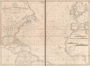
A Chart of the Atlantic or Western Ocean.
sold
- Digital Map Information
- Suitable for large format printing
- File Size: 42.08 MB
- File Type: ZIP / TIFF
- ICC color profile embedded
- Delivered instantly via download link
This is an exquisitely composed 1855 John Stratton Hobbs nautical chart or maritime map of the Atlantic Ocean. The map, comprising two sheets, depicts the region from central North America and the Galápagos Islands to Sweden, the Baltic Sea, Sicily, and central ... (more details)
Herring Boom.
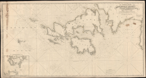
A Chart of the Coasts of Great Britain, Ireland, Frace, Spain, Portugal, and c. Showing the whole Navigation from Feroe and Orkney Isles to Gibraltar, Barcelona, Algeries, etc.
sold
- Digital Map Information
- Suitable for large format printing
- File Size: 102.58 MB
- File Type: ZIP / TIFF
- ICC color profile embedded
- Delivered instantly via download link
This is an expansive west-oriented 1858 J. H. Hobbs nautical map of the eastern Atlantic Ocean, covering England, Ireland, Scotland, the Faroe Islands, the English Channel, and the Bay of Biscay. The chart was likely intended to serve the late 19th-century British Herring Boom. (more details)
Busy but treacherous seas.
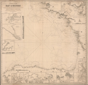
A Chart of the Bay of Biscay compiled from the latest French and Spanish surveys.
sold
- Digital Map Information
- Suitable for large format printing
- File Size: 52 MB
- File Type: ZIP / TIFF
- ICC color profile embedded
- Delivered instantly via download link
A rare 1860 blueback nautical map of the Bay of Biscay, prepared by John Stratton Hobbs and published by Charles Wilson. The Bay represents some of the worlds most active but unpredictably dangerous waters notorious for rough seas and treacherous storms. (more details)