
Hooker, William (sold)

William Hooker (fl. c. 1811 - 1846) was an important American geographer, surveyor, and engraver active in New York during the early part of the 19th century. He is responsible for a number of important maps and geographies particularly focusing on the New York area. As a young man, Hooker may have been apprenticed to Edmund March Blunt, the well established publisher of the New England Coast Pilot. What is certain, is that in 1819, Hooker married Eliza Carleton, Blunt's daughter. He went on to publish a number of nautical charts, school geographies, guide books, and atlases in conjunction with Blunt and others, including Humphrey Phelps, Peabody & Company, and A. W. Wilgus. Hooker passed away in 1846.
The Eddy Map.' One of the most important early maps of New York City ever printed.
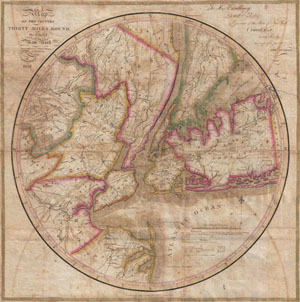
Map of the country Thirty Miles Round the City of New York.
sold
- Digital Map Information
- Suitable for large format printing
- DPI: 300
- File Size: 15.89 MB
- File Type: ZIP / TIFF
- ICC color profile embedded
- Delivered instantly via download link
Known as 'The Eddy Map,' this is an extremely rare and important circular map of New York City and vicinity, dated 1823. Covers the New York City area in roughly a thirty mile radius of Manhattan, extending north to Tarrytown, south to Monmouth, west to Somerset, ... (more details)
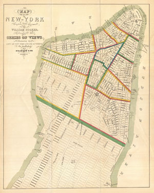
Map of the City of New-York Compiled & Surveyed by William Hooker.
sold
- Digital Map Information
- Suitable for large format printing
- File Size: 5.86 MB
- File Type: ZIP / TIFF
- ICC color profile embedded
- Delivered instantly via download link
This is an unusual map of New York City first issued in 1831 by William Hooker and Peabody. This example is a reissue, apparently from the same plate, dating to the Hardy edition of the Manual of the Corporation of New York , 1871. Perhaps this map's most ... (more details)
Rare chart of the Gulf.
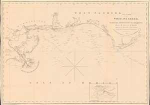
The Coasts of West Florida, Alabama, Mississippi and Louisiana; From the surveys of Gauld improved by those of the U.S. Government and the latest Astronomical Observations.
sold
- Digital Map Information
- Suitable for large format printing
- Full resolution TIFF file
- ICC color profile embedded
- Delivered instantly via download link
A rare Edmund March Blunt 1840 nautical map of West Florida, embracing the Gulf Coast from the mouths of the Mississippi to the Saint Marks River. The survey is based upon the groundbreaking work of Scottish hydrographer George Gould following the French and Indian War (1754 - 1763). Despite being nearly seventy years old by the time this chart was published, it remained the definitive mapping of the Gulf Coast until after the American Civil War (1861 - 1865). (more details)
Rare chart of Florida.
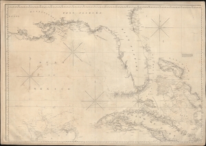
['Chart of the Gulf of Mexico, West Indies, and Spanish Main]. [Northwest Section].
sold
- Digital Map Information
- Suitable for large format printing
- DPI: 600
- File Size: 85.97 MB
- File Type: ZIP / TIFF
- ICC color profile embedded
- Delivered instantly via download link
An intriguing c. 1845 nautical map of Florida and part of the Gulf Coast by Edmund March Blunt. Following loosely on Spanish charts, this map represents the state-of-the-art Florida and Gulf Coast cartography going into the American Civil War (1861 - 1865). (more details)