
Humboldt, Alexander von (sold)
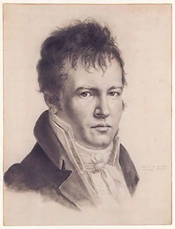
Alexander von Humboldt (September 14, 1769 - May 6, 1859), whose full birth name is Friedrich Wilhelm Heinrich Alexander Freiherr von Humboldt was a German born naturalist, biologist, geologist, explorer and cartographer active in the late 18th and first half of the 19th century. The importance and scope of Humboldt's work is staggering and its influence on both the development of America and the development of science itself is second to none. As Emil Du Bois-Reymond said, "Every scientist is a descendant of Humboldt. We are all his family." To compose a full biography of Humboldt is the work of volumes, not this simple medium, so we will attempt to focus on the highlights of Humboldt's life as it pertains to cartography. Humboldt was the first scientist to embrace and actually take into the field the Kantian concept of a union between careful scientific observation and intuitive analysis. Between 1799 and 1804 Humboldt traveled through northwestern South America, Central America, Mexico, and parts of the United States. During this voyage he collected a wealth scientific observations and measurements, including considerable surveying and cartographic work, in each of the regions through which he passed. Humboldt's mapping of Mexico, then inclusive of much of the southwestern part of the United States, was an accomplishment of seminal importance, not only because it was the finest map of the region yet produced, but also because of its impact on the future political geography of the Americas. Upon his arrival in Washington, Humboldt struck up a friendship with president Thomas Jefferson, soon to be president James Madison, and other luminaries of post Colonial America. He freely shared his mappings of Mexico with the U.S. President, little suspecting that they would soon influence the results of the Mexican American War and the manifest destiny movement that would follow. When he returned to Germany, Humboldt began a life-long correspondence with scientific luminaries and explorers throughout the world and most particularly in America. Humboldt's influence can be directly tagged to the development of numerous important careers in American cartography, including those of Nicolette, Fremont, Wilkes, Hassler, Bache, and others. Though Humboldt never again visited America, his name is etched across our landscape through numerous Mountains, Rivers, Islands, and other geological features that bear his name. Had the votes in Congress swayed slightly to the other direction, even the entire state of Nevada would have been the state of Humboldt. Throughout his life, Humboldt was a tireless supporter of human equality, scientific advancement, and personal liberty. Humboldt died in Berlin at 89 years old, in his long life he was an inspiration to the invention of modern anthropology, the political destiny of South America, the geographical exploration of the American West, and, ultimately, the development of modern science.
Aztec Exodus.
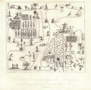
Histoire hiéroglyphique des Azteques, depuis le déluge jusqu'à la fondation de la ville de Mexico.
sold
- Digital Map Information
- Suitable for large format printing
- File Size: 7.83 MB
- File Type: ZIP / TIFF
- ICC color profile embedded
- Delivered instantly via download link
This is Alexander von Humboldt and Aimé Bonpland's 1810 depiction of the legendary Aztec migration from Aztlan to Chapultepec Hill, currently Mexico City. It appeared in their stunningly illustrated work Voyage aux régions équinoxiales du Nouveau Continent, which marked an important step in the development of knowledge about the flora, fauna, and cultures of the Americas. (more details)
'An important map.' - Wheat
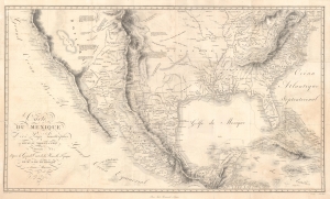
Carte Du Mexique et des Pays Limitrophes Situes Au Nord et a l'est Dressee d'apres la Grande Carte de la Nouvelle Espagne De Mr. A. De Humboldt et d'autres Materiaux par J.B. Poirson.
sold
- Digital Map Information
- Suitable for large format printing
- DPI: 600
- File Size: 70.19 MB
- File Type: ZIP / TIFF
- ICC color profile embedded
- Delivered instantly via download link
A seminal 1811 / 1827 map of Mexico and the American West by Alexander von Humboldt. Humboldt, who during his lifetime was considered the 'world's greatest living man,' composed this map during his 1803 sojourn in Mexico. Though often playing second fiddle to Humboldt's more regional Carte Generale du Royaume de la Nouvelle Espagne, published in the same volume, this map is a cartographic achievement in its own right and, as Wheat notes 'an Important Map.' (more details)
A Delicate and Accurately Rendered View of Two Great Mexican Volcanos
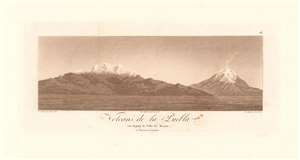
Volcans de la Puebla, vus depuis la Ville de Mexico de l'Imprimerie de Langlois.
sold
- Digital Map Information
- Suitable for large format printing
- DPI: 600
- File Size: 4.58 MB
- File Type: ZIP / TIFF
- ICC color profile embedded
- Delivered instantly via download link
This scarce 1811 aquatint presents an attractive and quite recognizable view of the mountains of Iztaccihuatl and Popocatepetl, the enormous Mexican volcanoes between Mexico City and Puebla, seen here from the north. The view would have been one the great scientist and explorer would have seen during his 1804 journey between Mexico and Veracruz. The aquatint was based on a drawing by Lud Martin in 1803; the engraving credits the artist as having drawn it from life, and it shows every sign of having been so executed: including the wisps of smoke rising from Popocatepetl's summit. Sadly, about the artist Martin - likely, Don Louis Martin, credited for work on several of Humboldt's maps - the historical record is silent. (more details)
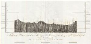
Tableau du Plateau central des Montagnes du Mexique, entre les 19 et 21 de Latitude boreale (Chemin de Mexico a Guanaxuato).
sold
- Digital Map Information
- Suitable for large format printing
- DPI: 300
- File Size: 13.4 MB
- File Type: ZIP / TIFF
- ICC color profile embedded
- Delivered instantly via download link
A stunning example of Alexander von Humboldt's 1811 geological profile view of southern portion of the Mexican Plateau. This view covers the corridor between Mexico City and Guanajuato, including the centers of Tula and Queretaro. The profile betrays Humboldt's ... (more details)
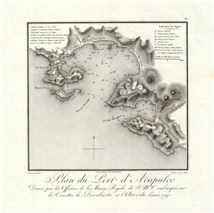
Plan du Port d'Acapulco Dresse par les Officiers de la Marine Royale de S.M.C. embarques sur les Corvettes la Descubierta et l'Atrevida lannee 1791.
sold
- Digital Map Information
- Suitable for large format printing
- DPI: 300
- File Size: 3.58 MB
- File Type: ZIP / TIFF
- ICC color profile embedded
- Delivered instantly via download link
A stunning example of Alexander von Humboldt's 1811 map of the port of Acapulco. This map was drawn to accompany Humboldt's important essai politique sur le Royaume de la Nouvelle-espagne , one of the most influential books written about late colonial period ... (more details)
Seminal Map of the American Southwest by 'World's Greatest Living Man'.

Carte Du Mexique et des Pays Limitrophes Situes Au Nord et a l'est Dressee d'apres la Grande Carte de la Nouvelle Espagne De Mr. A. De Humboldt et d'autres Materiaux par J.B. Poirson.
sold
- Digital Map Information
- Suitable for large format printing
- DPI: 300
- File Size: 15.17 MB
- File Type: ZIP / TIFF
- ICC color profile embedded
- Delivered instantly via download link
A seminal 1811 map of Mexico and the American West by Alexander von Humboldt. Humboldt, who during his lifetime was considered the 'world's greatest living man,' composed this map during his 1803 sojourn in Mexico. Though often playing second fiddle to ... (more details)
Key River to Humboldt's Explorations of the Orinoco system.
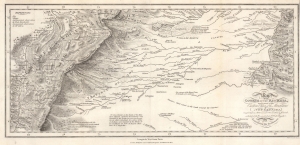
Map of the Course of the Rio Meta, and a part of the Eastern Chain of the Mountains of New Granada.
sold
- Digital Map Information
- Suitable for large format printing
- File Size: 8.59 MB
- File Type: ZIP / TIFF
- ICC color profile embedded
- Delivered instantly via download link
This is an 1818 Alexander von Humboldt map of the Rio Meta (Meta River) in Colombia and Venezuela. The Meta was one of the key waterways that Humboldt navigated while studying the intricate river systems of the Orinoco Basin. His observations and detailed descriptions of the Río Meta’s geography, flora, and fauna contributed to his broader understanding of South America’s natural environment. The map was compiled to illustrate Humboldt's epic voyage through South America, resulting in his Cosmos, an era-defining scientific work. (more details)
First printed map to focus on Oaxaca and Chiapas States.
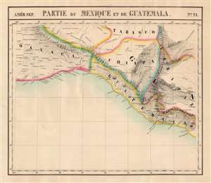
Partie du Mexique et de Guatemala. Amer. Sep. no. 71.
sold
- Digital Map Information
- Suitable for large format printing
- Full resolution TIFF file
- ICC color profile embedded
- Delivered instantly via download link
This is the 1827 Vandermaelen map of southern Mexico and western Guatemala. Vandermaelen's Atlas Universel was the first lithograph atlas as well as the first whose maps were printed on a universal scale. The present map was the first lithograph map of its region, and it is the earliest map to focus so narrowly on the states of Chiapas and Oaxaca. The map also includes the southern part of Tabasco, part of Veracruz, and part of Guatemala. The precursor is Arrowsmith's 1810 A New Map of Mexico and Adjacent Provinces Compiled from Original Documents, one of the first maps to present Alexander von Humboldt's mapping of Mexico. (more details)
The Best Large-Scale Map of Northern Mexico Based on First-Hand Survey.
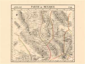
Parties du Mexique. Amer. Sep. no. 59.
sold
- Digital Map Information
- Suitable for large format printing
- DPI: 600
- File Size: 30.61 MB
- File Type: ZIP / TIFF
- ICC color profile embedded
- Delivered instantly via download link
This is the 1827 Vandermaelen map of the northern gold and silver mining region of Mexico, showing the states immediately south of the Rio Grande: Monterrey, parts of Chihuahua, Coahuila, Nuevo Leon, Zacatecas, Durango, and Sinaloa. Vandermaelen drew on the incomparable firsthand surveys of Alexander von Humboldt, whose 1803-4 travels informed his definitive 1804 map of Mexico. Vandermaelen's map, by addressing the geographical data at significantly higher scale than the Humboldt map, provides the best large-format mapping of the region - presented with the remarkable clarity afforded by the new printing technology of lithography. The map faithfully retains Humboldt's own array of symbols to distinguish cities and towns, mines, haciendas, ranches and presidios. No other map of the period provides this level of detail and focus on this region. (more details)
Humboldt's influential comparative elevation chart.
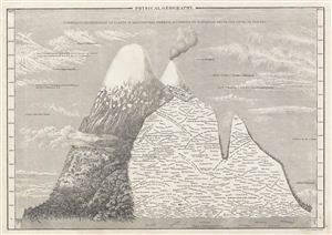
Physical Geography. Humboldt’s Distribution of Plants in Equinoctial America, According to Elevation Above the Level of the Sea.
sold
- Digital Map Information
- Suitable for large format printing
- DPI: 300
- File Size: 7.17 MB
- File Type: ZIP / TIFF
- ICC color profile embedded
- Delivered instantly via download link
This is Adam and Charles Black's rare 1840 profile view of the Andes Mountains, particularly Ecuador's Mt. Chimborazo, based upon an influential 1805 illustration by the renowned German explorer and scientist Alexander von Humboldt. Among the first ... (more details)
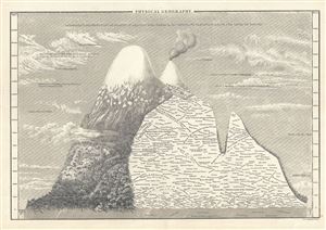
Physical Geography.
sold
- Digital Map Information
- Suitable for large format printing
- Full resolution TIFF file
- ICC color profile embedded
- Delivered instantly via download link
This is Adam and Charles Black's rare 1844 profile view of the Andes Mountains, particularly Ecuador's Mt. Chimborazo, based upon an influential 1805 illustration by the renowned German explorer and scientist Alexander von Humboldt. Among the ... (more details)
An early comparative mountains chart originally commissioned by Alexander von Humboldt.
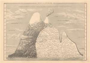
Physical Geography.
sold
- Digital Map Information
- Suitable for large format printing
- DPI: 600
- File Size: 13.69 MB
- File Type: ZIP / TIFF
- ICC color profile embedded
- Delivered instantly via download link
This is Adam and Charles Black's rare 1844 profile view of the Andes Mountains, particularly Ecuador's Mt. Chimborazo, based upon an influential 1805 illustration by the renowned German explorer and scientist Alexander von Humboldt. Among the ... (more details)
An early comparative mountains chart originally commissioned by Alexander von Humboldt.
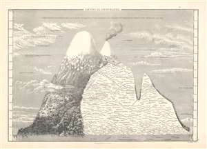
Physical Geography.
sold
- Digital Map Information
- Suitable for large format printing
- DPI: 600
- File Size: 13.59 MB
- File Type: ZIP / TIFF
- ICC color profile embedded
- Delivered instantly via download link
This is Adam and Charles Black's rare 1853 profile view of the Andes Mountains, particularly Ecuador's Mt. Chimborazo, based upon an influential 1805 illustration by the renowned German explorer and scientist Alexander von Humboldt. Among the first scientists to take Kant’s philosophy of Transcendental Idealism into the scientific field, Alexander von Humboldt illustrates discoveries made on his ascent (the first) of Mt. Chimborazo. (more details)